Forecast for the Logan Area Mountains

Issued by Toby Weed on
Thursday morning, March 26, 2020
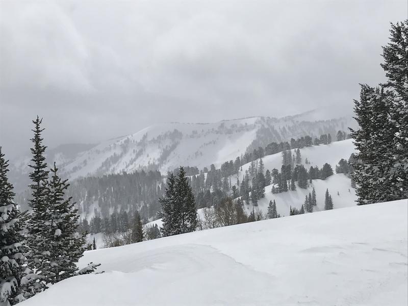
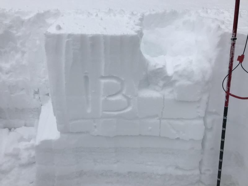
Significant accumulation of heavy snow and drifting from westerly winds have created heightened avalanche conditions and MODERATE danger at all elevations in the Logan Zone. People could trigger soft slab and loose avalanches of storm snow in steep terrain. Stiffer, larger, and more dangerous human triggered slab avalanches of wind drifted snow, 1 to 3 feet deep, are possible on upper elevation slopes facing the eastern half of the compass.
- Evaluate snow and terrain carefully.

Low
Moderate
Considerable
High
Extreme
Learn how to read the forecast here
Special Announcements
UAC operating schedule - We will continue issuing regular avalanche forecasts into mid April.
Spring Awareness Campaign - The UAC counts on donations from the backcountry community. We know these are uncertain times and any donation during our awareness campaign will help us continue providing avalanche forecasting and education.
CDC Guidelines - Even in the backcountry and in parking lots, please follow CDC guidelines like limiting group size and keeping a distance of at least 6 feet from other people to protect yourself and others. Read the guidelines HERE.
Taking risks - Be extra conservative to avoid the risk of accidents which can stress the capacity of our medical system.
Skiing and riding at closed ski resorts - Some resorts allow access now and some do not. Please check HERE for the latest info on ski area access.
New to the backcountry (including riding at closed resorts) - Watch the award-winning, 15 minute Know Before You Go video, or take the 5-part, free online-learning series.
Weather and Snow
It's 19°F at the 8400' Tony Grove Snotel. About 6 inches of new snow fell at the site in the last 24 hours, with 0.4" Snow Water Equivalent, bringing the storm total up to about 22 inches with close to 2" SWE. There is now 103 inches of total snow, containing 114% of normal SWE. It's 11°F at the 9700' CSI Logan Peak weather station, and northwest winds are currently blowing about 15 mph.
We found nice deep spring powder riding conditions in the Central Bear River Range yesterday.

Heightened avalanche conditions exist in the Logan Zone, with almost two feet of new snow in the Central Bear River Range.
The National Weather Service has continued a Winter Storm Warning for our area through this evening. The cold upper level trough to the west of Utah will slowly advance east into the state over the next 24 hours. This trough will exit the area by Friday evening, followed by high pressure aloft producing a gradual warming trend into the upcoming weekend.
It will be mostly cloudy in the mountains today with a few snow showers. 8500' high temperatures of around 30°F and 7 to 10 mph northwest winds are expected. It will be partly cloudy in the mountains tonight, with low temperatures expected to be around 10°F, and northwest winds will blow 8 to 13 mph, creating wind chill values as low as -2°F. It will be mostly sunny tomorrow, with high temperatures near 31°F and west-northwest winds will blow 7 to 13 mph.
Recent Avalanches
Yesterday, we noticed evidence of widespread natural loose avalanches of new snow on steep slopes in the Central Bear River Range, that occurred Tuesday night during the height of the storm.
60-year-old Phil Bregitzer of American Falls was killed by an avalanche Sunday, March 15 while skiing in the backcountry north of Pebble Creek Ski Area. Our condolences go out to the friends and family of the victim and those involved in the rescue. The final report on the tragic avalanche accident has been published and it's HERE.
This is a short video from our visit to the site on 3-16-2020.
Avalanche Problem #1
New Snow
Type

Location

Likelihood

Size

Description
Heightened avalanche conditions exist in the Logan Zone, and people could trigger soft slab and loose avalanches of storm snow in steep terrain at all elevations. I expect the snow continue to stabilize today, as the storm energy moves into central and southern Utah, and snowfall intensity continues to diminish in the Logan Zone.

Despite rapid stabilization during the day, a snow pit test at 3:00 PM showed a propagating failure on a layer of graupel and mixed snow grains beneith the new snow.
Avalanche Problem #2
Wind Drifted Snow
Type

Location

Likelihood

Size

Description
Drifting of the new snow by westerly winds yesterday and winds from the northwest overnight created heightened avalanche conditions on upper elevation slopes facing the eastern half of the compass. People could trigger large cornice falls and 1 to 3 foot thick slab avalanches of wind drifted snow.
General Announcements
EMAIL ADVISORY. If you would like to get the daily advisory by email you subscribe HERE.
Remember your information can save lives. If you see anything we should know about, please help us out by submitting snow and avalanche observations....HERE. You can also call us at 801-524-5304, email by clicking HERE, or include #utavy in your tweet or Instagram.
This forecast is from the USDA Forest Service, which is solely responsible for its content. The forecast describes general avalanche conditions and local variations always occur.
We will update this forecast before about 7:30 tomorrow morning.