Get Your Ticket to the 32nd Annual Backcountry Benefit on September 11th! Support Forecasting, Awareness, and Education
Ad

Forecast for the Logan Area Mountains

Toby Weed
Issued by Toby Weed on
Monday morning, March 16, 2020
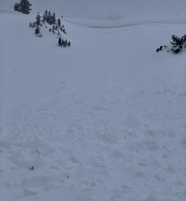
Drifting of the weekend's new snow by strong south winds has created heightened avalanche conditions and MODERATE danger on upper and some mid elevation slopes. People could trigger large cornice falls and/or slabs of wind drifted snow up to around a foot deep. Despite lower temperatures, high angle March sun will come out from behind the clouds and could create potential for loose avalanches of wet snow on steep slopes.
  • Evaluate snow and terrain carefully.
Low
Moderate
Considerable
High
Extreme
Learn how to read the forecast here
Special Announcements
  • We know there is a lot of uncertainty regarding coronavirus, but the Utah Avalanche Center is planning to continue issuing regular avalanche forecasts into April.
  • Uphill Travel at Ski Areas - Some resorts will be offering limited uphill access but not all do. Up to date info about uphill access from Ski Utah is posted HERE.
Weather and Snow
It's 33°F at the 8400' Tony Grove Snotel. About an inch of new snow fell yesterday at the site, and there is 85 inches of total snow, containing 111% of normal Snow Water Equivalent. It's 26°F at the 9700' CSI Logan Peak weather station, and south winds are currently blowing about 25 mph with a gust of 54 mph earlier this morning.
Heightened avalanche conditions exist on drifted upper and mid elevation slopes. Temperatures will drop into the upper 20s at upper elevations, but the strong March sun will peek out from under the clouds and loose avalanches of wet surface snow will again become possible in steep terrain.

The low pressure system along the northern California coast will maintain a mild southerly flow across Utah today. This low pressure will slowly drift east into the Great Basin and bring the potential for widespread precipitation over Utah midweek. Snow showers are possible early today, with little accumulation. It will be partly sunny with 8500' high temperatures around 28°F and south-southwest winds blowing 8 to 15 mph along the ridges. It will be partly cloudy tonight with low temperatures around 26°F and 10 to 14 mph east wind. There is a chance snow and rain showers in the mountains again tomorrow afternoon, with little accumulation likely. High temperatures are expected to be around 42°F, and and south-southwest wind will blow around 14 mph.
Recent Avalanches
I'm very sad to report that a fatal avalanche occurred yesterday in the backcountry near Pebble Creek Ski Area south of Pocatello Idaho. Preliminary accident information is HERE . We will head up to the area and help with the accident investigation today, and we will post more details when we can.
Observers reported a couple natural storm slabs and small triggered avalanches of new snow at upper elevations in the Central Bear River Range Saturday. Yesterday, riders likely remote triggered cornice fall which triggered a 1' deep and 60' wide avalanche of wind drifted snow at about 9400' on a northeast facing slope near Cornice Ridge.
Ad
Avalanche Problem #1
Wind Drifted Snow
Type
Location
Likelihood
Size
Description
Strong south winds in the past few days have created stiff and softer drifts of fresh snow up to about a foot deep, many of which could still be sensitive to human triggering today. Heightened avalanche conditions exist in drifted upper and some mid elevation terrain. Drifts formed on the lee sides of ridges and in and around terrain features where decelerating winds deposited the snow.
  • Wind drifted snow is often smooth, rounded, and chalky looking, and harder drifts may sound hollow like a drum when you get out them.
  • Watch for and avoid fresh drifts on the lee side of major ridge lines and in and around terrain features like cliff bands, scoops, gully walls, and sub-ridges.
  • Avoid ridge top cornices, which can break much further back than expected and could start avalanches on slopes below.
Avalanche Problem #2
Wet Snow
Type
Location
Likelihood
Size
Description
Sun will pop out later today and the new snow from the weekend will quickly become moist with warm temperatures. People could trigger small loose wet avalanches on steep slopes today where a few inches of fresh snow accumulated.
  • Avoid being on or under steep slopes with melt-softened saturated snow.
  • Roller balls, pinwheels, and naturally occurring sluffs or other avalanches indicate potential for wet avalanche activity.
General Announcements
EMAIL ADVISORY. If you would like to get the daily advisory by email you subscribe HERE.
Remember your information can save lives. If you see anything we should know about, please help us out by submitting snow and avalanche observations....HERE. You can also call us at 801-524-5304, email by clicking HERE, or include #utavy in your tweet or Instagram.
This forecast is from the USDA Forest Service, which is solely responsible for its content. The forecast describes general avalanche conditions and local variations always occur.
We will update this forecast before about 7:30 Wednesday morning.