Enjoy spring skiing at Snowbasin Resort. The UAC has discount Snowbasin tickets available.
HEREThe Tony Grove Snotel at 8400' reports 4 inches of new snow overnight, with .3" SWE. It's 25ºF this morning and there is 92" of total snow with 107% of average SWE for the date. It's 15ºF at the 9700' CSI Logan Peak weather station, and northwest winds are currently averaging around 20 mph. The snow on most slopes is stable, with much colder temperatures, wind, and cloud cover helping to reduce wet snow instabilities in sunny terrain. Heightened avalanche conditions today at upper elevations, and you might trigger shallow avalanches of fresh wind drifted snow in some areas.
A cold pacific trough will cross the area through tonight with accumulating snow to the valley floors along the I-15 corridor. High pressure will build in late week bringing a more prolonged stretch of dry and increasingly mild weather. It'll snow in the mountains today, with 2 to 4 inches possible. High temperatures at 8500' expected be around 21 ºF, with 17 to 23 mph northwest winds. Snow will continue tonight, with 1 to 3 inches of accumulation possible. Low temperatures will be around 11º F, with 15 to 20 mph northwest winds. It will be sunny tomorrow, with high temperatures around 25ºF, and 16 mph north wind.
There were numerous natural wet loose avalanches visible from Cache Valley, and yesterday the mountains looked like they were dripping hot wax.
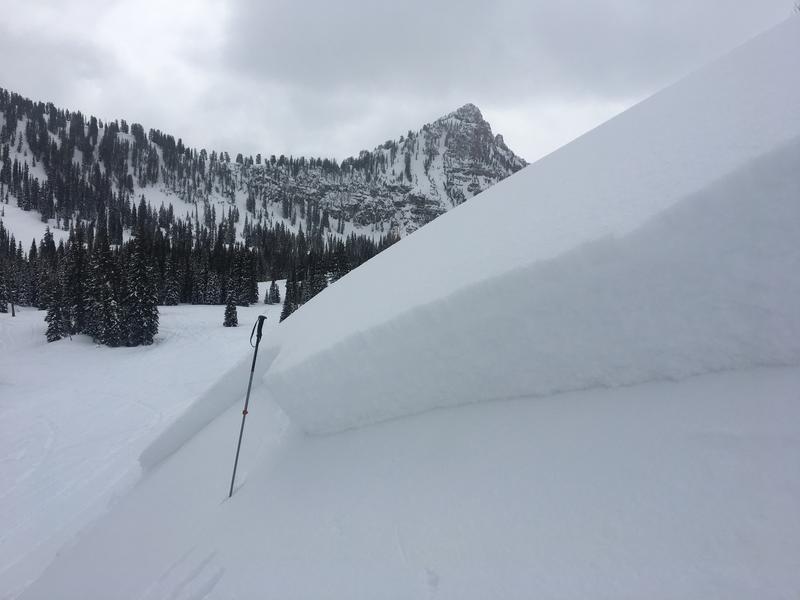
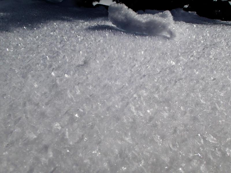
Snowmobilers triggered a couple good sized soft slab avalanches on Saturday. One on a south facing slope at around 8700' in elevation in Boss Canyon in Franklin Basin near the Idaho State Line, the other on a southeast facing slope at around 8400' in White Pine Canyon. The avalanches appear to have failed on a thin sugary or faceted persistent weak layer on top of a melt-freeze crust that was on the snow surface at the beginning of March.
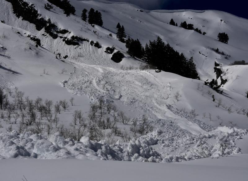
A sled triggered soft slab avalanche from Saturday (3/9/19) in White Pine Canyon.