Take time this winter to make avalanche education a priority for you and your backcountry partners. Join the UAC's Backcountry 101, Introduction to Avalanches Class this weekend at Powder Mountain. Get more details on the UAC Education page.
Dangerous conditions exist on drifted upper elevation slopes, but you can find nice snow and safer conditions at lower elevations, on lower angled slopes, and in sunny or sheltered terrain. We found mostly stable snow and very nice fast shallow powder conditions at lower elevations in Logan Canyon yesterday.
The Tony Grove Snotel at 8400' reports 2º F this morning and there's 74" of total snow containing 98% of average SWE for the date. It's 2º F, at the 9700' CSI Logan Peak weather station. South-southwest winds are increasing this morning and are currently averaging around 30 mph.
High pressure will shift east of the area today. A weak storm system will pass through the region Saturday, with a much stronger cold front forecast to surge through Utah late Sunday into Sunday night. An active pattern is expected to continue through much of next week.
Today in the Logan Zone, it'll be mostly cloudy in the mountains, with temperatures at 8500' expected to be around 14º F, and 11 to 18 mph east winds veering from the southwest in the afternoon. Wind chill values of -26º F at times! Tonight, temperatures will fall to around 1º F and 15 to 17 mph south wind will cause wind chills around 18º F below zero. Snow is likely tomorrow afternoon, with 1 to 3 inches of accumulation possible, high temperatures near 18º F and 14 to 17 mph south winds, veering from the east in the afternoon.
One snowmobiler is missing in an avalanche east of Beaver, UT near Circleville Mountain. The missing person is not wearing a transceiver. SAR operations are underway this Friday morning. Mark Staples is heading to the accident site and we will issue a report on this as soon as we can.
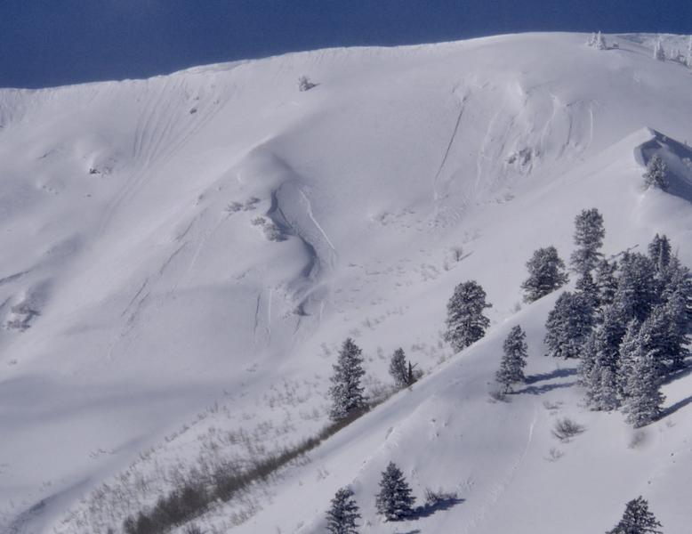
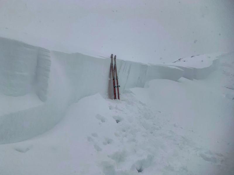
I could see blown-in and covered up evidence of fairly extensive natural activity in the Wellsville Mountain Wilderness, likely from Monday. There was also some fresher activity apparent, involving loose sluffs or soft slabs of wind drifted drifted snow. I caught a glimpse yesterday evening of a large hard slab avalanche on the north side of Logan Peak, that looks to have released on a deeply buried persistent weak layer.
Fresh wind drifted snow avalanche activity in the Wellsville Mt Wilderness was visible from Mendon yesterday.
It has been active in the last few days across the state. Recent avalanche reports are on our avalanche page... HERE
Large, deep hard slab avalanches like this natural on the Wasatch Crest ridge above Park City are possible in some areas where heavy drifted new snow overloaded buried persistent weak layers.