*** Check out our new blog post by UAC Forecaster, Drew Hardesty, "Utah – The Greatest...*Rain* on Earth?!?" and, by UAC Director Paige Pagnucco, - Weak Snow: Today’s Surface, Tomorrow’s Avalanche Problem
The past few days have felt more like May than February, with very warm temperatures in the mountains and strong sunshine creating dirt patches and puddles at trailheads. It is getting harder to find soft, dry snow, but it is possible (see Flygare ob here), and surface conditions are highly variable. During our field work yesterday, we found the best conditions on the groomed trail back to the trailhead. Despite the non-winter-like feel, it is still worth getting out and exploring. There is good coverage above 8000', which makes for easy travel, especially on a snowmobile.
Persistent fair and mild weather will continue in the mountains through the weekend. Skies will be mostly sunny again today with high temperatures at 8500 feet near 41°F. Light winds will blow from the west. Under a strong high-pressure system, we can expect a repeat of today's conditions tomorrow. For snow lovers, there is some hope on the horizon as clouds will move in on Sunday night, and 1 to 2 inches of accumulation from a quick-hitting frontal passage is expected at upper elevations in the Logan Zone on Monday. A cool, unsettled weather pattern will continue through the remainder of the week as a series of storm systems move through the Great Basin.
This morning, at the UAC Card Canyon weather station at 8700 feet, the temperature is 31°F, and there is 39 inches of total snow. The Tony Grove Snotel at 8400 feet reports 34°F and 52 inches of total snow. On the summit of Logan Peak (9700 feet), the wind is blowing 22 mph from the west with gusts near 30 mph. It's 26°F on Paris Peak at 9500 feet, and the wind is blowing from the south-southwest 16-21 mph.
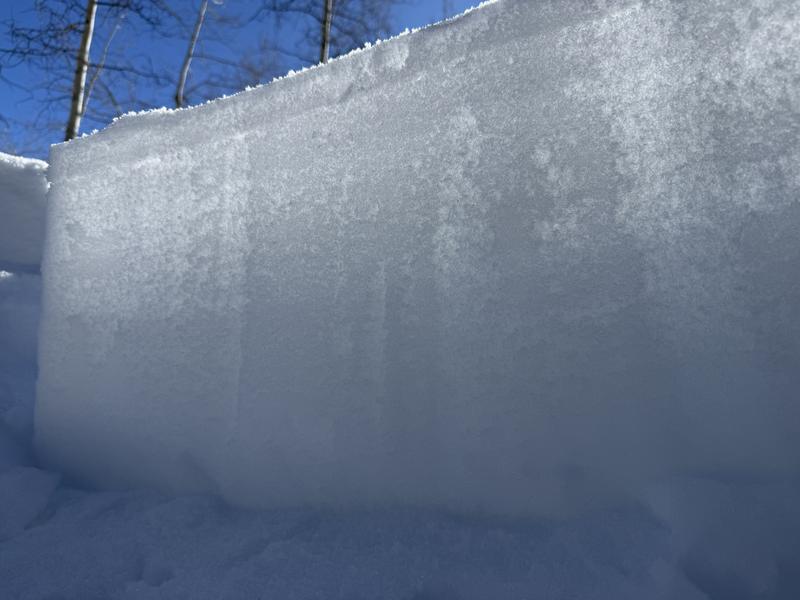
Different kinds of weak layers have developed on and near the snow surface in the past couple of weeks, and these will lead to dangerous avalanche conditions when buried by inevitable future snows. After a few weeks with minimal snow accumulation, the snow is generally stable but loose and sugary. The current warm temperatures are turning the soft recrystallized surface snow into mush, and natural and triggered loose, wet avalanches are possible on steep slopes today. The snow cover is quite thin at lower elevations, with sunny slopes below about 7000 feet in elevation completely bare of snow.
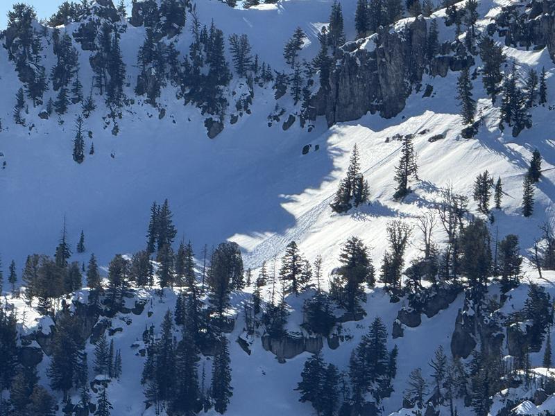
We observed a sizable debris pile from a recent natural loose wet avalanche on Thursday in Upper Steam Mill Canyon.
For all observations and avalanche activity in the Logan Zone, go HERE