Forecast for the Logan Area Mountains

Paige Pagnucco
Issued by Paige Pagnucco for
Friday, February 3, 2023
Elevated avalanche conditions and MODERATE danger exist in drifted upper and mid elevation terrain. People could trigger slab avalanches of wind drifted snow, and some of these could fail on a persistent weak layer buried 1 to 3 feet deep. Loose avalanches entraining moist snow are possible in very steep, sunny terrain. Large avalanches are unlikely and the danger is mostly LOW at lower elevations and in areas where the wind has not affected the snow.
  • Evaluate snow and terrain carefully.
Low
Moderate
Considerable
High
Extreme
Learn how to read the forecast here
Weather and Snow
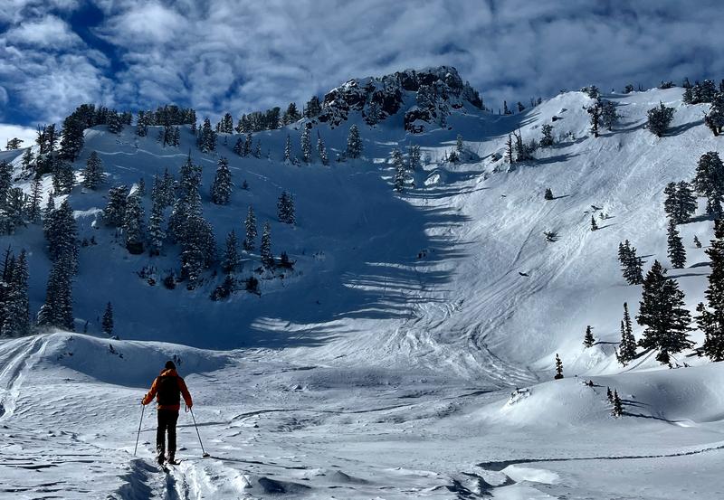
The snow is deep and you'll find really nice powder at all elevations in the backcountry, although the sun has moistened/crusted the snow surface on most southerly facing slopes. The new snow has settled significantly over the past few days and stable conditions exist in most areas. The exceptions may be avalanches in drifted terrain failing on a persistent weak layer buried 1 to 3 feet deep.
The Tony Grove Snotel at 8400' reports 98"of total snow (137% of normal SWE) and it's currently 27° F.

Today will be partly sunny and temperatures at 8500' will top out around 32° F. It'll be a little breezy with southwest winds blowing 11-18 mph. Clouds will increase as the day goes on as a weak and mostly dry storm moves through the zone.
Tonight there is a slight chance for flurries, the temperature will drop to around 13° F, and west southwest winds will blow 13-16 mph.
Saturday will be mostly sunny, with a high near 30 F and west southwest winds blowing around 10 mph.
Unsettled weather returns Sunday into Monday with a chance for snow (3-6") and slightly cooler temperatures.
Recent Avalanches
  • Tuesday, a party of skiers triggered a soft slab avalanche in the Mount Naomi Wilderness, that swept by and narrowly missed the first skier who was waiting for their partner. Click HERE for a short video.
  • A widespread natural avalanche cycle occurred across the Logan Zone last Saturday night and Sunday morning, and numerous avalanches can be seen in the Wellsville and Bear River Mountains. Of note are large natural avalanches observed in the Mount Naomi Wilderness, Smithfield Dry, Wood Camp, and on Mt. Magog, which included large slab avalanches 2 to 3 feet deep and hundreds of feet wide. Mt. Magog Avalanche report is HERE.

Find a list of all recent observations & avalanches from across Utah HERE.
Ad
Avalanche Problem #1
Persistent Weak Layer
Type
Location
Likelihood
Size
Description
There are areas where weak surface snow was buried and preserved by last week's storm snow. We're finding a buried persistent weak layer consisting of sugary faceted snow, and in many cases, associated with a thin sun-crust. A party of skiers triggered an avalanche failing on this PWL on Tuesday. Conditions have become more stable in recent days, but people should be aware that this persistent weak layer still may be active in some areas, especially where wind drifted snow sits on top of it.
  • Avoid corniced slopes and stiffer drifts on steep slopes near ridges and in and around terrain features like under cliff bands, sub-ridges, mid-slope break-overs, and gully walls.
  • The good news is riding conditions are excellent on lower angle slopes especially in shaded, northerly terrain where surface hoar is present.
Avalanche Problem #2
Wet Snow
Type
Location
Likelihood
Size
Description
As the powerful sun moistens the snow surface. loose avalanches entraining wet snow are possible on very steep, sunny slopes at all elevations.
  • On sustained slopes loose avalanches can pick up speed and volume pretty quickly.
  • You should stay out from under your partners and other parties and avoid very steep terrain where you could be swept into trees, gullies or other terrain traps.
Additional Information
General Announcements
  • Please submit your observations from the backcountry HERE.
  • For a list of avalanche classes from the Utah Avalanche Center go HERE
  • For information on where you can ride your sled or snowbike, check out this map of the winter travel plan for the Logan and Ogden Ranger Districts HERE, and a close up of the Tony Grove and Franklin Basin Areas HERE.
This forecast is from the U.S.D.A. Forest Service, which is solely responsible for its content. This forecast describes general avalanche conditions and local variations always occur.