Get Your Ticket to the 32nd Annual Backcountry Benefit on September 11th! Support Forecasting, Awareness, and Education
Ad

Forecast for the Logan Area Mountains

Toby Weed
Issued by Toby Weed on
Saturday morning, February 29, 2020
Snow is stable, avalanches are unlikely, and the danger LOW on most slopes in the backcountry. Exceptions probably exist on very steep slopes at upper elevations, where people might trigger shallow slab avalanches of wind drifted snow or small wet-loose avalanches of melt-saturated surface snow.
  • Use normal caution, which means check everyone's rescue gear, and continue to follow safe travel protocols.
Low
Moderate
Considerable
High
Extreme
Learn how to read the forecast here
Special Announcements
The UAC's Avy Awareness Auction is currently underway with tons of great gear, jewelry, artwork and experiences available. Visit the auction page HERE to help support the UAC's spring avalanche awareness and outreach efforts.
Weather and Snow
It's 34°F at the 8400' Tony Grove Snotel, and there is 84 inches of total snow, containing 114% of normal Snow Water Equivalent. Southwest winds picked up overnight, and are blowing around 30 mph, with gusts close to 50 mph this morning at the 9700' CSI Logan Peak weather station, and it's 26°F.
The snow is stable on most slopes in the Logan Zone and avalanches are unlikely. Exceptions might be found on steep upper elevation slopes, where shallow wind drifts exist on slopes facing the eastern half of the compass, and people could trigger small loose sluffs of moist surface snow on sheltered sunny slopes. Yesterday in the middle of the day, we found nice Spring-like corn snow conditions in sunny mid and lower elevation terrain in the Wood Camp Area, but temperatures stayed fairly warm overnight and the snow will probably soften earlier today. Greenhousing is possible as clouds increase during the day and trap the heat, especially in sheltered terrain.

A storm system will move south across the region late tonight through early Monday, followed by a second weaker storm Tuesday. The National Weather Service has issued a Winter Weather Advisory for the zone for late tonight through tomorrow night. We'll see partly sunny skies today with gradually increasing clouds and 8500' high temperatures around 36°F. It will be breezy, with 20 to 22 mph west-southwest wind. It will snow starting late tonight, with 3 to 5 inches of accumulation possible, low temperatures around 19°F, and west winds 14 to 17 mph. Snow will continue tomorrow, with 3 to 7 inches of accumulation possible, high temperatures near 26°F, and north winds 15 to 17 mph. It looks like sunny conditions will return on Monday.
Recent Avalanches
Although there was some small natural activity during Monday's windy storm, no other significant avalanches were reported in the Logan Zone recently.
Ad
Avalanche Problem #1
Normal Caution
Type
Location
Likelihood
Size
Description
There is Low danger in the backcountry and avalanches are unlikely but not impossible. People should check everyone in their party to make sure all their avalanche rescue gear is in good working order. Be sure everybody has a beacon, probe, and shovel. Continue to practice safe backcountry travel protocols, which means only cross steep slopes and avalanche paths one-at-a-time while the rest of your party watches from a safe location. Although avalanches are generally unlikely, they are still possible, especially on steep upper elevation slopes.
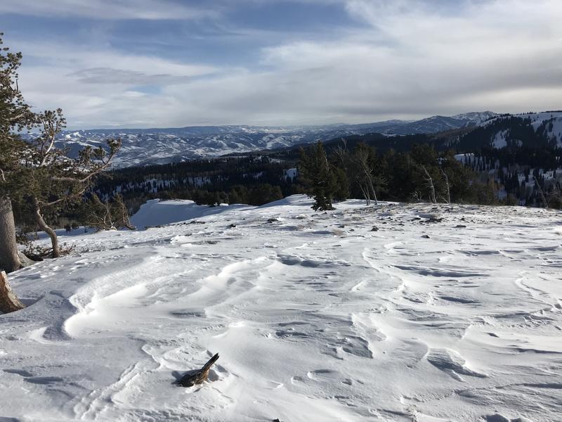
  1. Early this week, several inches of snow fell at upper elevations in the Bear River Range, and it was drifted by fairly strong westerly winds. Shallow drifts formed on some upper elevation slopes, mainly on those facing the eastern half of the compass. Southwest winds picked up overnight, with gusts near 50 mph on Logan Peak. Although there is not much in the way of transportable snow, there is some in shady upper elevation terrain, and people might trigger shallow avalanches of wind drifted snow today on very steep recently drifted slopes.
  2. Loose sluffs of melt-saturated surface snow sliding on slick crust are possible on steep sunny slopes. These will be mostly manageable, but people should avoid travel on very steep slopes with saturated surface snow and potential terrain traps below.

Westerly winds this week drifted Monday's snow, scouring it off exposed windward facing slopes and depositing it where the winds decelerate on the lee side of major ridges and around terrain features.
  • Watch for and avoid drifts near ridge lines and in and around terrain features like cliff bands, scoops, gully walls, and sub-ridges.
  • Avoid ridge top cornices, which can break much further back than expected and could start avalanches on slopes below.
Additional Information
  • Many slopes are quite slick and treacherous due to rain and rime events earlier in February. You could encounter slippery and dangerous "slide for life" conditions in steep terrain with a hard snow surface or a shallowly buried thick crust. An ice ax and crampons, (or whippet and ski crampons) may be needed for safe travel on many of the steep slopes and mountaineering routes in the zone.
  • A cross country skier was charged by a moose in upper Green Canyon earlier this week, resulting in a very shaken skier and a broken ski pole. The big guys are out and about, and they can be grumpy this time of year. People and dogs need to yield the packed trail to the moose and give them lots of room.
General Announcements
Thanks to the generous support of our Utah ski resorts and Ski Utah, we have discount lift tickets available. All proceeds from these go towards paying for avalanche forecasting and education! Get your tickets HERE.
EMAIL ADVISORY. If you would like to get the daily advisory by email you subscribe HERE.
Remember your information can save lives. If you see anything we should know about, please help us out by submitting snow and avalanche observations....HERE. You can also call us at 801-524-5304, email by clicking HERE, or include #utavy in your tweet or Instagram.
This forecast is from the USDA Forest Service, which is solely responsible for its content. The forecast describes general avalanche conditions and local variations always occur.
I will update this forecast before about 7:30 tomorrow morning.