Forecast for the Logan Area Mountains

Issued by Toby Weed on
Tuesday morning, February 18, 2020
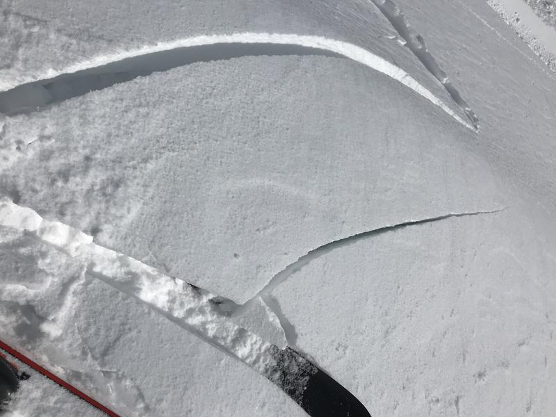
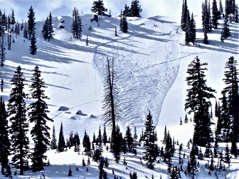
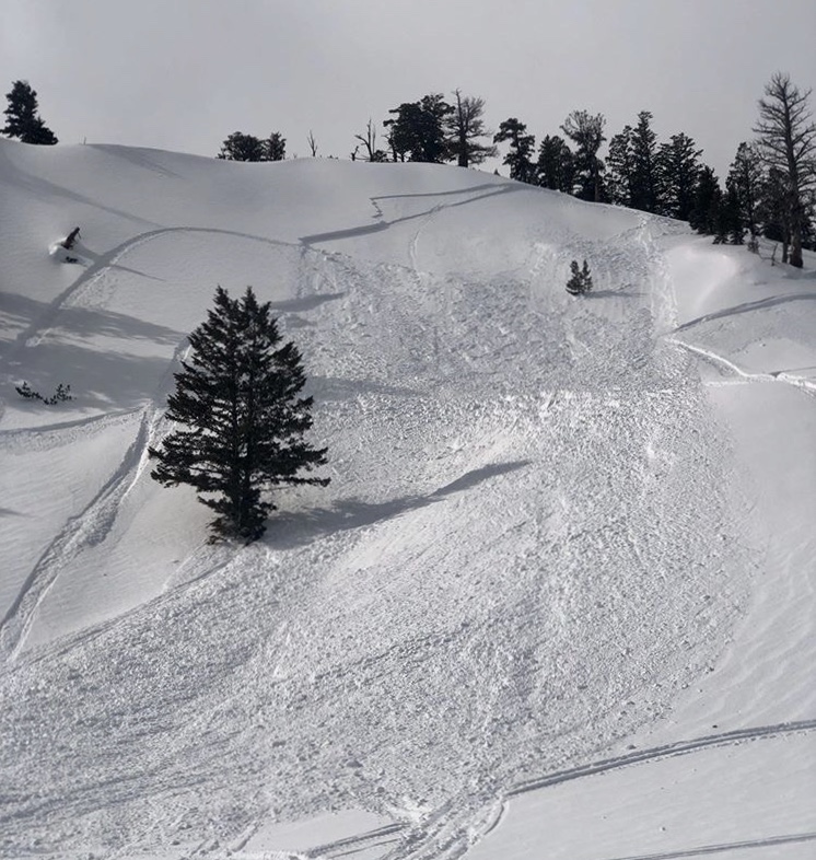
Heightened avalanche conditions exist on upper and mid elevation slopes, and people could trigger slab avalanches of wind drifted snow. Areas with lingering CONSIDERABLE danger can be found on drifted upper elevation slopes facing the east half of the compass, where human triggered avalanches are still likely. The snow is stable and avalanches are unlikely at lower elevations, on lower angled slopes, and in sheltered terrain.
- Evaluate snow and terrain carefully. Use caution while route-finding, and make conservative decisions.

Low
Moderate
Considerable
High
Extreme
Learn how to read the forecast here
Weather and Snow
It's 5°F at the 8400' Tony Grove Snotel, and there is is 93 inches of total snow, containing 133% of normal Snow Water Equivalent. The station reports about 18"of new snow with 2.1" SWE from the weekend storm. West winds diminished overnight and are currently blowing around 5 mph at the CSI Logan Peak weather station, and it's 0°F this morning at 9700'.
With severe drifting from west winds and about a foot-and-a-half of snow with over 2" of SWE in the Central Bear River Range from the weekend storm, heightened avalanche conditions exist on upper and mid elevation slopes. Because of the widespread crust from 2/7 under the new snow, the best riding is in lower angled terrain anyway.

We easily cracked out stiff wind drifts in the backcountry on the south ridge of Beaver Mountain yesterday. Cracking is a red flag, indicating unstable snow.
A high pressure system will gradually move over the area and dominate the weather pattern through the remainder of the week. Today will be sunny, with 8500' high temperatures around 25°F and 5 to 7 mph northwest winds. Wind chill values will be as low as -11°F. It will be mostly clear tonight with low temperastures around 0°F, 7 mph south wind veering from the west, and wind chills around -13°F. Tomorrow will be sunny with high temperatures near 24°F, 8 mph east wind, and wind chills as low as -14°F.
Recent Avalanches
Yesterday was active, with numerous human triggered avalanches and several close calls in the mountains of Northern Utah. There were a handful in the Logan Zone including a couple in the backcountry of Beaver Mountain's Backside.

A skier triggered and escaped an avalanche of wind drifted new snow in Boiler Bowl, Steam Mill Canyon, in the Franklin Basin Area. The 1+' deep and 100' wide avalanche occurred on a northeast facing slope at around 9000' in elevation.

Details are limited, but it looks like a sled triggered avalanche occurred yesterday on an east facing slope at around 9100' in elevation near Tony Grove Lake.
Avalanche Problem #1
Wind Drifted Snow
Type

Location

Likelihood

Size

Description
West winds were strong all day Sunday as heavy snow fell in the Central Bear River Range. The winds continued into yesterday, gusting near 60 mph, and drifting lots of fresh snow into avalanche starting zones. Heightened avalanche conditions exist today on drifted mid and upper elevation slopes, and human triggered avalanches are possible. In fact, people are still likely to trigger avalanches of recently wind drifted snow on some exposed upper elevation slopes.
- Watch for and avoid drifts near ridge lines and in and around terrain features like cliff bands, scoops, gully walls, and sub-ridges.
- Avoid ridge top cornices, which can break much further back than expected and could start avalanches on slopes below.
General Announcements
Thanks to the generous support of our Utah ski resorts and Ski Utah, we have discount lift tickets available. All proceeds from these go towards paying for avalanche forecasting and education! Get your tickets HERE.
EMAIL ADVISORY. If you would like to get the daily advisory by email you subscribe HERE.
Remember your information can save lives. If you see anything we should know about, please help us out by submitting snow and avalanche observations....HERE. You can also call us at 801-524-5304, email by clicking HERE, or include #utavy in your tweet or Instagram.
This forecast is from the USDA Forest Service, which is solely responsible for its content. The forecast describes general avalanche conditions and local variations always occur.
I will update this forecast before about 7:30 tomorrow morning.