Forecast for the Logan Area Mountains

Issued by Toby Weed on
Thursday morning, December 24, 2020
Dangerous avalanche conditions and CONSIDERABLE danger exist on drifted upper and mid elevation slopes. People are likely to trigger avalanches of wind drifted snow, 1 to 3 feet deep, failing on a sugary persistent weak layer. Avalanches are possible at all elevations, but you can find safer conditions in lower angled and sheltered terrain, and at lower elevations where only a couple inches of new snow accumulated.
- Cracking and collapsing indicate unstable snow.
- Avalanches could be triggered remotely or from a distance.
- Stay off and out from under drifted slopes steeper than about 30 degrees.

Low
Moderate
Considerable
High
Extreme
Learn how to read the forecast here
Special Announcements
Thanks to the generous support of our local resorts, Ski Utah, and Backcountry, discount lift tickets are now available. Support the UAC while you ski at the resorts this season.
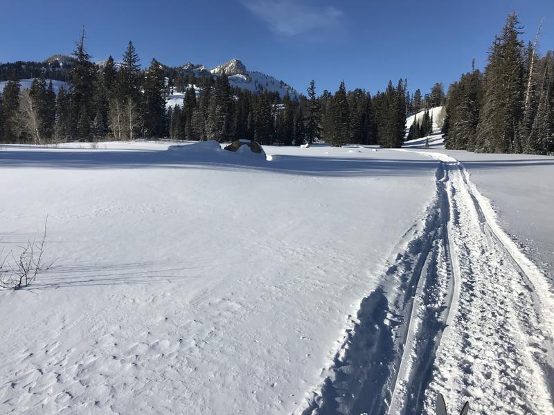
 Tickets are available here.
Weather and Snow
Several inches of light new snow accumulated Tuesday night on upper elevation slopes, which created nice shallow powder conditions. Overall snow coverage is still very shallow in the Logan Zone, and the snow that was on the ground in November and early December is loose and sugary. In many places you still sink all the way to the ground when you hop off your sled. Trail breaking is difficult on skis because you sink deeply into the sugary snow, and it's scary on a sled because you expect to hit rocks and down trees at any moment. Not many people are out riding, especially off trail, and there are already a few tales of broken A-arms from those who have tried.

Still too shallow to ride comfortably. Nice shallow powder riding conditions, but the snow pack is shallow and full of land mines. (12-23-2020)
Expect sunny and cold conditions in the mountains today, with a chilly westerly breeze, high temperatures in the twenties at upper elevations, and wind chill values this morning as low as -18°F. A strong high pressure system will build over Utah in the next couple days, through Christmas. The next chance for snow looks to be over the weekend, as a weak storm should impact Northern Utah. The disturbance should be enough to mix out the inversion, but accumulations in the mountains will not be heavy. Despite apparent gradual stabilization of the snow pack, dangerous avalanche conditions persist on steep drifted slopes at upper and mid elevations, and human triggered avalanches remain likely on steep drifted slopes.
Recent Avalanches
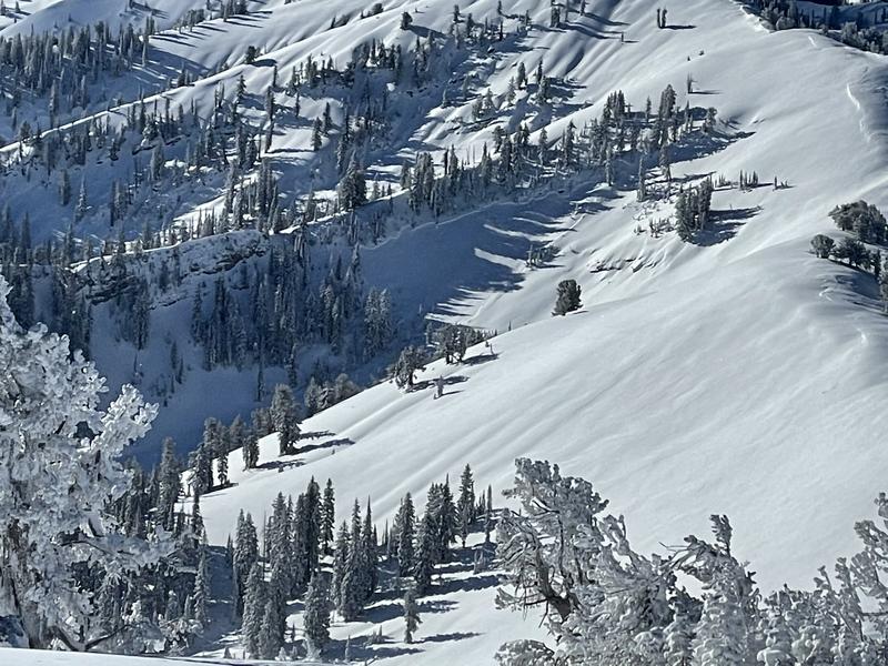
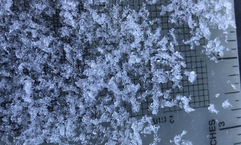
Many natural and remote triggered avalanches were observed last Friday and over the weekend in the Logan Zone. The mostly 1'-deep soft slab avalanches, failing on a persistent weak layer consisting of sugary faceted snow, were fairly forgiving and nobody got caught.
From a distance yesterday, an observer noticed a recent large natural avalanche in the Mount Naomi Wilderness, in Upper Cottonwood Canyon. The broad slab avalanche below a cliff band was probably a few days old.

Avalanche Problem #1
Persistent Weak Layer
Type

Location

Likelihood

Size

Description
Many slopes in the region are plagued by layers of weak faceted snow formed during the prolonged November dry spell. Avalanches failing on a persistent weak layer can be very sensitive, and they might be triggered remotely, from a distance, or worse from below!

The faceted crystals at the bottom of the snow pack are getting bigger and are becoming more well developed. This is becoming depth hoar, and it will likely haunt us in the future!
Avalanche Problem #2
Wind Drifted Snow
Type

Location

Likelihood

Size

Description
Fairly strong west and northwest winds yesterday and again overnight drifted the fresh new snow into lee slope starting zones and around terrain features like gullies, cliff bands, and sub ridges. The light new snow obscures hard drifts that formed over the weekend from southwest winds. Harder drifts or wind slabs are usually not as sensitive as soft ones, and they may allow people to get out on them and into avalanche paths before releasing.
- People are still likely to trigger dangerous avalanches of wind drifted snow, 1 to 3 feet deep, on steep upper and mid elevation slopes, especially where drifts formed on weak, sugary, or faceted snow.
- Even a small avalanche could be very dangerous due to shallow early season snow conditions.
Additional Information
Everybody should make time to examine and practice with your avalanche rescue equipment, and convince your backcountry partners to practice with you. Watch our companion rescue video HERE
My tip for avoiding avalanches in the backcountry is to keep your slope angles low. Avoid and stay out from under slopes steeper than about 30 degrees. Get a tool to measure slope angle and practice with it in the backcountry. Watch the video HERE.
Paige shows what we are talking about when we mention faceted snow in our forecasts. Watch the video HERE
General Announcements
Visit this website with information about Responsible Winter Recreation by the Utah Office of Outdoor Recreation.
We've kicked off Season 4 of the UAC podcast with a Conversation with American Avalanche Institute owner Sarah Carpenter. You can stream it HERE or wherever you get your favorite podcasts.
The Tony Grove Road is not maintained for wheeled vehicles in the winter.
EMAIL ADVISORY. If you would like to get the daily advisory by email you subscribe HERE.
Remember your information can save lives. If you see anything we should know about, please help us out by submitting snow and avalanche observations....HERE. You can also call us at 801-524-5304, email by clicking HERE, or include #utavy in your tweet or Instagram.
I will update this forecast by around 7:30 tomorrow morning.
This forecast is from the USDA Forest Service, which is solely responsible for its content. The forecast describes general avalanche conditions and local variations always occur.