Forecast for the Logan Area Mountains

Toby Weed
Issued by Toby Weed for
Monday, December 17, 2018
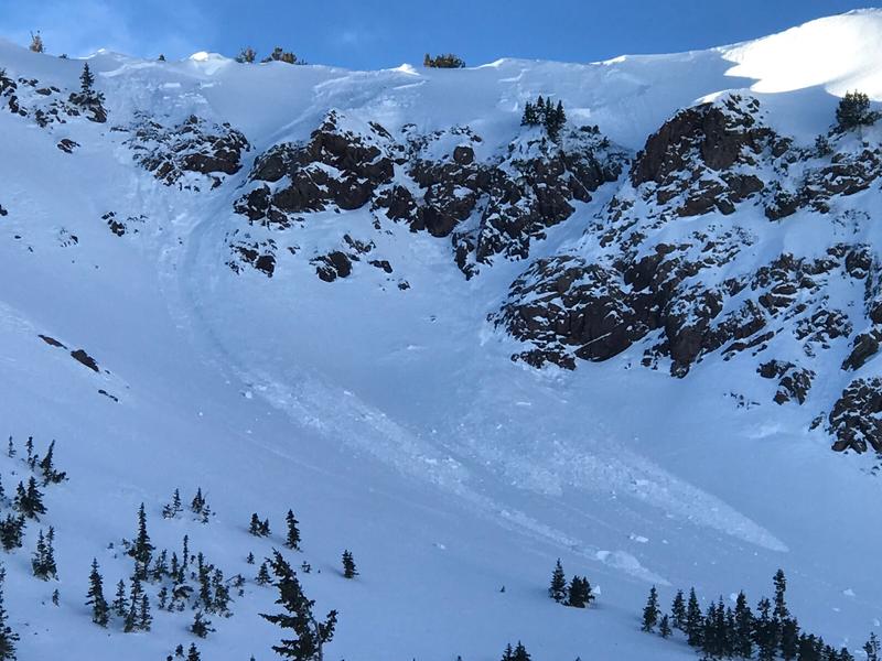
MODERATE: Heightened avalanche conditions exist on drifted upper elevation slopes. You might trigger avalanches involving stiff wind drifted snow in exposed terrain today. Unlikely, but dangerous avalanches failing on a sugary persistent weak layer near the ground remain possible on some steep north facing upper elevation slopes.
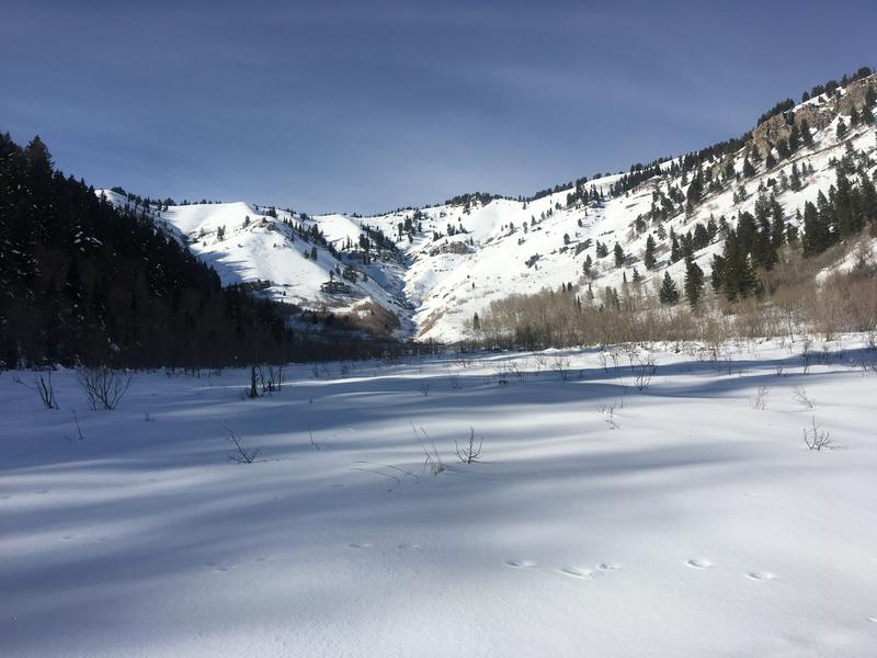
You can find generally stable snow, LOW danger, and good early season conditions in sheltered, lower angled, and lower elevation terrain.
Evaluate snow and terrain carefully.
Low
Moderate
Considerable
High
Extreme
Learn how to read the forecast here
Weather and Snow
South winds picked up overnight, drifting snow into stiff drifts at upper elevations and creating heightened avalanche conditions. You can find good access for this time of year and nice soft snow in sheltered shady terrain. The snow is still just a bit too shallow to ride in steep terrain or to get aggressive with your throttle. Keep your speed down and pay attention. I've heard a few stories of recent rock encounters.
Wood Camp Bowls (12/16/18)

It's just too warm in the mountains again this morning. The Tony Grove Snotel at 8400' reports a balmy 36º F and 33"of total snow, containing 90% of average SWE for the date. It's 30º F at the 9700' CSI Logan Peak weather station where south winds are whistling along at 30 mph and gusting into the mid 40s. A weakening storm system will cross the region today. Strong high pressure aloft will follow for the middle portion of the week. We'll see mostly cloudy conditions and some snow in the mountains today, with high temperatures at 8500' around 34º F and 15 to 20 mph south-southeast wind, veering from the southwest this afternoon. Snow is likely tonight, with mostly cloudy skies, low temperature around 19º F, and 10 to 15 mph west-southwest wind. About an inch of accumulation is possible. Tomorrow will be cloudy with a chance of snow showers, high temperature near 32º F, and 13 to 18 mph southwest wind.
Recent Avalanches
There was some natural avalanche activity due to wind drifted snow on steep upper elevation slopes in the central Bear River Range during the intense storm on Wednesday.
Ad
Avalanche Problem #1
Wind Drifted Snow
Type
Location
Likelihood
Size
Description
Drifting from south winds occurred in exposed terrain overnight, and heightened avalanche conditions exist on upper elevation slopes. You could trigger avalanches consisting of stiff wind drifted snow.
  • Watch for and avoid fresh or older drifts on the lee sides of major ridges and in and around terrain features like cliff bands, scoops, gullies, stringers, and sub-ridges.
  • Avoid steep slopes that have a smooth, rounded appearance, or that sound hollow like a drum.
Natural avalanches consisting of wind drifted snow occurred in the heat of the day yesterday above Snowbasin. 12/16/18
Avalanche Problem #2
Persistent Weak Layer
Type
Location
Likelihood
Size
Description
Avalanches failing on a persistent weak layer near the ground remain possible on upper elevation slopes with poor snow structure. Although rather unlikely, dangerous human triggered hard slab avalanches are still possible.
  • Collapsing and cracking indicate that the snow is unstable.
  • Avoid steep shady or rocky terrain at upper elevations.
Sugary, faceted snow from early November creates a persistent weak layer near the ground on upper elevation slopes facing the north half of the compass.
Additional Information
I will update this advisory on Wednesday morning.
General Announcements
The new UAC IOS mobile app is now available on the app store. Check out the new "My Weather" feature. HERE
Check out the new free online avalanche course series developed by the Utah Avalanche Center. This is a great way to refresh your skills or prepare you for a Backcountry 101 or Level 1 class. HERE
Now is a great time to practice companion rescue techniques with your backcountry partners. Here is our practice video.
If you would like to get the daily advisory by email you subscribe HERE.
Support the UAC through your daily shopping. When you shop at Smith's, or online at REI, Backcountry.com, Patagonia, NRS, Amazon, eBay by clicking on these links, they donate a portion of your purchase to the UAC. If you sell on eBay, you can have your See our Affiliate Page for more details on how you can support the UAC when you shop
Remember your information can save lives. If you see anything we should know about, please help us out by submitting snow and avalanche observations. HERE You can call us at 801-524-5304, email by clicking HERE, or include #utavy in your Instagram.
This advisory is from the U.S.D.A. Forest Service, which is solely responsible for its content. This advisory describes general avalanche conditions and local variations always occur.