Forecast for the Logan Area Mountains

Toby Weed
Issued by Toby Weed for
Thursday, November 29, 2018
MODERATE: Heightened avalanche conditions exist in areas with where weak preexisting snow was overloaded by the Thanksgiving storm and on recently drifted upper elevation slopes. Dangerous human triggered avalanches are possible. Evaluate snow and terrain carefully.
Low
Moderate
Considerable
High
Extreme
Learn how to read the forecast here
Special Announcements
Join us on Wednesday December 5th to celebrate the coming of winter! Our 15th Annual Pray for Snow Party and Fundraiser is at The Cache with music from Two Headed Trout, pizza from Lucky Slice, beverages from Moab Brewery, and a raffle and silent auction if amazing donated items. Thanks for your support of avalanche awareness and education. We look forward to seeing you! Tickets available online: CLICK HERE.
Weather and Snow
Heightened avalanche conditions exist on drifted slopes that held snow before the Thanksgiving storm, and dangerous human triggered persistent slab avalanches are possible. This morning the Tony Grove Snotel at 8400' reports 6" of new snow with 0.6"Snow Water Equivalent . It's 29º F and there's 28"of total snow. It's 19º F at the 9700' CSI Logan Peak weather station and a southwest wind is blowing around 20 mph.
Snow is likely in the mountains today, mainly after 11:00 AM, with 1 to 2 inches of accumulation possible. High temperatures at around 8500' of 30º F are expected with light southwest winds, veering from the southeast by evening. More snow is expected tonight, with 3 to 5 inches possible, 10 to 15 mph east and southeast winds, and 28º F temperatures. Moderate snowfall will continue into the weekend, but accumulations don't look too significant for the Logan Zone.
Recent Avalanches
There were numerous natural and perhaps a couple remote triggered persistent slab avalanches in the central Bear River Range. Most of these likely occurred overnight Friday or early Saturday during the most intense period of the Thanksgiving storm. The soft slab avalanches failing on weak faceted snow from mid November were 1 to 2 feet deep, and some were hundreds of feet wide. Evidence of many avalanches observed in the Tony Grove Area included blown-in crowns and debris piles in Miller Bowl wall to wall, Secret Slot, Blind Hollow Saddle into Rock Bowl, Grandfather Cornice, and pockets of Cornice Ridge.
(photo thanks to William Rouse)
Some blow-in evidence of a fairly widespread natural avalanche cycle that occurred during the Thanksgiving storm.
Ad
Avalanche Problem #1
Persistent Weak Layer
Type
Location
Likelihood
Size
Description
You could trigger dangerous persistent slab avalanches in shady upper elevation terrain that didn't naturally avalanche during the Thanksgiving storm. Even small avalanches can be very dangerous with such shallow snow cover. You could get dragged through rocks if you get caught and carried.
  • Very weak faceted snow exists under the Thanksgiving storm snow on shady upper and mid elevation slopes.
  • The weak snow was fairly shallow in the Logan Zone, so resulting slab avalanches will likely be on smooth slopes or in pockets between rocky anchors and terrain features.
  • Collapsing and cracking indicate that the snow is unstable. Many instances of whumpfs and shooting cracks were witnessed and reported in the last few days.
The shallow snow under the fresh powder on north facing slopes at upper elevations is plagued by loose, sugary faceted snow.
Avalanche Problem #2
Wind Drifted Snow
Type
Location
Likelihood
Size
Description
Consistent southwest winds drifted light snow at upper elevations, building stiffer drifts on the lee side of sub-ridges and in and around terrain features like gullies, cliff bands, scoops, and tree stringers.. Avoid recently drifted snow in steep terrain.
General Announcements
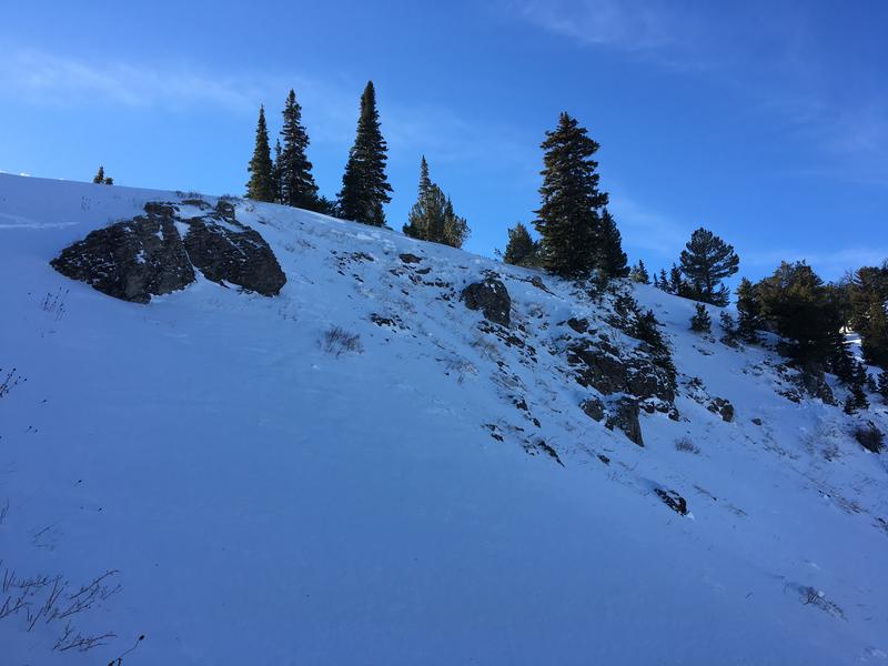
The Tony Grove Road is open but not maintained for winter travel of wheeled vehicles. With a few more inches of snow, the road is likely to be sketchy to try to drive on again today, especially up high. The Tony Grove Road is shared use with vehicles, sleds, pedestrians and dogs, so please use caution, keep your speed down and be nice.
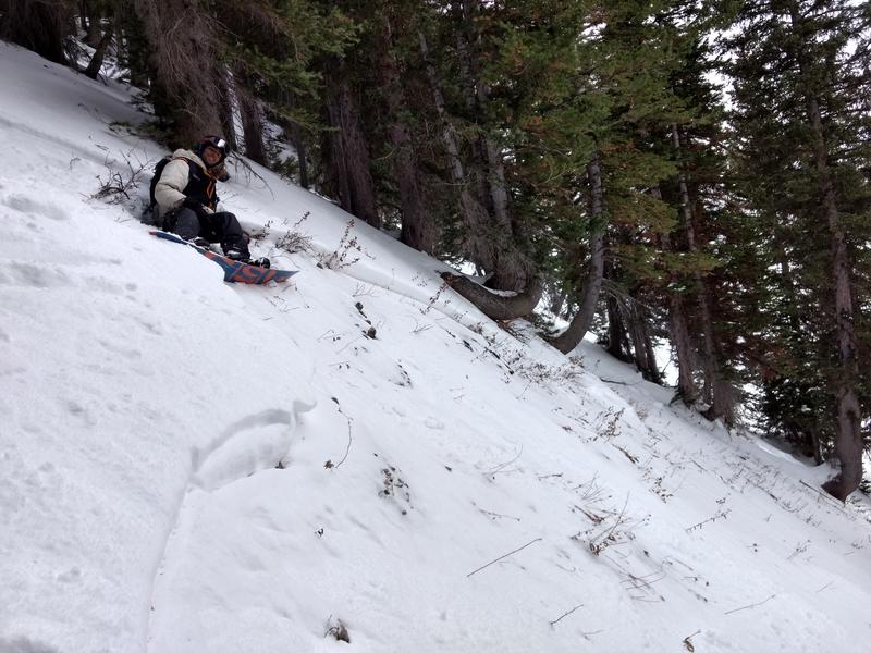
Snow is starting to pile up on the slopes of Beaver Mountain, and managers are glad to allow uphill traffic. You can avoid the Tony Grove Road challenge, find generally safe conditions in lower angled terrain, and help pack out the ski hill. We found pretty nice, smooth powder conditions up there yesterday, and good coverage. Remember, before it opens, Beaver Mountain is the backcountry.
Join the UAC for the 2nd Annual Ogden Backcountry Bash at The Front Climbing Gym in Ogden. Beer, pizza, silent auction, prizes, and climbing! November 29 6:30 PM - 9:30 PM The Front Climbing Club, 225 20th street, Ogden UT 84401
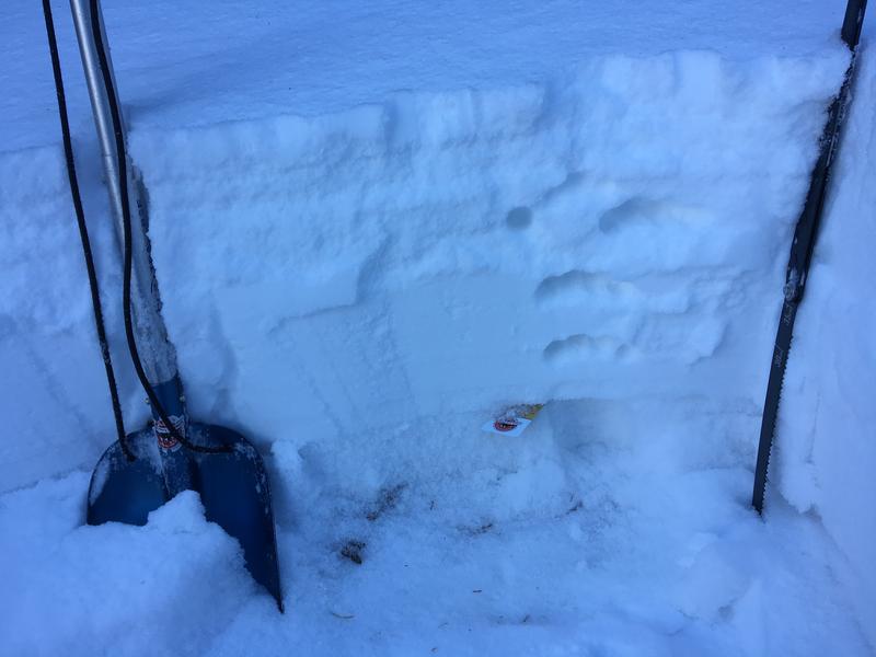
Now is a great time to practice companion rescue techniques with your backcountry partners.
Remember your information can save lives. If you see anything we should know about, please help us out by submitting snow and avalanche observations. HERE You can call us at 801-524-5304, email by clicking HERE, or include #utavy in your Instagram.
This advisory is from the U.S.D.A. Forest Service, which is solely responsible for its content. This advisory describes general avalanche conditions and local variations always occur.