Forecast for the Logan Area Mountains

Issued by Toby Weed on
Saturday morning, November 14, 2020
Heavy snowfall and drifting from last night's storm created heightened avalanche conditions in the backcountry, and people could trigger avalanches of drifted new snow in many areas. Continued drifting from west winds today could create CONSIDERABLE danger on some upper elevation east facing slopes, and human triggered avalanches may become likely.
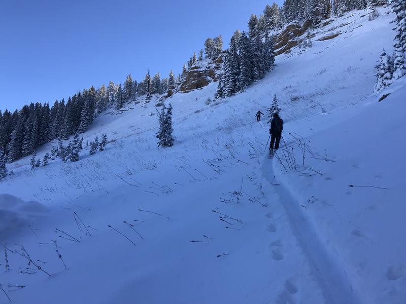
As snow starts to accumulate in the backcountry, it’s a good idea to tone it down because it’s pretty easy to get hurt in shallow snow, and it’s absolutely the worst time to do so because you could ruin your whole season.
- Avoid going too fast, maintain control, and be conservative. Stick to smooth, grassy, low-angled slopes.
- Stay off steep slopes with recent deposits of wind drifted snow. Even a very small, early season avalanche can be very dangerous if you are caught carried over rocks or raked through bushes and stumps.

Low
Moderate
Considerable
High
Extreme
Learn how to read the forecast here
Weather and Snow
The National Weather Service has continued a Winter Storm Warning through 10:00 Saturday morning, with significant snowfall winding down and strong westerly winds continuing in the mountains in northern Utah. About 17" of new snow fell at the 8400' TGLU1 Snotel overnight, and winds have been cranking along the ridges, with hourly average wind speed in the mid thirties (mph), and gusts in the 60 mph range at the CSI Logan Peak weather station. Plenty of new snow and significant wind drifting has created heightened avalanche conditions on many steep mountain slopes. Continued drifting from west winds today could cause dangerous conditions to develop in some upper elevation terrain, and people will be more likely to trigger dangerous wind slab avalanches.
Paige looks at shallow pre-storm snow conditions in the Central Bear River Range on 11-13-2020
This week we found a bit more than a foot of new snow covering up the rocks, with no old snow at all before last weekend's storm. After a short break today, snowfall will return tonight and tomorrow, with 4 to 10 inches of additional accumulation possible.

This week's snow is accumulating on bare ground after a warm and dry October. There is no base, and the biggest risk for early backcountry travelers will be hitting rocks and other shallowly buried obstacles.
There is not yet enough snow to cause much risk of avalanches on most slopes now, but shallow, early season snow conditions can still be quite dangerous. Just in the past week, shallowly buried rocks are to blame for the tragic death of a Bozman woman who died while skiing a steep chute in the Montana backcountry (info here). Also, for that of a British Columbia snowboarder who was killed by head trauma in a “freak backcountry accident” while skiing on his split board in relatively flat, rolling terrain. He was found with his helmet off his head and on his backpack (info here).
Recent Avalanches
Please report what you are seeing out there, especially any new avalanche activity.
Avalanche Problem #1
Wind Drifted Snow
Type

Location

Likelihood

Size

Description
Avalanches of fresh wind drifted snow are possible on all steep upper and mid elevation slopes, most likely on slopes facing the eastern half of the compass. Even a small wind slab avalanche could be very dangerous due to shallow early season snow conditions. You do not want to get caught and carried over rocks or strained through bushes and stumps, so it's best to avoid travel on all steep drifted slopes.
Avalanche Problem #2
New Snow
Type

Location

Likelihood

Size

Description
Avalanches of heavy new snow are possible for people to trigger today on all steep slopes with significant deposits of fresh snow, most likely at upper elevations.
General Announcements
The Tony Grove Road is not maintained for wheeled vehicles in the winter, and you can expect very poor driving conditions this weekend. Be sure you are dressed for winter and have a shovel and emergency items if you do attempt to drive up. Please keep your speed down and be patient.
EMAIL ADVISORY. If you would like to get the daily advisory by email you subscribe HERE.
Remember your information can save lives. If you see anything we should know about, please help us out by submitting snow and avalanche observations....HERE. You can also call us at 801-524-5304, email by clicking HERE, or include #utavy in your tweet or Instagram.
This forecast is from the USDA Forest Service, which is solely responsible for its content. The forecast describes general avalanche conditions and local variations always occur.