Forecast for the Logan Area Mountains

Nikki Champion
Issued by Nikki Champion for
Tuesday, January 9, 2024
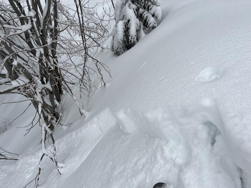
This morning, the overall avalanche danger is MODERATE but will rise to CONSIDERABLE on most slopes as the storm develops. The elevated winds may create unstable slabs of wind-drifted snow at mid and upper elevations. Be particularly cautious on west to north to southeast-facing terrain, as a now-buried weak surface layer could cause any avalanche triggered within the wind-drifted snow to step down deeper into the snowpack. Additionally, today’s new snow may produce long-running sluffs.

The danger may spike to HIGH during or after periods of heavy snowfall within the upcoming days. Pay attention to changing weather patterns; the danger will rise sooner than anticipated if the storm comes in sooner than anticipated.
Low
Moderate
Considerable
High
Extreme
Learn how to read the forecast here
Avalanche Watch
THE FOREST SERVICE UTAH AVALANCHE CENTER IN SALT LAKE CITY HAS ISSUED A BACKCOUNTRY AVALANCHE WATCH WHICH IS IN EFFECT FROM 6AM MST TUESDAY TO 6AM MST FRIDAY.
* WHAT...THE AVALANCHE DANGER IS EXPECTED TO REACH HIGH.
* WHERE...FOR THE MOUNTAINS OF NORTHERN AND CENTRAL UTAH AND SOUTHEAST IDAHO, TO INCLUDE THE WASATCH RANGE...THE BEAR RIVER RANGE..UINTA MOUNTAINS...AND THE MANTI-SKYLINE PLATEAU.
* WHEN...IN EFFECT FROM 6AM MST TUESDAY TO 6AM MST FRIDAY.
* IMPACTS...EXPECTED STRONG WIND AND HEAVY SNOWFALL WILL CREATE WIDESPREAD AREAS OF DANGEROUS AVALANCHE CONDITIONS. BOTH HUMAN TRIGGERED AND NATURAL AVALANCHES ARE LIKELY.
Special Announcements
Sign up for forecast region-specific text message alerts. You will receive messages about changing avalanche conditions, watches, and warnings...HERE
Weather and Snow
This morning, skies are overcast and it is lightly snowing in the mountains, with no real measurable precipitation yet. Temperatures are hovering in the single digits F. Winds picked up and switched directions, becoming more west-southwesterly and averaging 25-35 mph, with gusts near 45 mph along the highest ridgelines.
Today a winter storm warning has been issued for the area, which could produce up to 30" of new snowfall to the Logan area. Snowfall should continue through Thursday morning, bringing up to 6-8" of new snow to the range by 5 PM tonight and another 6-10" of new snow overnight. Snowfall will be heavy at times, particularly mid-day today between 11 AM and 5 PM. Temperatures will remain crisp, climbing into the mid-teens Fs F. The southwesterly winds will remain elevated throughout the day; the mid-elevation ridgeline winds will average 25-35 mph, gusting up to 45 mph. Some of the highest ridgetops could see winds between 50-60 mph. An active and increasingly cold weather pattern will bring storm systems to the region throughout the week.

Over the last few days, skiers and riders found up to 2' of soft snow across the range. As conditions increase in quality, so will the avalanche danger increase with very weak pre-existing surface snow widespread across the mountains of northern Utah. The new snow is not bonding well to the weak, old snow surface. Avalanches will become increasingly possible as the fresh powder accumulates on slopes steeper than 30° and drifts into avalanche-starting zones.

Shallow, early-season conditions still exist; hitting rocks or downed trees is a significant consideration.
Recent Avalanches
Yesterday, near the Dog Leg Trees, Toby triggered both a cut-bank with the sled and a couple of very small soft slabs on a steep mid-elevation slope that failed on the same sugary interface You can find the full observation HERE.
Dog Leg Trees - T. Weed

Check out local observations and avalanches HERE.
Ad
Avalanche Problem #1
Wind Drifted Snow
Type
Location
Likelihood
Size
Description
Winds remained elevated overnight, with gusts near 50 mph. With high winds and so much soft snow available for transport, you are likely to find sensitive slabs of wind-drifted snow on all upper-elevation slopes, and mid-elevation terrain features that allow for drifting snow to accumulate. The new soft slabs will be most pronounced on lee-ward facing slopes, but high winds can load any aspect because winds swirl and change direction as they pass through the mountains, this is known as cross-loading.
What to do? Look for evidence of fresh drifts and wind slabs that look wavy, rounded, smooth, and pillow-shaped, and avoid steep terrain where you could trigger them.

Though alluring, these smooth-looking, rounded pillows of snow are sitting on top of very weak, pre-existing surface snow. The best riding conditions will be in sheltered, lower-angle terrain out of the wind.
Avalanche Problem #2
Persistent Weak Layer
Type
Location
Likelihood
Size
Description
As an active system brings high snowfall totals this week, the avalanche danger is expected to rise. Widespread weak, faceted surface snow will become a persistent weak layer as successive storms bury it. The December drought layer, is now capped by 12-24" of low-density snow. In most areas, this new snow has not yet formed a cohesive enough slab for widespread avalanches. Instead, it has triggered dry loose new snow avalanches, often stepping into the weak facets below.
While we haven't reached a tipping point, the combination of water and wind is bringing us close, and this storm is likely to tip the scales. The weak snowpack structure is clear, and once a slab forms on top of this weak faceted surface snow, we will have very dangerous avalanche conditions.
Avalanche Problem #3
New Snow
Type
Location
Likelihood
Size
Description
The issue is straightforward today: as snowfall intensity increases, so does the avalanche danger. The approaching front is expected to bring periods of high snowfall rates and overall high snowfall totals. Anticipate shallow new snow avalanches in the backcountry, especially in the upper elevations, with fast-running sluffs likely.
The type of avalanche will depend on how quickly the new snow bonds compared to the rate of snowfall. Watch for signs of instability like cracking and sluffing, as even a small slide can pose serious risks in steep terrain or near cliffs. The sensitivity of the new snow is closely tied to the rate of snowfall, with higher rates (greater than 2 inches per hour) making avalanches easier to trigger. Be alert to changing weather and increased snowfall rates, particularly late this afternoon and early this evening, when small natural avalanches may be possible.
Additional Information
Always follow safe travel protocols on or under slopes steeper than 30°.
  • Be sure everyone in your party has working avalanche rescue equipment, including a transceiver, probe, and shovel. Practice with this equipment regularly, and include and instruct new partners.
  • Cross avalanche paths and runout zones one person at a time, with the rest of the party watching from a safe place.
  • Reevaluate and be willing to change your plans if you encounter any signs of instability, like recent avalanches, audible collapses (whumpfs), or cracking in drifted snow.

Two new weather stations are found in the Logan Zone this season. The Paris Peak Weather Station (available HERE) and the Card Canyon Weather Station (available HERE)
General Announcements
  • For all questions on forecasts, education, KBYG, events, online purchases, or fundraising: call 801-365-5522.
  • To report an avalanche or submit an observation from the backcountry: go HERE
  • Read Mark's blog about electromagnetic interference of avalanche transceivers HERE.
    We will update this forecast by 7:30 AM tomorrow.

    This forecast is from the U.S.D.A. Forest Service, which is solely responsible for its content. This forecast describes general avalanche conditions, and local variations always occur.