Forecast for the Logan Area Mountains

Issued by Nikki Champion on
Monday morning, January 8, 2024
Monday morning, January 8, 2024
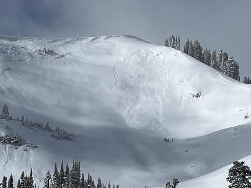
In general, there’s a MODERATE avalanche danger on most slopes across the range. However, a CONSIDERABLE danger exists on all upper-elevation slopes due to heavy snowfall and elevated winds. Be particularly cautious on west to north to southeast-facing terrain, as a now-buried weak surface layer could cause any avalanche triggered within the wind-drifted snow to step down deeper into the snowpack. In wind-protected areas, watch out for loose dry sluffs.
As the avalanche danger increases, careful snowpack evaluation, cautious route-finding, and conservative decision-making will be essential.

Low
Moderate
Considerable
High
Extreme
Learn how to read the forecast here