Forecast for the Logan Area Mountains

Toby Weed
Issued by Toby Weed for
Wednesday, January 23, 2019
CONSIDERABLE: Heightened avalanche conditions exist this morning on previously drifted upper and mid elevation slopes with buried persistent weak layers. Drifting of accumulating snow from westerly winds today will cause rising avalanche danger and dangerous conditions to develop in some areas. You can find safer conditions on lower angled slopes, at lower elevations, and in sheltered terrain, but evaluate snow and terrain carefully.
-Use extra caution in the backcountry, make conservative choices, and continue to stay off and out from under steep drifted slopes.
Low
Moderate
Considerable
High
Extreme
Learn how to read the forecast here
Weather and Snow
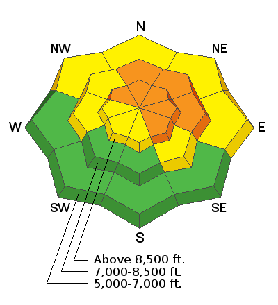
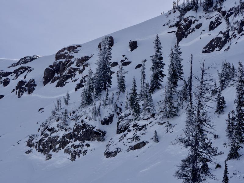
Wicked cold north winds wrecked the snow at upper elevations in the Bear River Range and obscured evidence of widespread natural avalanches from last weekend's storm. Stability has improved on lower elevation slopes, where cold temperatures solidified rain-saturated snow. We found nice shallow powder conditions on sunny slopes, in sheltered terrain and at lower elevations.
Cold north winds sculpted the fresh snow on Naomi Peak, scouring it off of exposed slopes and depositing it into deep stiff drifts where the wind is slowed by terrain.
The Tony Grove Snotel at 8400' reports 13º F this morning and there's 61" of total snow containing 93% of average SWE for the date. I'm reading a wind chill of -17º F, with 7º F at the 9700' CSI Logan Peak weather station, and west-southwest winds are currently averaging around 35 mph, with gusts approaching 50.
A series of weak storm systems will move over the Logan Zone through the end of the week, bringing periods of mountain snow accumulations and temperatures near seasonal normals. Today we'll see 4 to 8 inches of snow, with high temperatures at 8500' around 23º F, and 20 to 25 mph west-southwest winds with gusts around 40 mph.. Tonight, 3 to 7 inches of snow, temperatures around 25º F, and 15 to 20 mph west wind. Snow showers are likely tomorrow, with temperature around 25º F, and 15 to 20 mph west-northwest wind.
Recent Avalanches
-A backcountry skier was buried by an avalanche and killed near Fairview late Thursday, 1/18/19. Search and rescue teams from Emery and Sanpete County recovered his body Friday near Electric Lake on the Manti Skyline. Preliminary report is HERE.
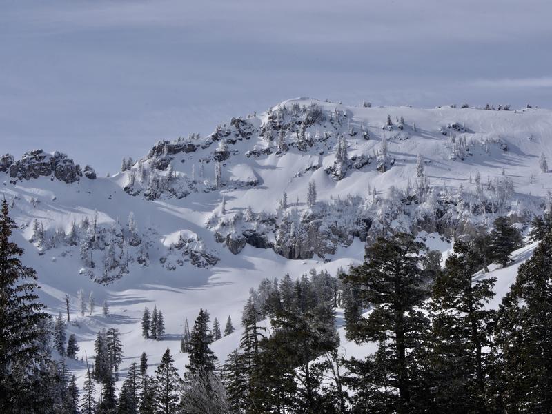
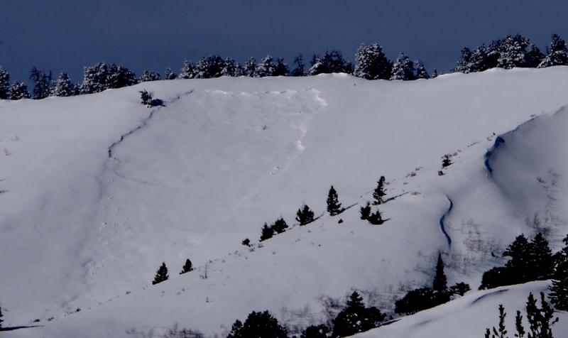
-Natural avalanches were widespread across the Logan Zone late last week, but they're covered up by fresh snow now so not so obvious. Natural avalanches of note include somewhat blown-in evidence of large hard slab avalanches on many paths in the Wellsville Range, and in the Bear River Range, including big ones in Wood Camp, Tab Hollow, Logan Dry Canyon, and Castle Rock near Naomi Peak.
I could see evidence of a large hard slab avalanche in off the Beirdneau Ridge in Tab Hollow.

Part of the 1/4mile-long crown on Castle Rock near Naomi Peak
Ad
Avalanche Problem #1
Wind Drifted Snow
Type
Location
Likelihood
Size
Description
Drifting from westerly wind continues at upper elevations this morning and will intensify today. Wind drifted snow is causing dangerous avalanche conditions in exposed upper and mid elevation terrain. Dangerous triggered wind slab avalanches, 1 to 2-feet-deep will become likely this afternoon in some areas. As drifts built up and continue to build on slopes with buried persistent weak layers, elevated avalanche conditions are likely to persist for a while.
Avalanche Problem #2
Persistent Weak Layer
Type
Location
Likelihood
Size
Description
Layers of weak December snow and shallow snow near the ground in many areas is loose, sugary, and faceted. Hard slab avalanches 2 to 4 feet deep failing on buried persistent weak layers could be remote triggered on steep slopes with poor snow structure, meaning you might trigger one from a distance, or below. The weak faceted snow will cause slopes to be unstable as they gradually adjust to the new snow and drifting. A smaller wind drifted snow avalanche might step down into old snow as it descends and become large and dangerous. The sugary snow will remain weak and many slopes will probably stay unstable for a while.
Additional Information
I will update this forecast Friday morning.
Now is a great time to practice companion rescue techniques with your backcountry partners. You should check out and use the new Avalanche Beacon Training Park we set up at the Franklin Basin trailhead. Special thanks to Northstars Ultimate Outdoors and USU Outdoor Program for helping us to make this possible.
General Announcements
The Beaver Mountain Backside is the backcountry, and it is avalanche terrain. If you cross the ski area boundary, you and your partners should carry and practice with avalanche rescue equipment.
Check out the improved weather links, road conditions, and weather links for each forecast region on the new UAC IOS App. Do you use the NOAA point forecast? If so, now you can bookmark your favorite weather locations in "My Weather" in the App. HERE
Are you new to the backcountry or looking to refresh your skills? The UAC has released a free 5-part avalanche skills eLearning series. HERE
If you would like to get the daily advisory by email you subscribe HERE.
Support the UAC through your daily shopping. When you shop at Smith's, or online at REI, Backcountry.com, Patagonia, NRS, Amazon, eBay by clicking on these links, they donate a portion of your purchase to the UAC. If you sell on eBay, you can have your See our Affiliate Page for more details on how you can support the UAC when you shop
Remember your information can save lives. If you see anything we should know about, please help us out by submitting snow and avalanche observations. HERE You can call us at 801-524-5304, email by clicking HERE, or include #utavy in your Instagram.
This forecast is from the U.S.D.A. Forest Service, which is solely responsible for its content. The forecast describes general avalanche conditions and local variations always occur.