We found less sensitive drifts than expected from the strong east winds on the last day of 2018, but triggered avalanches involving wind drifted snow are certainly possible on drifted upper and mid elevation slopes. Some drifts probably formed in unusual or unexpected places, and you'll need to carefully evaluate any slope you plan to commit to. Continue to avoid steep drifted terrain.
The Tony Grove Snotel at 8400' reports 8º F this morning and there's 42"of total snow containing 85% of average SWE. It's a balmy 15º F at the 9700' CSI Logan Peak weather station, and north-northwest winds are currently averaging about 23 mph.
High pressure aloft will expand east across the western states through the balance of the week. Strengthening inversions will trap cold air in the valleys, with a warming trend developing across the higher elevations. Today will be sunny and cold in the mountains, with a high temperature at 8500' around 19º F and 5 to 7 mph west-northwest wind. Wind chills as low as -13º F are expected. Tonight will be clear, with a low around 3º F and 6 mph west wind, creating wind chill values around -6º F. Tomorrow will be sunny and warmer in the mountains, with a high temperature near 27º F, and 5 to 8 mph west-southwest wind.
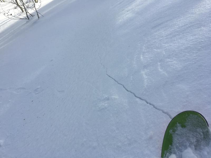
The shallow snow on the ground in many areas has become loose, sugary, and faceted in the past couple weeks, and this week's very cold temperatures are only making it worse. We've found particularly weak snow at mid and lower elevations in the backcountry, anywhere where the total snow is fairly shallow. Lacking a slab of stronger snow on top for now, the sugary snow is currently stable despite it's weakness.
No avalanches were reported recently in the Logan Zone.. A party reported triggering an audible collapse or whumpf yesterday on an upper elevation ridge in Franklin Basin, just north of the Idaho State Line.