Looking to up your avalanche knowledge? Want to feel more confident about making decisions in the backcountry with your group? Join us for a Backcountry 101 for snowmobilers on January 28 and 29. This life-saving course is designed for snowmobilers and snow bikers taking their first on-snow avalanche class or looking to refresh previous training. For more information and to sign up, click here.
Sunny slopes will stay firm until they soften with today’s warmth, while sheltered, shady, and northerly aspects still hold dry, settled powder. Riding conditions are generally good in wind-protected terrain. The fast, “loud powder” you’re finding is surface hoar and recrystallized snow, which will become our next weak layer once the next storm buries it. A LOW avalanche danger means avalanches are unlikely, but still possible on slopes steeper than 30 degrees, especially in very steep, outlying, or rarely traveled terrain.
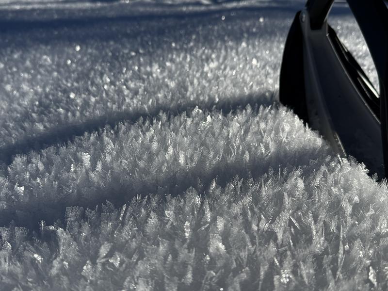
Feathery surface hoar is frost growing on the snow surface. If preserved and buried intact, it can become a devious, persistent weak layer.
The snowpack is mostly stable across the zone, with little recent activity and no reported persistent-slab avalanches since December 7. Use normal caution in the backcountry today, watching for wind-drifted snow at upper elevations and wet snow on steep sunny slopes. Even small avalanches can have serious consequences or step down into deeper weak layers, so use safe travel practices and make sure everyone carries and knows how to use a beacon, shovel, and probe.
The Tony Grove Snotel at 8400 feet reports 22°F and 58 inches of total snow. At the UAC Card Canyon weather station at 8700 feet, it's 19°F, and there is 43 inches of total snow. Currently at 9700 feet on Logan Peak, the wind is blowing in the 20s mph from the northwest, with gusts in the 30s. It's 14°F on Paris Peak at 9540 feet, and the wind is blowing 30 to 38 mph from the north.
As for the forecast, rinse and repeat for the next five days, at least ... Today will be another beautiful day in the mountains with mostly sunny skies and temperatures reaching 29°F. Steady light winds will blow from the northwest. The strong high pressure remains over the region through much of next week, with a continued temperature inversion keeping hazy conditions in the valleys and fair, unseasonably mild conditions in the mountains. There is some hope on the horizon, though, with a chance of measurable precipitation next Friday.
There were no avalanches reported yesterday. It has been a week since the last significant avalanche report, a natural wind slab on Cherry Peak.
For all observations and avalanche activity in the Logan Zone, go HERE.