Join us for the 33rd Backcountry Benefit - Get Your Tickets Now!

Forecast for the Logan Area Mountains

Paige Pagnucco
Issued by Paige Pagnucco on
Saturday morning, January 10, 2026

The avalanche danger is MODERATE today, and human-triggered avalanches are possible on slopes steeper than 30 degrees in mid- and upper-elevation terrain. The biggest concerns are isolated slabs of wind-drifted snow and persistent weak layer avalanches. Evaluate snow and terrain carefully.

Riding conditions are excellent - to ensure you have a great day, only expose one person at a time in steep terrain, and make sure everyone in your group has working rescue equipment and knows how to use it.

Low
Moderate
Considerable
High
Extreme
Learn how to read the forecast here
Weather and Snow

Riding conditions are the best they have been all season right now, with lots of fresh, cold powder across the zone. Expect packed trailheads today. Our primary concerns are slabs of wind-drifted snow on exposed, steep slopes, as well as in and around terrain features such as ridges, sub-ridges, and gullies. Slab avalanches failing on weak facets around three feet deep are also still on our radar. There's plenty of snow to play in, and if you decide to move onto slopes steeper than 30 degrees, follow safe travel protocols, evaluate snow and terrain carefully, and be sure everyone in your group has a beacon, shovel, and probe and knows how to use them.

The Tony Grove Snotel at 8400 feet reports 13°F, with 69 inches of total snow. At the UAC Card Canyon weather station at 8700 feet, it's 11°F, with 50 inches of total snow. Currently at 9700 feet on Logan Peak, it's 9°F, and the wind is blowing around 31 mph from the west-northwest. It's 8°F on Paris Peak, and sadly, the wind sensor is still rimed. Today will be a stunning day in the mountains with a 8500' high of 24°F, mostly sunny skies, and light winds blowing from the northwest. Expect more of the same for the rest of the weekend and the upcoming week, as high pressure continues to dominate the weather pattern over the west.

Recent Avalanches

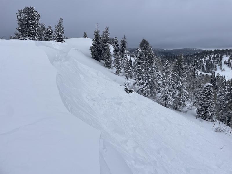
An observer reports triggering a sizable cornice fall avalanche on Tuesday by dropping a cornice on a drifted east-facing slope off the Knob in the Strawberry area near Emigration Summit in the Northern Bear River Range. For all observations and avalanche activity in the Logan Zone, go HERE.

Avalanche Problem #1
Wind Drifted Snow
Type
Location
Likelihood
Size
Description

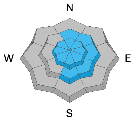
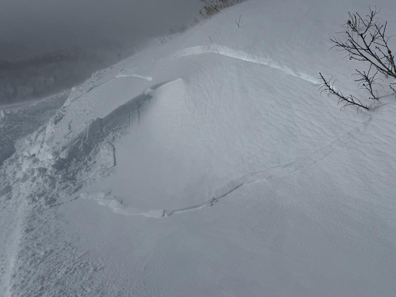
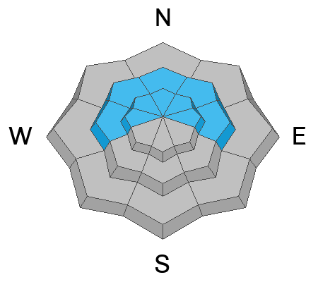
People could trigger wind slab avalanches today, especially in exposed terrain at upper elevations and on drifted mid-elevation slopes facing the east side of the compass. Cornices are likely to break further back than you might expect, and could trigger wind slab avalanches on slopes below.

  • Wind slabs are rounded and chalky-looking and can sound hollow, like a drum when you travel over them.
  • Cracking is an obvious sign of instability.
  • Soft wind slabs of drifted new snow might be quite sensitive to human triggering, while hard, older wind slabs can be devious, sometimes allowing people to get well out on them before releasing suddenly, like a mousetrap.
  • Avoid travel on and under cornices and steep slopes with stiff deposits of recently wind-drifted snow.

Avalanche Problem #2
Persistent Weak Layer
Type
Location
Likelihood
Size
Description
  • Although unlikely, there is lingering potential on isolated slopes with poor snow structure for large and destructive hard slab avalanches that fail on a buried persistent weak layer near the ground. Our concern is gradually decreasing, but the problem may still exist on isolated upper-elevation slopes—especially north-facing, rocky terrain where the snowpack remains thin.
  • Another potential buried persistent weak layer consisting of small sugary grains of faceted snow exists on the interface of last year's snow surface and the heavy snow from the New Year's storm. Slab avalanches today, up to three feet thick, might fail on this buried persistent weak layer.
Additional Information

We checked out the Card Canyon weather station on Thursday. Video here.

Use safe travel practices: travel with a partner, and cross or ride steep slopes one at a time while the rest of your group watches from a safe spot.

Are you interested in learning more about avalanches? Visit our education page for details on all our classes.

For more information, visit the UAC weather page here: UAC Weather Page For Logan-specific weather, go here: Logan Mountain Weather

-For all questions on forecasts, education, Know Before You Go, events, online purchases, or fundraising, call 801-365-5522.

-Remember, the information you provide could save lives, especially if you see or trigger an avalanche. To report an avalanche or submit an observation from the backcountry, go HERE

-Receive forecast region-specific text message alerts to receive messages about changing avalanche conditions, watches, and warnings. Sign up and update your preferences HERE

This forecast is from the U.S.D.A. Forest Service, which is solely responsible for its content. This forecast describes general avalanche conditions and local variations always occur.

General Announcements
This information does not apply to developed ski areas or highways where avalanche control is normally done. This forecast is from the U.S.D.A. Forest Service, which is solely responsible for its content. This forecast describes general avalanche conditions and local variations always occur.