
Greg Gagne
Forecaster
Our Week in Review highlights significant snowfall, weather, and avalanche events of the previous week. (Click here to review the archived forecasts for the Salt Lake mountains.)
The danger roses for the Salt Lake mountains from Friday, December 6 through Thursday, December 12, 2019:
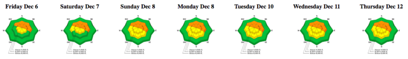
Summary: Continued avalanching in weak snow down near the ground on mid and upper elevation northerly aspects. A decent storm system on Sunday delivers 6-12" of dense snow/graupel containing 0.8-1.5" water. A multi-day storm commences on Thursday, with additional dense snow totaling 4-8" inches by Thursday evening, accompanied by strong winds from the west.
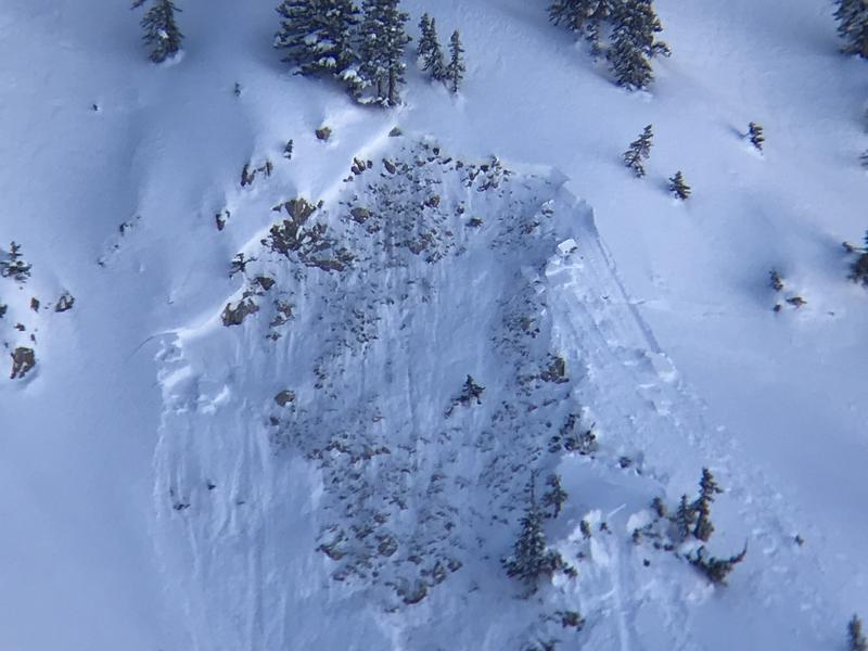
Friday, December 6 - Clearing weather and light winds. Control work at a Little Cottonwood resort in unopened terrain triggers a large avalanche failing in weak snow down near the ground:
Two slides on a north aspect on Sunset Peak are reported, likely triggered remotely. Again, failing down near the ground. (photo: Bo Torrey) [Observation]
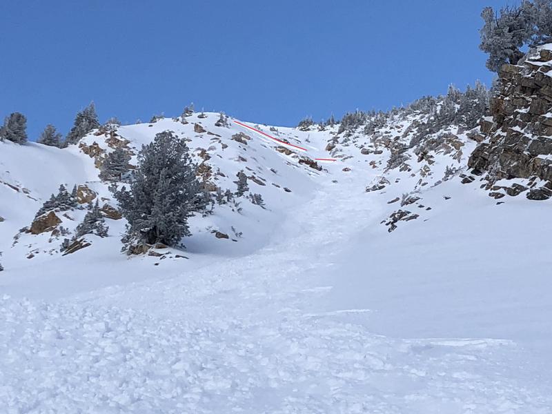
Saturday, December 7 - Increasing southerly winds ahead of a storm system arriving on Sunday. A remotely-triggered slide on a steep north aspect along the west ridge of Peak 10,420' in Big Cottonwood canyon. Failing on weak facets and depth hoar down near the ground. [Excellent Observation]
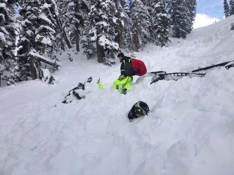
In the Bear River Range just over the Idaho border, a near-miss with a partial-burial involving two snow machiners. Fortunately, no injuries and both riders were able to leave the scene on their own [Observation]
Sunday, December 8 - 6-12" of dense snow and graupel (containing 0.8-1.5" of water) is reported throughout the Salt Lake mountains. A skier-triggered avalanche on Square Top along the Park City ridgeline [Observation] which involved triggering a sizable avalanche on a slope cut, which then sympathetically released two other avalanches. These avalanches were on a steep, northeast aspect at 9400', failing in weak snow down near the ground. It is likely this slope had slid earlier (known as a "repeater"), leaving the weak snow down near the ground intact.
Monday, December 9 - A skier-triggered avalanche on a southeast aspect in Toledo Chute in Little Cottonwood canyon. The slope was likely wind-loading from recent winds. [Observation]
Tuesday, December 10 -
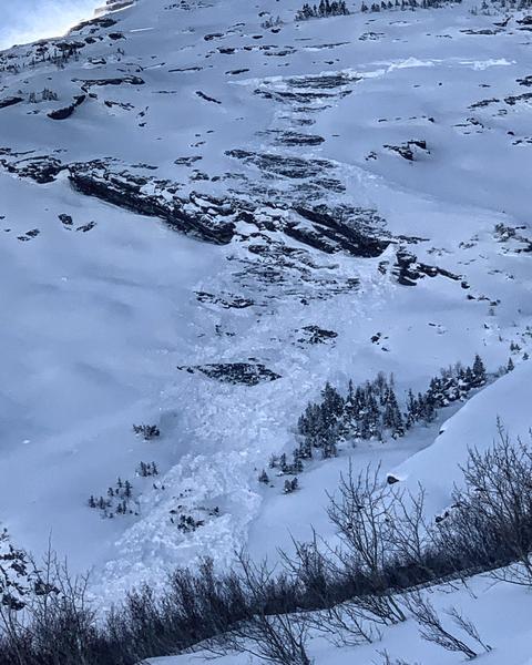
Two glide avalanches reported from Broads Fork in Big Cottonwood Canyon, on the classic runs Bonkers and the Diving Board. Glide avalanches are typically more of a spring-time phenomenon and are rather unusual for early December. (Mark White photo)
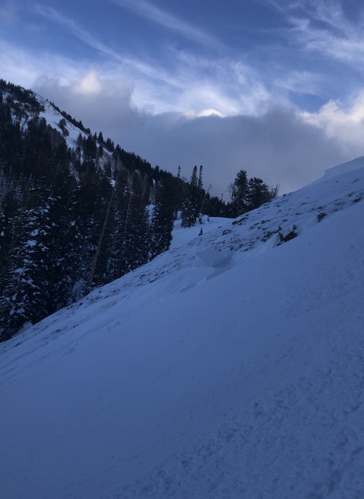
Wednesday, December 11 - Increasing clouds and westerly winds with trace amounts of new snow. Control work at Cottonwood resorts continue to produce avalanche activity on northerly aspects, failing in weak snow down near the ground. Some of these avalanches are repeaters, which avalanched over Thanksgiving, but left weak snow in place, providing a weak layer for continued avalanching once more snow filled in on the slope.
Thursday, December 12 - Snowfall begins in the early morning hours, with evening snowfall totaling 4-8". Periods of strong winds from the west/southwest create wind slabs along upper elevation ridges. Reports of sensitive storm slabs 6-10" thick, failing within the storm snow.


