

Week in Review for Friday Jan 19 through Thursday Jan 25
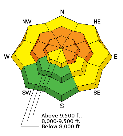
Progression of danger roses and overall hazard rating for the Salt Lake Mountains from 1/19- 1/25. (Click on the day of the week for the archived forecast for that day.)
| Friday | Saturday | Sunday | Monday | Tuesday | Wednesday | Thursday |
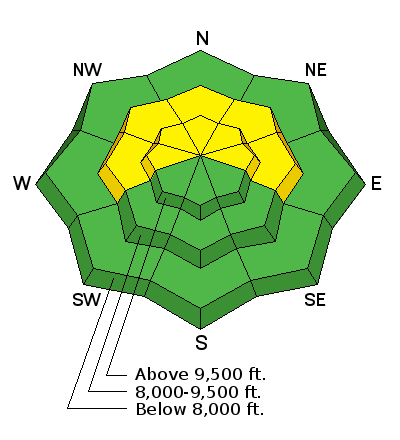 | 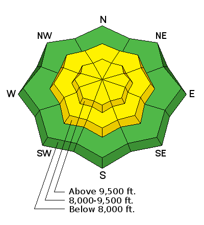 |  | 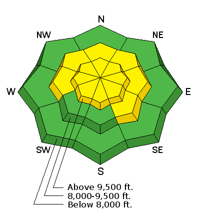 |  | 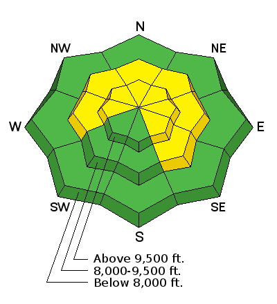 |  |
| Moderate | Moderate | Considerable | Moderate | Moderate | Moderate | Considerable |
Summary- A storm system early in the weekend delivered cool temperatures, light winds, and 1-2' of legendary Wasatch fluff. Weekend storm totals included (snow/water):
- Little Cottonwood - 20"/1.08"
- Big Cottonwood - 16"/0.85"
- Park City ridgeline - 16"/1.0"
- Ogden area mountains -14"/1.05"
- Provo area mountains - 10"/0.75"
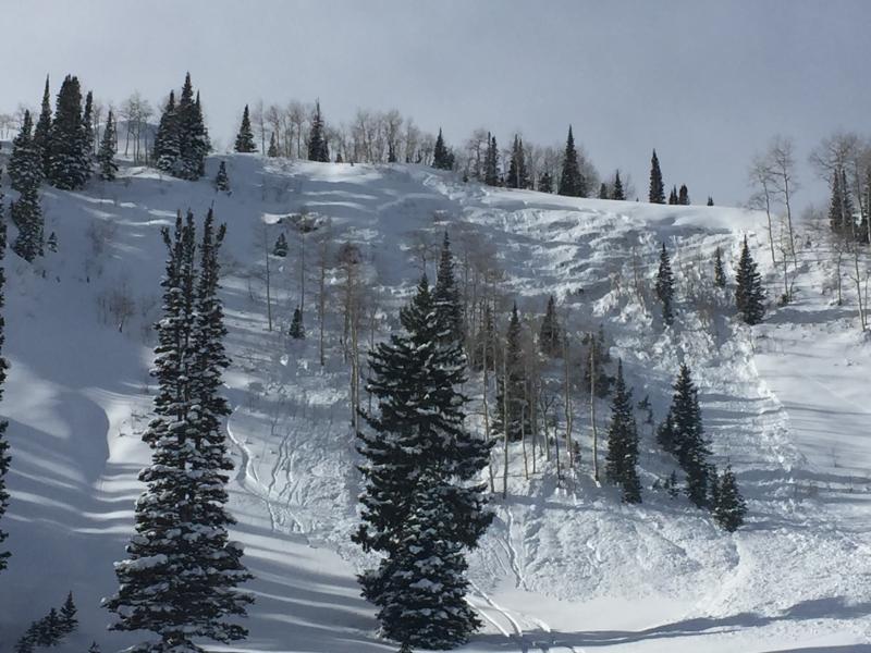
With a weak, pre-existing snowpack on the shady aspects, numerous human-triggered avalanches occurred, with at least one close call.
Friday January 19 - Winds and warm temperatures signaled the arrival of a cold front which entered the Wasatch mountains in the evening.
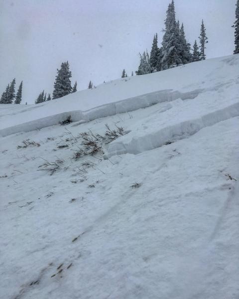
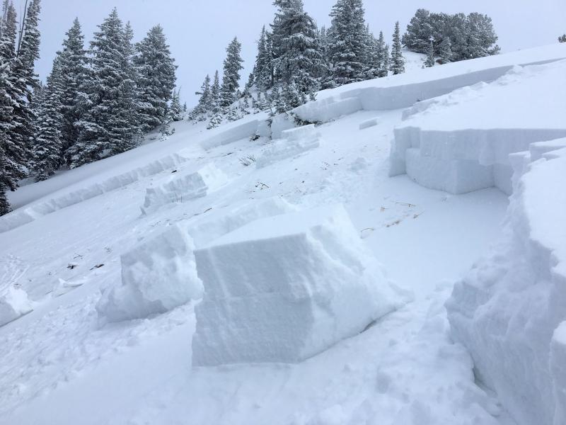
Saturday Jan 20 - Storm totals overnight favored areas that do well with a southwest flow including upper Big Cottonwood Canyonand the Park City ridgeline. Three human-triggered avalanches were reported on Saturday, all breaking into faceted snow down 2-3':
No Name Bowl - (Observation as well as report from party that triggered the slide.)
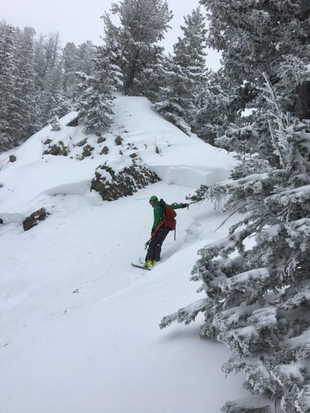
Sunday Jan 21 - Winds veered to the northwest later on Saturday, with additional snowfall especially interrain that favors a northwest flow such as upper Little Cottonwood. A slide was triggered by a snowmobiler in Caribou Basin adjacent to Snake Creek:
An avalanche also occurred at the Snowbasin Resort in a zone with recently-opened terrain.
Monday/Tuesday Jan 22/23 - Benign, cool high pressure with a few inches of very low-density snow reported at the upper elevations. Steeper lines on solar (southerly) aspects safely being skied.
Wednesday Jan 24 - Winds begin to pick up and observations of fresh wind-drifting are reported. A human-triggered slide occurs along the Park City ridgeline on Point Peak. Like other slides from this past week, this was on a northeast aspect and failed on a buried persistent weak layer, breaking down 2-3'. The rider deployed their airbag and ended up partially buried with fortunately no injuries.
Thursday Jan 25 - Winds increased ahead of a storm that arrived in the afternoon, delivering 6-8" of fresh snow in the Cottonwoods and along the Park City ridgeline by Friday morning.
Storm totals for the week pushed 2' for many locations, with about 1.5" of water.


