
Week in Review for Friday, February 27th - Thursday, March 5th, 2026
We look back at the key events from the previous week. Click HERE for archived forecasts.
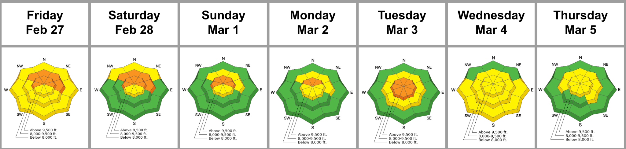
Summary: The main concerns this week centered around an increasingly dormant PWL, wind slabs around the compass, and rising danger for wet loose avalanches on solar aspects. Even though the last known avalanche that failed on the buried Dry January Layer of facets was on Thursday, February 26, the danger remains CONSIDERABLE for much of the week. A storm drops a foot of heavy, dense snow Monday night, but the new snow issues quickly stabilize. By Wednesday, the likelihood of triggering one of these hard slabs failing on the PWL drops from “likely” to “possible”, and the overall danger drops to MODERATE.
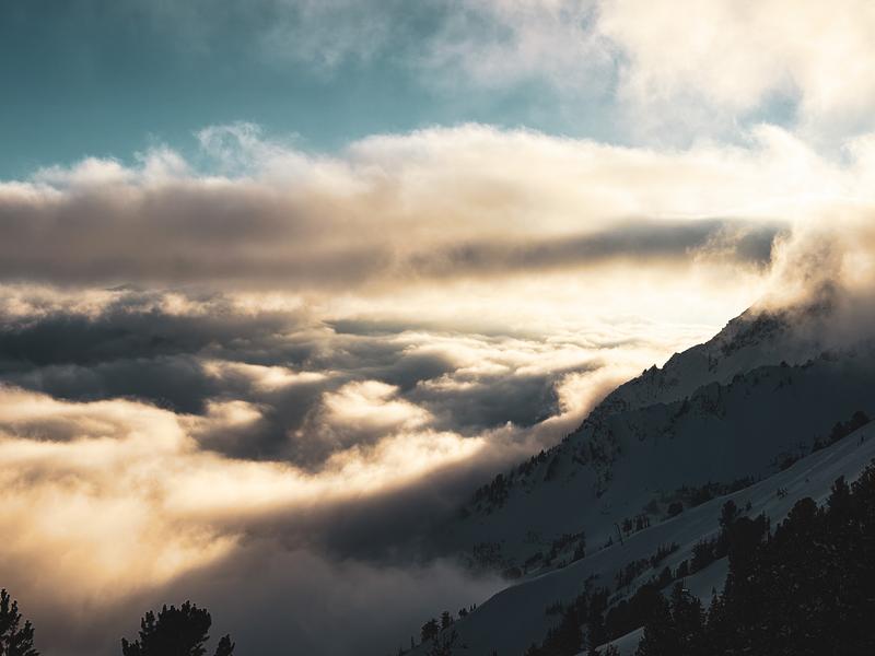
Dusk patrol light on Superior, Bo Torrey
Friday, February 27: Friday dawns clear. Forecasters, wary of two large avalanches triggered the day before (upper Days and Caribou Basin) on the buried PWL 2-3’ deep, continue to warn of dangerous conditions. Perhaps it was a lack of people in the backcountry, or just recreationists heeding our warnings, but no significant activity was reported on this day.
Saturday, February 28: Skies are partly cloudy. Forecasters continue to worry about the buried Dry January Layer; the avalanche danger remains at CONSIDERABLE. Tests and general lack of activity show the problem as becoming more stubborn, but the consequences of triggering remain the same.
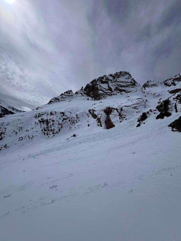
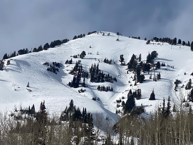
Sunday, March 1: Skies are partly cloudy, and a number of backcountry riders forget the menace of the strong March sun and trigger longer running wet loose sluffs down the south-facing terrain near Superior. Perhaps it doesn’t dawn on them that the Little Cottonwood road is in the runout of these avalanche paths, but the avalanches stop in the main apron. Pic below.
Monday, March 2: Mostly cloudy with light rain to 8000’. South wind ahead of the storm cements just enough wind slab in the very unforgiving terrain of Holy Moly couloir on the north side of Toledo. A skier triggers and is caught in not one but two 10” deep wind slab avalanches, but escapes unharmed. He arrives home and sends us the footage, below.
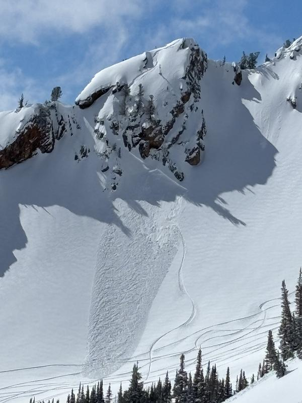
Tuesday, March 3: The storm delivers…Cascade Concrete… with 8-12” of heavy dense snow, containing 1.60” of snow-water-equivalent. The danger is pegged at CONSIDERABLE as gusty west to northwest winds ensure that the wind slab locator rose is colored around the clock. Backcountry skiers unintentionally trigger sizeable wind slabs in Cardiff Bowl and Toledo Chute, each big enough to catch, carry, and bury someone. (Cardiff pic below). Unfortunately, the sun breaks through the clouds earlier than expected, and we hear of a number of natural and human-triggered wet loose sluffs, including a catch and carry on west-facing Patsy Marley late in the day.
Wednesday, March 4: The danger drops to MODERATE around the compass for lingering and developing wind slabs as well as wet loose sluffs on the solars. One skier triggers a wet, loose sluff off the Flagstaff shoulder around midday on a steep east-southeast-facing slope, is caught, and carried, but is otherwise ok. Another skier triggers a 1000’ long running sluff on the south face of Superior.
Thursday, March 5: The danger remains at MODERATE. A classic Wasatch storm commences and it snows off and on all day with 6-10" by 6pm Thursday), it’s snowing that classic low- density snow: We came for a season and stayed for a lifetime…Ski areas and backcountry observers report just new snow and wind slab avalanches in steep terrain.


