This WiR was co-authored by UAC Forecasters Nikki Champion & Brooke Maushund.
Week in Review for Friday, February 13th - Thursday, Feb 19th, 2026
We look back at the key events from the previous week. Click HERE for archived forecasts.
Summary: A weak snowpack structure gets a minor first load without too many obvious signs of instabilities, but all the red flags are there. A series of healthy storms arrive late Monday night, dropping close to 50” of new snow (4.7” H2O) by Thursday morning. An Avalanche WATCH is issues Monday through Tuesday, and is elevated to an Avalanche WARNING Wednesday through Thursday. The first avalanche fatality of the season occurs Wednesday, with the second one occurring not long after on Thursday. The UAC mourns the devastating losses while heading to accident sites, coordinating with local SAR, ski patrols, and Sheriff teams.
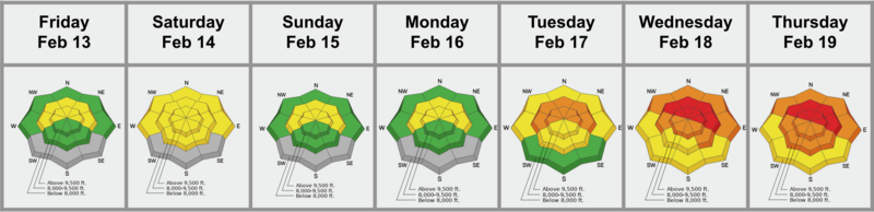
Friday, February 13th: Storm totals from Wednesday and Thursday were 8 to 12 inches of heavy dense snow, bringing snow depths to 60 to 70 inches in the upper Cottonwoods and 40 to 50 inches along the Park City ridgeline, though trailheads and low elevation exits remained thin. Several human triggered avalanches were reported in the backcountry, with rumors of two close calls near Brighton. Most occurred on upper elevation north through east facing slopes where soft slabs 12 to 24 inches deep failed on weak January facets at the new old interface, even on slopes that did not look obviously wind loaded. The persistent weak layer problem was introduced back to the forecast for the first time since January 20th.
Saturday, February 14th: Skies cleared and temperatures increased. The forecast remained a tricky MODERATE as the storm snow began to settle out, but the likelihood of triggering an avalanche on the old snow new snow interface remained about the same. Just outside the Brighton boundary along Pioneer Ridge, a snowboarder triggered a 1 to 2 foot deep soft slab on a wind drifted northeast facing slope around 10,000 feet that failed on facets. In the Upper Cottonwoods, ski area teams also triggered a very large north facing slab at 10,200 feet that broke on faceted snow beneath a cliff band.
With the bump in temperatures and cold new snow blanketing many aspects, wet snow was also added to the danger rose.
Sunday, February 15th: After a beautiful Saturday, clouds moved in and a prefrontal system began to settle across the Wasatch. While wet snow remained on the mind, the primary concern was areas receiving elevated winds sitting atop weak faceted snow. The mountains were generally quiet, with no new avalanches reported, as all eyes were on the next system gearing up to make an impact across the state.
Monday, February 16th: Cloudy skies persisted, winds picked up and gusted near 100 mph along the upper ridgelines, and an Avalanche WATCH was issued for much of the state. While little to no precipitation fell, the system began to set the stage for the rest of the week, with avalanche danger expected to rise. The front began to roll in during the last hours of the night.
Tuesday, February 17th: The forecast team decides to continue the Avalanche WATCH as danger rises to CONSIDERABLE throughout the day. Precipitation falls primarily as graupel. Great skiing is reported, as well as a natural large avalanche in Days Fork, on a NE aspect, 9500’ close to sunset. Mitigation teams at ski areas see impressive results—a sign of what’s to come in the following days. Teams along the PC Ridgeline reported producing a very large (D2.5) avalanche big enough to damage a vehicle with explosives. The slide was a 300' wide wind slab breaking into weak, old snow on a N aspect, 9100'. Teams in Upper Little Cottonwood — reported producing avalanches up to 32" deep and 100' wide with air blasts, potentially breaking into the facets below the new snow on a NW aspect, 10,650'. The stage is set for a large avalanche cycle as more snow falls into the evening.
Large natural avalanche in Days Fork — Burr reported a large natural (D1.5-2) avalanche of new storm snow running in Lucky Days yesterday evening. NE, 9500'
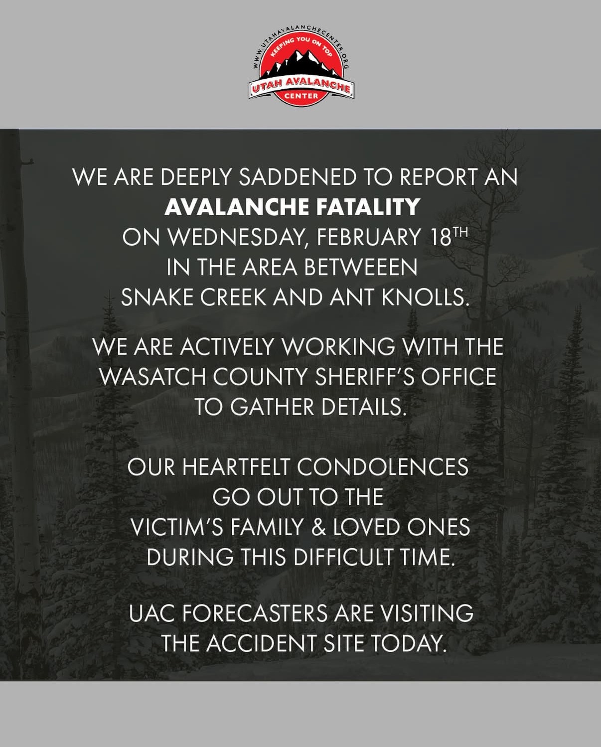
Wednesday, February 18th: Just shy of 20” of new snow (2.22” H2O) is on the ground as the forecast is being written. Another 25-30” are expected throughout the day with blizzard-level precipitation rates in the afternoon. The forecast team in every zone across the state issues HIGH danger, and an Avalanche WARNING is issued in the Salt Lake zone, among others. Multiple close calls are had inbounds and out-of-bounds, but the afternoon is passing without what every forecaster fears. Roads are dangerous at best and may keep a lot of traffic out of the backcountry, but reports of large, destructive avalanches fill the observation page. Then, before the forecaster hand-off call, reports come in of a tragic accident involving 2 snowmobilers near Ant Knolls on the Wasatch Back. Wasatch County Sheriff and SAR teams work to respond. Details trickle in overnight, and a fatality is confirmed. The forecast team makes plans to visit the accident site the following day.
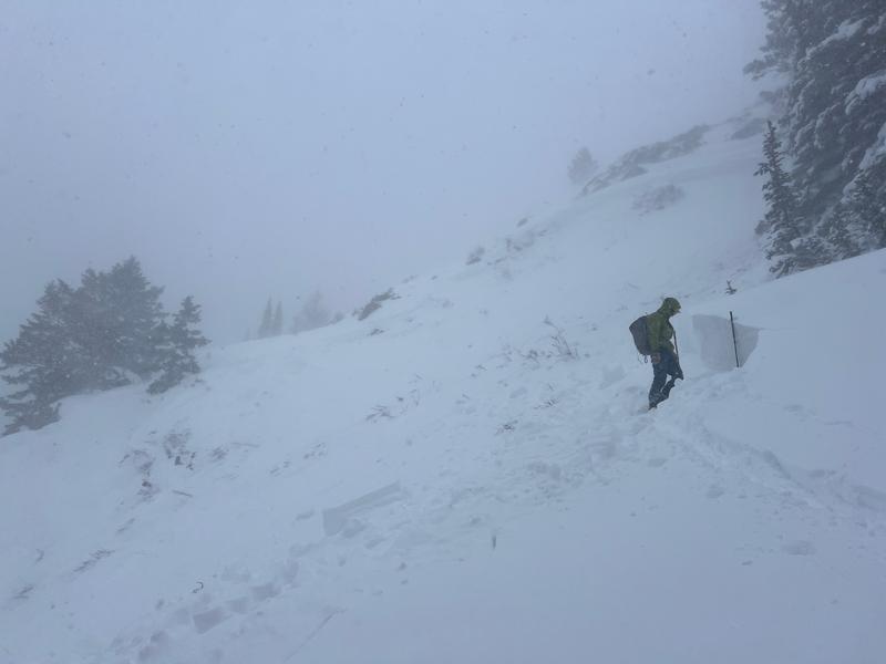
An impressive example of an avalanche crown occurred on a slope where the terrain immediately below the crown was only 27 degrees, failing on faceted and buried near-surface facets with a moderately hard slab. Just left of the main West Desolation Ridge on a shorter, steeper slope. (W. Ambler)
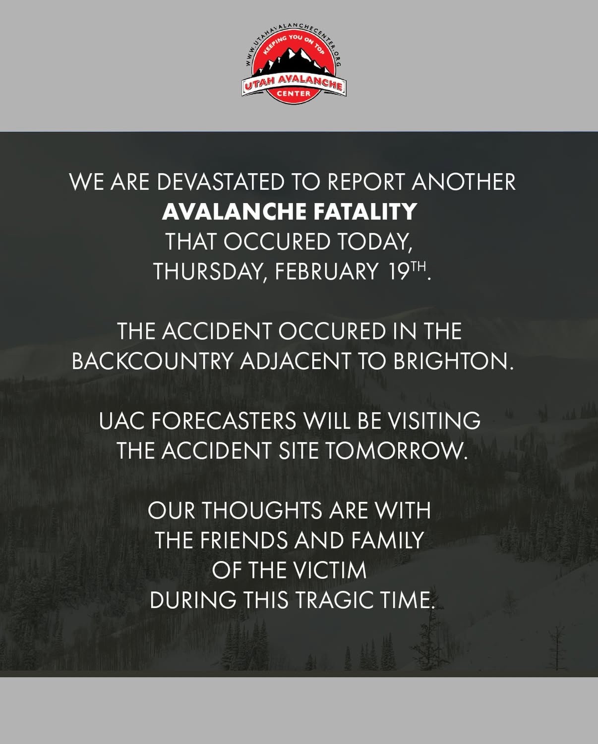
Thursday, February 19th: The Avalanche WARNING and HIGH danger continue, as storm totals inch close to 50” (4.7” H2O) with snowfall the night prior. Avalanche activity and reports are too many to count throughout the day as a break in the weather before another system arrives in the evening. UAC Director Paige Pagnucco and Forecaster Trent Meisenheimer head out to the Ant Knolls area to investigate the accident the night prior. Then, reports of an avalanche involvement in the backcountry adjacent to Brighton reach the forecast team. By the early afternoon, another avalanche fatality is confirmed and the forecast team buckles up for another investigation the following day. In the evening, discussion of what may come this weekend leaves forecasters not resting easy heading into the first weekend with significant new snowfall—and very dangerous avalanche conditions—in over a month.