Week in Review for Friday, February 6th - Thursday, February 12th, 2026
We look back at the key events from the previous week. Click HERE for archived forecasts.
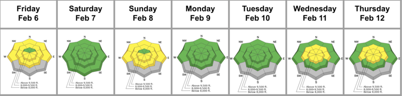
Summary: High and dry conditions prevail through the weekend with mountain temperatures again well above freezing. Backcountry parties trigger wet loose sluffs on solar aspects almost large enough to bury a person on Saturday in Big Cottonwood Canyon, but there’s little else to discuss. The much-anticipated weather pattern change is signalled by a cold front Monday evening. The avalanche danger oscillates between LOW and MODERATE with wet and dry loose being the primary avalanche concerns until mid-week. Wednesday’s storm takes a Wasatch on life-support and breathes life back into the mountains. But avalanches fall into lock-step with the snow and wind, with Wednesday and Thursday being very active days in the backcountry. The danger is pegged at MODERATE for Wednesday and Thursday.
Friday, February 6th: Mountain temperatures again skyrocket into the upper 40s. A backcountry observer reports a natural wet loose sluff in mid-elevation west facing Mineral Fork, although this may have occurred the day before when 700mb temperatures were forecast to be +4C.
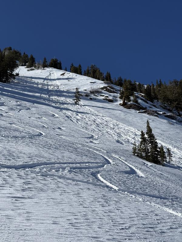
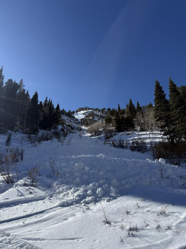
Saturday, February 7th: Wet sluffs continued to show up in the backcountry, with activity noted on east facing Mt Raymond and east facing Kessler Peak. None of the slides were insignificant; each could have buried a person. The party that triggered two slides on Raymond submitted an excellent, and introspective write-up, noting that they perhaps had their blinders on because of the green rose. Pic below.
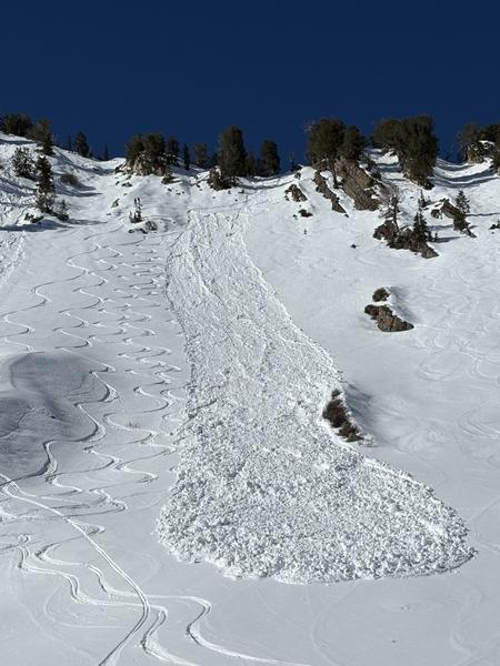
The other significant slide occurred high on Kessler Peak, which required a skier to ski out of the way of an approaching wet slide. The party wrote, “What made this event so scary for us was that the point release essentially developed behind us, while we were looking uphill, and turned into a heavy, dense avalanche before we had time to process the gravity of the situation.” It can be very easy to underestimate wet sluffs - they can start out small and slow, but continue to pick up mass and volume, leaving impressive debris piles. What perhaps made these slides more impactful was that the east and west aspects still hold weak faceted snow…and these sluffs likely gouged down into these weak sugary facets. Pics below:
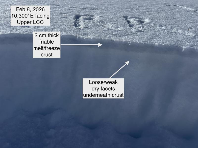
Sunday, February 8th: Another scorcher of a day. All quiet in the backcountry. The Seahawks beat the Patriots in the Super Bowl. Greg Gagne’s outing into upper LCC provides evidence of a slight thermal “crust” on high northerlies and a thin, friable melt-freeze crust with weak snow above and certainly below. Photo below
Monday, February 9th: Red skies in the west portend the storm. Or at least a pattern change. Temperatures drop with frontal passage and light flurries flurry for most of the day, although storm totals end up a trace to 1”.Consistent westerly wind did lead to shallow and mostly unreactive wind pockets along the ridgelines in the Ogden zone. Guide Erik Fullmer has evidence that it really does snow in Utah.
Tuesday, February 10th: Overcast with light flurries. Winds pick up out of the southwest ahead of the next approaching storm. It’s getting ridiculous in Provo as a lot of snow has melted during the weekend’s heat wave.
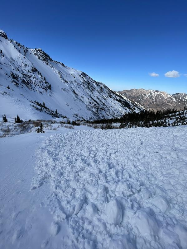
Wednesday, February 11th: A storm on a southwest flow arrives with an initial rain-snow line to 7500’. The danger rises to MODERATE (L2) for wind drifted snow avalanches. Storm totals are a fairly even 8-12” up high with up to 1.25” of snow water equivalent. While the heavy dense new snow breathed life back into the riding conditions, it did come with a cost: cracking, audible collapsing and sensitive and remotely triggered slides were the rule and not the exception. Most slides were 8-12” deep and 40-75’ wide and primarily on upper elevation north through northeast facing slopes that had been affected by the wind.
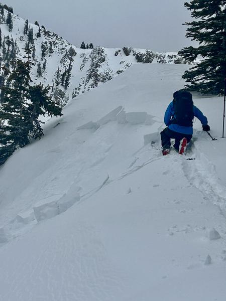
Paige Pagnucco investigates the crown of a remotely triggered avalanche above Twin Lakes pass.
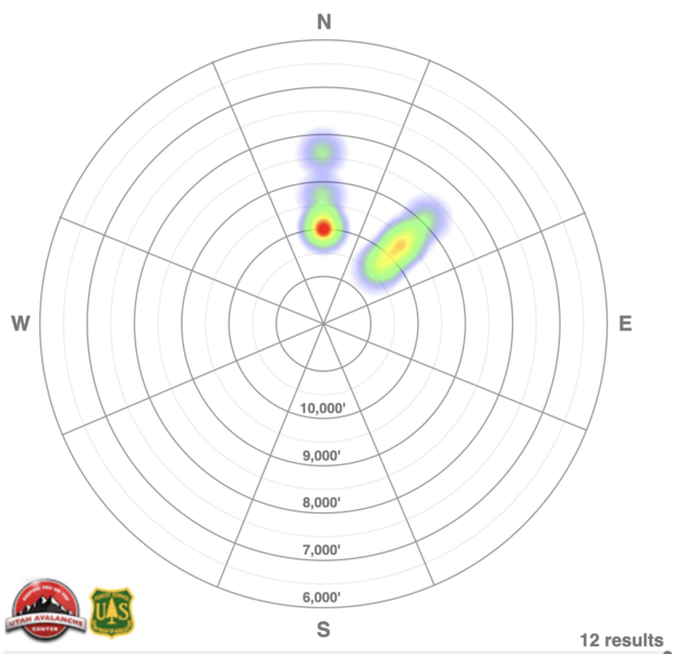
Thursday, February 12th: Skies are partly cloudy until the next wave arrives by midday. Greenhousing ensues, though fortunately the winds remain calm to light. Another six avalanches reported in the backcountry that fail on the January drought layer facets - it's the new/old interface prior to the weeks' storm. Many of these are remotely triggered with one person caught and briefly carried. The two day heat map of avalanche activity is below: