Observer Name
B. Murdock, Trenbeath
Observation Date
Saturday, March 25, 2023
Avalanche Date
Wednesday, March 22, 2023
Region
Moab
Location Name or Route
Northern La Sals, Grand View Peak
Elevation
9,600'
Aspect
Northwest
Slope Angle
38°
Trigger
Natural
Avalanche Type
Soft Slab
Avalanche Problem
New Snow
Depth
2'
Width
500'
Vertical
1,500'
Comments
Forecaster note: This avalanche was first observed by USFS Recreation Program Manager Brian Murdock. I was so intrigued by this anomalous, large "wet slide" at lower elevations where we don't often have much snow, that I had to go check it out.

Comments
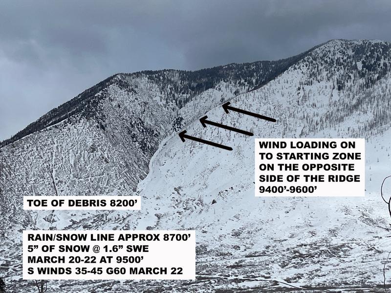
This avalanche occurred during a stormy period that brought a round of very dense, wet snow with the rain/snow line near 9000'. A period of strong SW winds accompanied the event, and several natural storm/wind slab avalanches occurred on upper elevation, northerly aspects. No rain fell in areas that are generally considered avalanche terrain in the range, at least not where recreation occurs, or where there is generally sufficient snow. No other wet avalanche activity was observed.
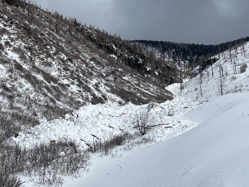
Upon arrival at the toe of the avalanche, I was confronted with what certainly appeared to be wet avalanche debris.
The starting zone was several hundred feet above the rain/snow line, and the crown was located just below the ridge crest on a slope leeward to the wind.
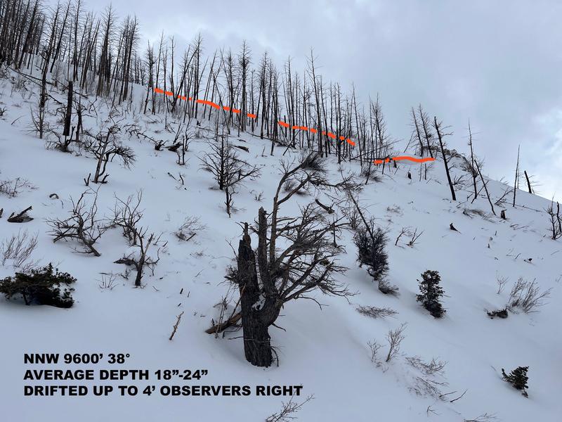
The crown face presented as a dry snow, storm slab with deep wind drifting on the observers right hand side. This is concurrent with other avalanches that occurred during this period.
It's my conclusion that the avalanche failed as a storm or wind slab, triggered by loading from very dense snow and strong winds a few hundred feet above the rain snow line. It did not appear to be triggered by saturation, but it certainly entrained saturated snow as it moved down in elevation giving the debris the appearance of a wet avalanche.
Coordinates


