Observer Name
Trenbeath, Garcia
Observation Date
Thursday, January 19, 2023
Avalanche Date
Tuesday, January 17, 2023
Region
Moab » Miner's Basin
Location Name or Route
Miner's Basin Moraines
Elevation
10,400'
Aspect
North
Slope Angle
Unknown
Trigger
Natural
Avalanche Type
Hard Slab
Avalanche Problem
Persistent Weak Layer
Weak Layer
Facets
Depth
4'
Width
400'
Vertical
1,500'
Comments
This avalanche ran during a storm cycle that ultimately produced 32" of snow at 3.6" SWE. It was accompanied by strong SW winds. Heavy snow around New Year's produced many large avalanches on the same PWL. Since then the snowpack has gained considerable strength and in most areas the snowpack is very deep - up to 200 cms or more. This avalanche failed in a shallower snowpack area, on a slope with a steep convexity that is subject to heavy wind loading. A stability test performed on a nearby slope produced no results. It is our opinion that this avalanche is somewhat anomalous with a perfect storm of conditions, and that avalanches like this are unlikely to be triggered by humans.
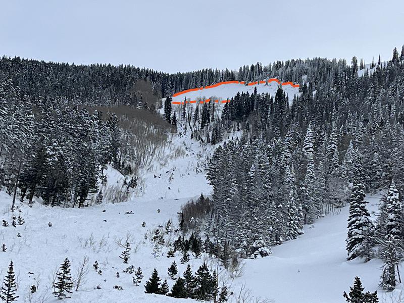
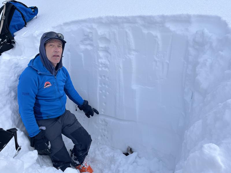
Photo illustrates location of weak layer on nearby slope. It is very thin now, and all of the facets beneath are rounding and strengthening into 4f+, 1f-. ECTX
Video
Coordinates


