Observer Name
AAI Pro 1
Observation Date
Wednesday, December 15, 2021
Avalanche Date
Wednesday, December 15, 2021
Region
Salt Lake » Park City Ridgeline » Monitors » West Monitor
Location Name or Route
West Monitor
Elevation
9,500'
Aspect
Northeast
Trigger
Skier
Trigger: additional info
Remotely Triggered
Avalanche Type
Soft Slab
Avalanche Problem
Persistent Weak Layer
Weak Layer
Facets
Depth
3'
Width
60'
Comments
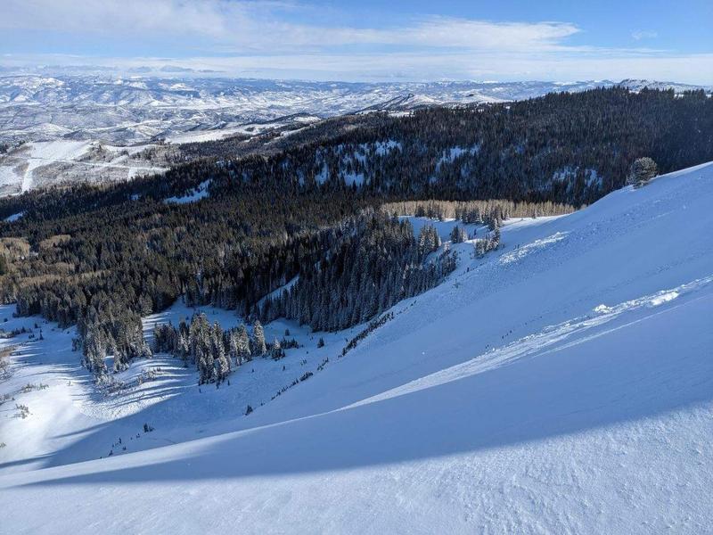
Group out for AAI Pro 1, we went to Willows and Park City Ridgeline to see how structure on the periphery of the Wasatch was handling the storm load. Weather was cold and clear with moderate west winds on the 10K ridgeline. Notable wind loading plumes were seen in both Monitors. We saw a remote triggered slide in Katie’s Trees / South Monitor that failed on the persistent weak layer beneath the last two storm loads. When skinning across West Monitor Sneak just below the ridge we remotely triggered a hard slab avalanche (HS-ASr-D2-R1-I) that failed on the same faceted layer.
The crown was about 3 feet, roughly 60 feet wide and ran full track, about 650 vertical feet.
We were expecting avalanche activity in the area but were surprised by the sensitivity to remote triggering and the connectivity of the slab. Didn’t do a full crown profile but we dug a quick pit along the cracks where the failure propagated but wasn’t steep enough to release with the rest of the slab. The failure occurred around a crust 45 cm down with 5-6cm of well-developed 2-3mm facets both above and below the crust.
We found the same crust with 2-3mm facets above and below it on a NW aspect at 9,500’ on Will’s Hill earlier in the day. We had a variety of test results (ECTN 14 / ECTN 16 / CTV Sudden Planar) in pits there with notably poor structure. Traveling the ridge from Will’s Hill to the top of West Monitor we saw another avalanche on north facing terrain at 9,550’ where the slope entered the trees (HS-U-D1-R1-I) that had failed on the same layer.
In all we noted a lot of sensitivity where the crust sandwich with facets on both sides was found on the Wasatch Periphery, suggesting it’s not handling the new storm and wind loads well. Bottom line, we’re expecting to see continued activity and high sensitivity on W-N-E aspects, particularly where the snowpack is thinner and poor structure exists, with more snow in the forecast.

Coordinates


