
Observer Name
Bill Hunt
Observation Date
Sunday, February 14, 2021
Avalanche Date
Friday, February 12, 2021
Region
Ogden » Snowbasin Backcountry » Hells Canyon
Location Name or Route
Hell's Canyon
Elevation
8,500'
Aspect
Northeast
Slope Angle
40°
Trigger
Unknown
Avalanche Type
Soft Slab
Avalanche Problem
Persistent Weak Layer
Depth
2.5'
Width
150'
Vertical
1,250'
Comments
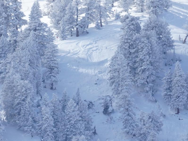
This observation was from the Canyon Rim parking lot, near the flags at the entrance of Snowbasin, noticed with binoculars, and observed with a spotting scope and telephoto lens. Photos were taken Feb 14. Date of slide is an estimate. Elevation and aspect are pretty accurate, and I am familiar with the slope angles in this area, which is a steep rollover into trees that is a clearly a change of character. As I don't see this slide in this year's list of observations, I thought it was worthwhile to report.
A few sobering facts:
1. The fracture occurred on a rollover that is about 5 to 10 yards outside the area boundary. Two boundary signs are visible in the photos.
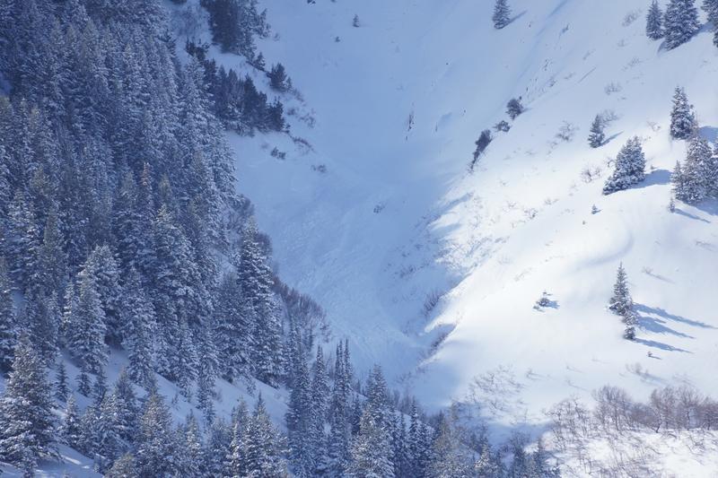
2. Judging from the size of this fracture, and the evident debris pile at the bottom of this area, this fracture was approximately 2 to 3 feet deep at the crown, and propagated about 150 feet to skiers left, as there are related fractures visible to viewers right in the photos; and it ran about 1200 feet through thick trees, ending in a deposition pile in a large gully known as "the Cemetery".
3. There are ski tracks above the fracture. I don't know if this was a natural or skier-triggered, but as it was the only slide in the area, and some of the only tracks in the area were directly above the fracture, it is possible it was skier-triggered.
Comments
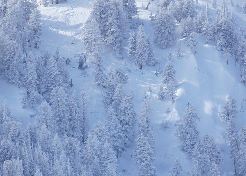
There was also a single track entering via the upper Hells bowl (which is a commitment to exit via the Cemetery, as there is no other easy way out of this gully). This would not be considered a conservative line, with slope angles around 38 degrees and a gully exit.
The deposition pile is in the middle of this large gully, and probably 6 to 8 feet deep at least. Keep in mind these photos were taken from a mile away, measuring on Google maps, and have a foreshortened perspective of the debris pile.
While much larger slides have occurred in this area, this is not one I would call "manageable", if you were even slightly below the fracture line.
Snowbasin has reported another 15" in the past 48 hours, so these fractures, deposition pile, tracks, and weak layers are under another 15" of snow at this time.
Coordinates


