Observer Name
Trenbeath
Observation Date
Tuesday, December 29, 2020
Avalanche Date
Monday, December 28, 2020
Region
Moab » Gold Basin » Exxons Folley
Location Name or Route
Exxon's Folly
Elevation
10,600'
Aspect
North
Slope Angle
40°
Trigger
Natural
Avalanche Type
Soft Slab
Avalanche Problem
Persistent Weak Layer
Weak Layer
Facets
Depth
2'
Width
100'
Vertical
500'
Comments
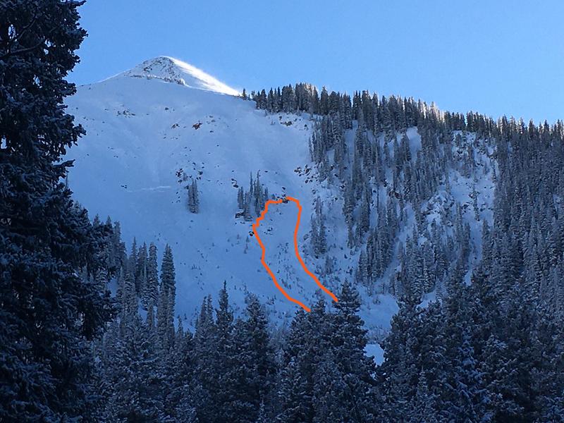
Chris Benson photo
First natural cycle of the season. After an extended dry spell, 12"-20" of snow accompanied by mod-strong SW winds placed a significant load on a shallow and fragile snowpack. Did not get close enough to observe the crown but snowpits dug that day, and up to this point throughout the season, revealed a stratified and faceted snowpack, with the primary layer of concern being a weak layer of loose facets from early November storms sitting on top of a faceted, knife hard, melt-freeze layer formed in late October. We also observed a weak layer higher up in the snowpack that failed with a score of ECTP18, and this could also be the culprit, but due to widespread sensitivity and collapsing on the deeper, faceted layer above the crust at 35 cm, I'm inclined to believe that is the weak layer involved here.
Coordinates


