Observer Name
G.Harmsen
Observation Date
Sunday, March 15, 2020
Avalanche Date
Saturday, March 14, 2020
Region
Southwest » Brian Head Backcountry
Location Name or Route
Brian Head Area
Elevation
9,900'
Aspect
Northwest
Trigger
Skier
Depth
3'
Width
20'
Snow Profile Comments
Spent 2 days this weekend in the area around Brian Head. Lots of new heavy snow (>2ft in most spots) and high winds falling on a variety of bases.
On due S, new snow was on bare ground, even up to 10000ft. N aspects had significant weak facets down low, and a much deeper snowpack (measured up to 6ft in spots). E and W seemed to have generally solid lower snow packs (1-3ft of refrozen wet grains) with the new snow on top. Probably did 7ish ECTs over the course of 2 days, with no significant results in the new snow on W-S-E aspects, but had propagation in N facing pits.
Noted significant Whumpfing in multiple locations on N aspects.
Also saw a large natural N-W facing avalanche (ran >1000ft) that looked to be a windslab triggered by cornice fall, but can't be sure if it stepped down.
In general, good stability on W-S-E with no issues in the new snow other than windslabs (that are likely healed by now with warm temps), but pretty sketchy on NW-NE aspects. Anything with facets down low is reactive right now.
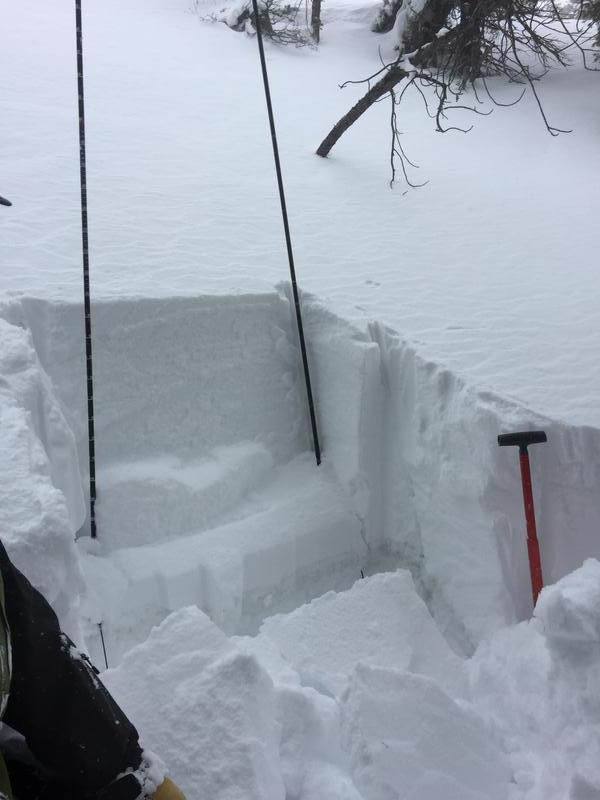
Image of a single ECT on a N aspect. Broke within a density change on new snow, but we also had them fail in facets in slightly different locations.
Comments
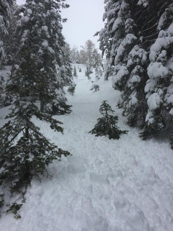
Triggered a slide on a small steepish slope on a fairly treed N/NW aspect. About 3 turns in, a windslab about 1ft deep broke out on a convexity, causing a larger slide to step down into facets about 40 ft above me. Luckily was moving quickly and the overall slope height was short, so was able to ski out of it and to the side into tighter trees. Slope was short so slide only ran ~100ft.
Significant new snow in the area (~2ft) with high winds made windslabs sensitive and likely loaded underlying facet layers for first time in a while.


Coordinates


