Observer Name
Eric and Amy Flygare
Observation Date
Friday, March 15, 2019
Avalanche Date
Friday, March 15, 2019
Region
Logan » Central Bear River Range
Location Name or Route
Central Bear River Range
Elevation
9,000'
Aspect
North
Slope Angle
35°
Trigger
Snowboarder
Trigger: additional info
Intentionally Triggered
Avalanche Type
Hard Slab
Avalanche Problem
Persistent Weak Layer
Weak Layer
Surface Hoar
Depth
2'
Width
25'
Vertical
Unknown
Comments
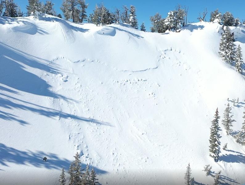
We traveled through the Central Bear River Range today and found evidence of a widespread natural avalanche cycle on Wednesday. We observed at least a dozen natural soft slab avalanches most occurring on north and east facing slopes above 8000 feet. All the slides appeared to have failed on the new/old snow interface (buried surface hoar) and we anywhere from 8-16 inches deep and up to 100 feet wide.
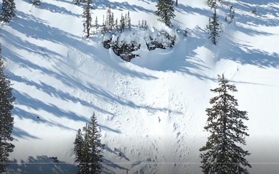
We also found sensitive wind slabs today. These slabs also failed on the new/old snow interface on buried surface hoar. One of the slabs broke lose while snowmobiling along a ridgeline. It was on a steep north facing slope and was about 2 foot deep and 25 feet wide. Several other smaller slabs failed while riding steep north facing wind loaded slopes. The slabs were around 20 feet wide and up to 16 inches deep. The slabs were somewhat slow moving and did not gain enough momentum to travel too far down the slopes.
We were leery of any big committing lines, or any slope that funneled into terrain traps.