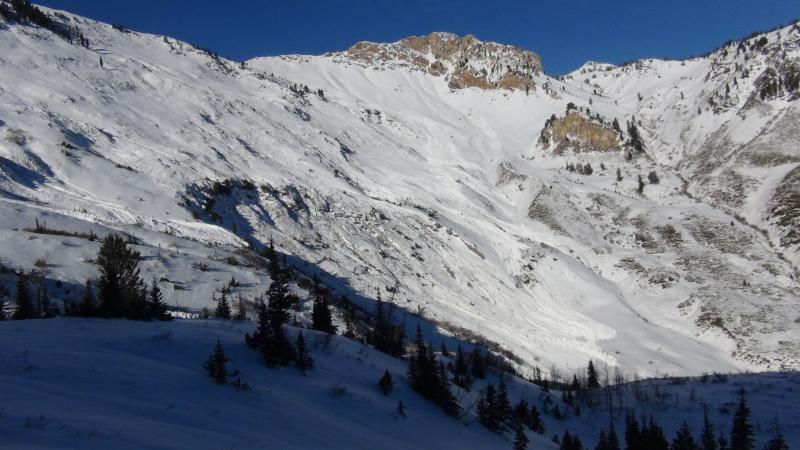
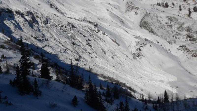
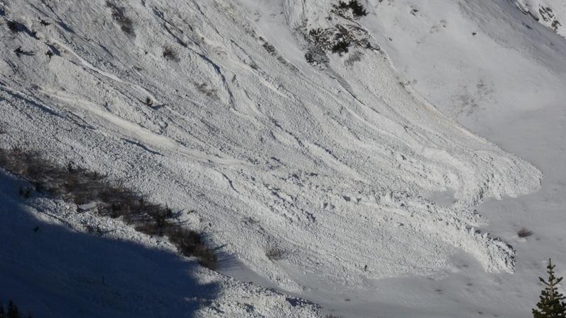
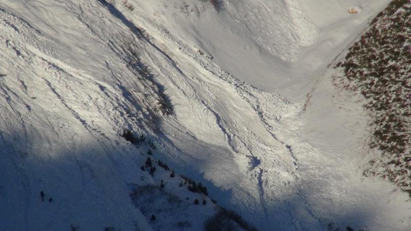
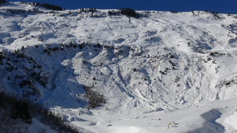
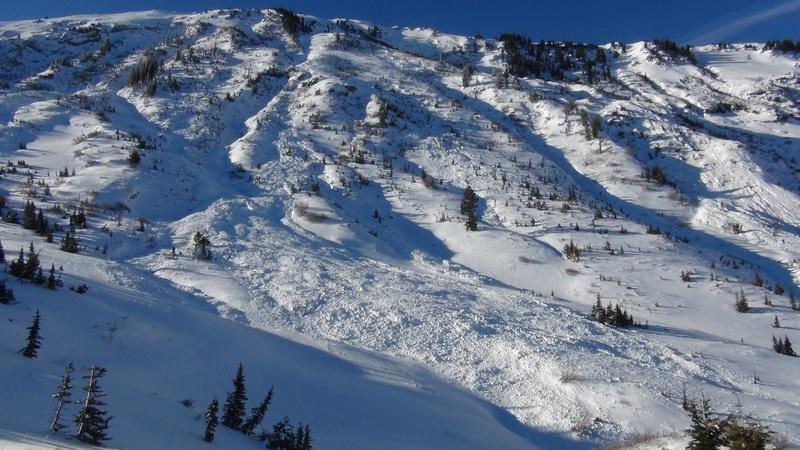
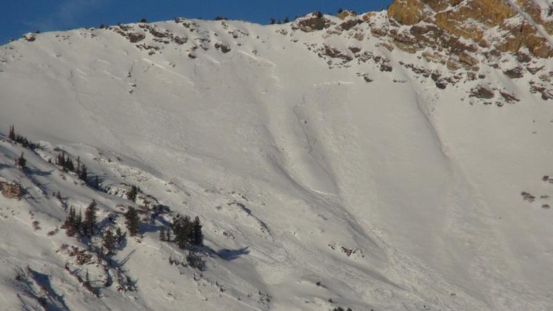
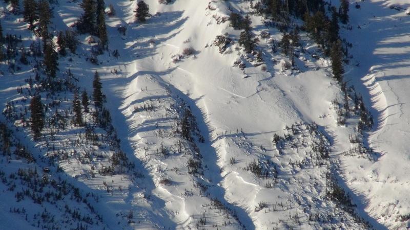
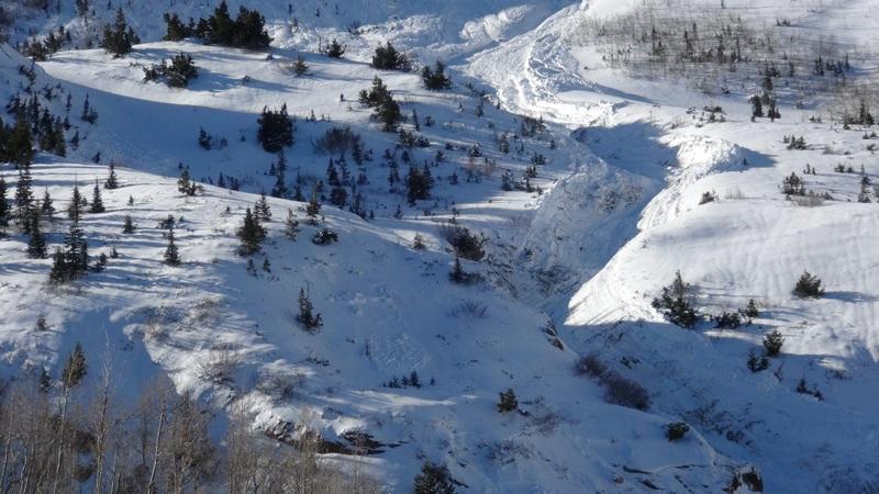
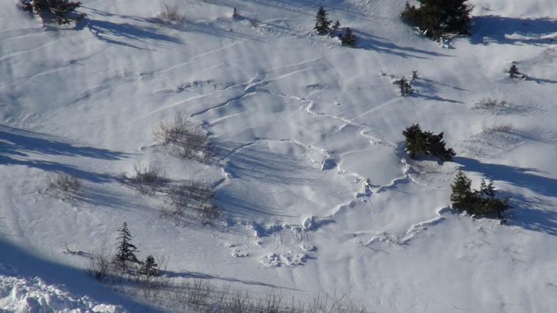
I visited Cutler Basin on Jan. 15th and appear to have had better visibility than when previous observers (Drew, Lee, Bill) photographed the large avalanche in Cutler Basin. I thought I'd submit these photos to show the extent of the avalanche activity. I always enjoy looking at avalanches, but this one was one of the most impressive avalanche events I've seen in the basin. I've seen these slide paths run farther, larger, and deeper, but typically the evidence is buried during the storm. These avalanches were still crisp and uncovered, many days after the event. Most of the avalanches were easily D4 in size. Many produced enough friction and heat to gouge the sidewalls of the path, looking more like a wet slide. Many of the remaining slopes that did not avalanche had evidence of fracturing, cracking and/or visibly collapsing (see the last photo #10). I also noticed a decent slide down lower in the trees near Bailey Springs, but did not get a good photo of it. All of the starting zones appear to have been at 8000' or higher in elevation, although some slides ran to approx. 7300' in elevation.
The snow surface was highly variable, but mostly a firm rain crust with thin patches of settled powder. Widespread surface hoar covered the surface on nearly all aspects and elevations. [Forecaster comment - Thanks Doug! Excellent photos documenting a significant avalanche cycle.]