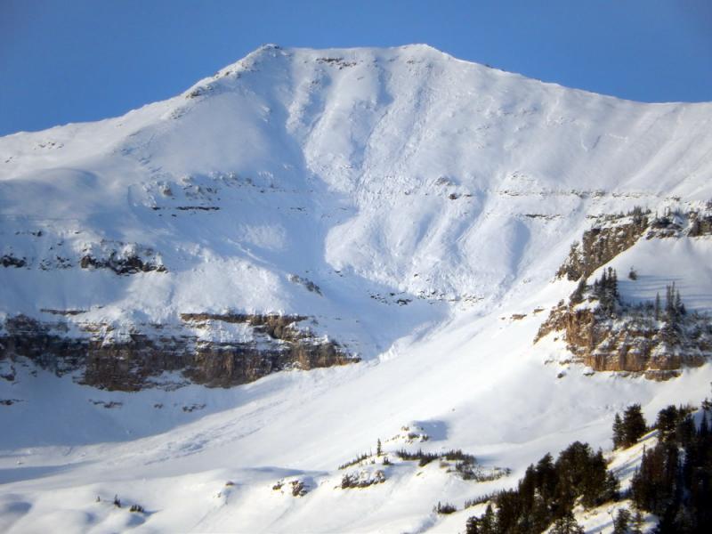
I got a look, from the road, into the east side of the Cascade Ridge today and was able to see many slides along the upper ridgeline from Bunnells to Big Springs. I would call this the first avalanche cycle off of Cascade for the season. Much of upper Bunnells Fork and portions of upper Big Springs that face E-NE avalanched late Saturday afternoon/early evening during the height of precip. These are also the areas that held the most early season snow that has been lingering now since late september. Travel to these areas is still very challenging, requiring lots of dry land travel to thin snow cover. It has been a few weeks since I've been above 10,000' in these parts but it is clear that the snow that existed before last weekends storm was old, tired and faceted. The Provo area received about 13" of snow with 1.3" H2O along with moderate to strong SW-W winds.

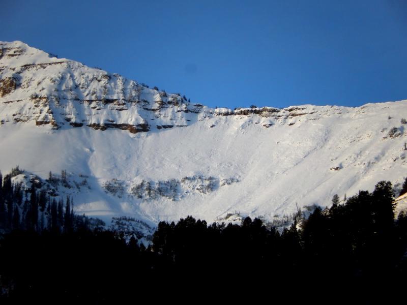
This next slope is the north most bowl in Bunnells Fork affectionately named White Bimbo. It also slid close to wall to wall likely around the same time as White Limbo. These areas are notorious facet farms early season, and sometimes well into the season. A few other moderate sized slides were seen along the Cascade Ridge to the south but not quite as widespread as in Bunnells.


