Observer Name
Trent Meisenheimer
Observation Date
Thursday, March 1, 2012
Avalanche Date
Thursday, March 1, 2012
Region
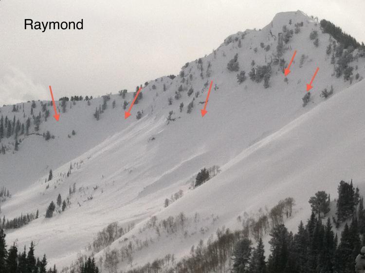
Salt Lake » Big Cottonwood Canyon » Raymond Peak
Location Name or Route
Mill Creek to Gobblers
Elevation
9,000'
Aspect
North
Slope Angle
32°
Trigger
Natural
Avalanche Type
Soft Slab
Depth
Unknown
Width
Unknown
Vertical
Unknown
Comments
Great powder day finally. However I still kept the slope angles at about 30 degrees, I do not like the complex snow structure we are dealing with. Best way to avoid avalanches is to use terrain to your advantage and keep the slope angles down. No collapsing today
Raymond ran big over night within the new snow. My guess is that the avalanche ran on a melt freeze crust of some sort, running far and fast judging by the run out zone.
Total snow depth where I dug on Gobblers North side was 195cm.
Comments
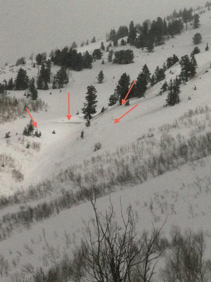
Bad place to be caught in an avalanche, the debris piled up very deep in the gully.
Comments
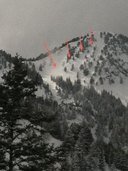
Light was in and out, hard to get a good picture. Upper West Porter also avalanched within the new snow.
Video
Coordinates


