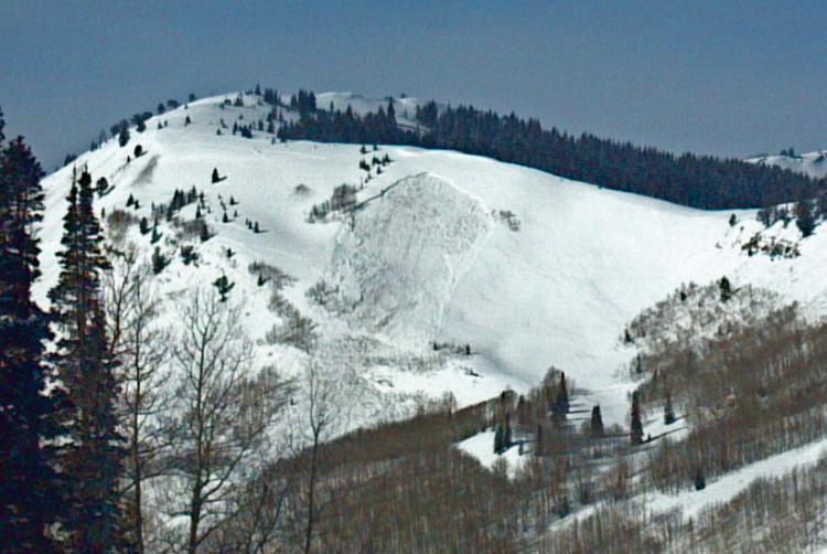
Attached are a couple pics of our remote-trigger slide today. We classified it as HS-AEr-R2+D3-O/G 2-3ft x 270ft. It ran about 600 vert. Dimensions were taken using Google Earth image of path. The path faces ENE at 9600ft and HAS held onto snow all fall/winter. The trigger was a 2# shot thown into the snow 150 ft south of the slide (same elevation as crown). in the first photo, you can see the black smudge looker's left of the crown south of the aspen band. My route partners on the ridge above the shot felt a strong collapse with detonation just before the slide released. While we could not do crown profile, we can suppose the failure was either the rime-capped SH from mid-January, a combination of sun crusts and facets, or perhaps just full failure to the mid-November dirt layer over depth hoar. Hopefully we can get a better look at it before the next storm.
Forecaster Note - Thanks for the good info Mark/Dave/Colin from PC Snow Safety. Very impressive slide. It should be noted that this was in uncompacted closed terrain that has not seen skier traffic or previous control work; in essence, a "backcountry" snowpack.