Observer Name
Cawley
Observation Date
Saturday, February 18, 2012
Avalanche Date
Monday, February 13, 2012
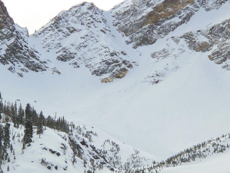
Region
Salt Lake » Big Cottonwood Canyon » Mill B South
Location Name or Route
N Facing O'Sullivan Peak, Broads Fork Back Bowls
Elevation
10,700'
Aspect
North
Slope Angle
Unknown
Trigger
Natural
Avalanche Type
Hard Slab
Depth
2'
Width
300'
Vertical
1,250'
Comments
Observed a couple big naturals in Broads Fork today. Most notable was what appeared, from a distance, to be a fresh deep slab release on the backside of O'Sullivan Peak, west of Tanners Col, running to the flats beneath E couloir of Twin Peaks. The closest we got to the crown was the toe of Bonkers, so the dimensions I've provided are estimated. I'm guessing it ran sometime towards the end of the storm on 2/12 or 2/13, as the debris still looked fresh. This is either a repeater on a weakness leftover from the 1/20-1/22 cycle, or a slide on buried surface hoar from 2/3-ish. Significant debris from yesterday's wet-loose activity originating in steep SE facing cliffs above Bonkers.
Coordinates


