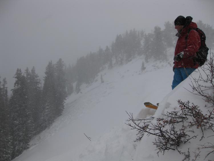
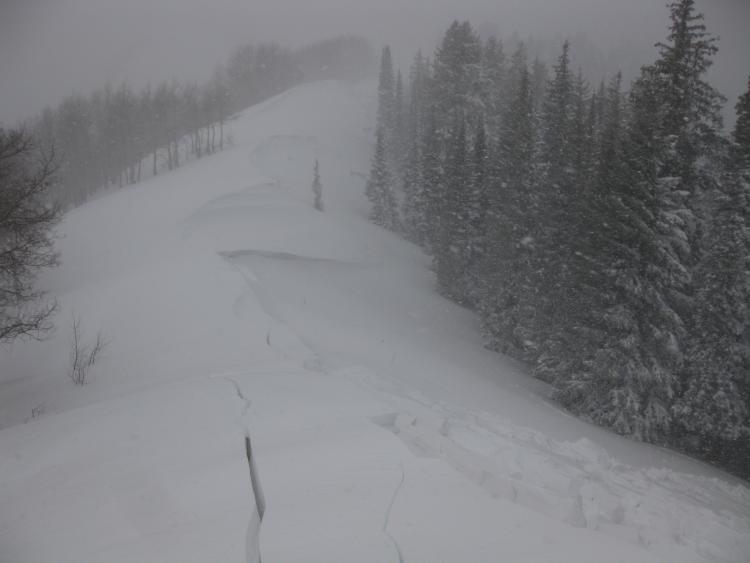
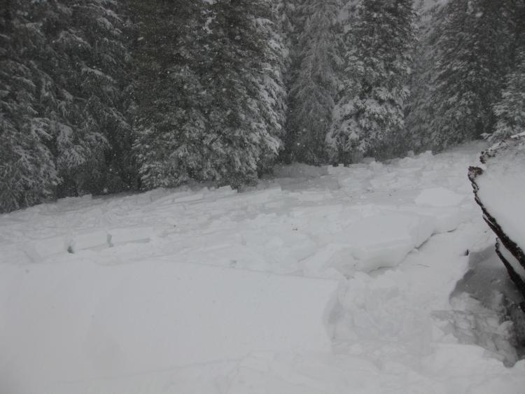
Intentionally triggered avalanche during long ridge walk in blustery storm conditions. Felt a lot colder than it was due to wet and wind. As expected, the snowpack was alive today. All the red flags waving. Great day. Walked over from Bear Trap Fork and triggered a large avalanche below us as we approached the ridge above Lake Desolation. Far right NW-facing pocket went along sympathetically. As we rounded the corner we found that the whole ridgeline went, wrapping around to the NE-facing aspect. Deepest parts of crown about 2'. I suspect it went the on a thin SH/NSF layer under the snirt layer that has been real active in pits lately, but we couldn't examine the crown safely so we'll just guess. The lower angle connecting patches that didn't avalanche were littered with cracks. Total width about a 1/4 mile on North, NW, and NE aspects. Photos show far NW-facing pocket, a long series of fracture lines wrapping around to the E-facing slopes above the lake, and the slab blocks below us with a visible snirt layer (doesn't show up too well in the pics),