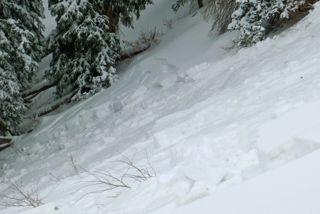
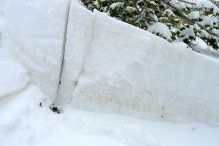
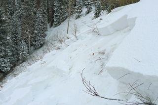
From Mill D north TH, I took the ~NW gully that ascends toward Reynold's Peak. Where new snow overlies old, collapsing was reliable every 5th step of so, and particularly on the shoulder of Reynold's where old snow was deepest (and faceted top to bottom). Continuing back toward Tom's Hill, I triggered this remotely, at a point 15-20 feet back from the ridge. Aspect is about NNE, slide consisting of new snow, I estimate the total width at about 250 ft., length well into the trees about 100 ft. down, but it's possible some of this continued out to the flats (I didn't check). Crown depth ranged from 12 to perhaps 20 inches, slope angle ranged from 35 to 43 degrees.
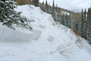
Predominantly, this was a new snow slab, but in spots took some of the old with it (photo 2).
More pictures are available if interested. Not sure what kind of conditions warrant an extreme rating, but this has to be pretty darned close. The snow is very, very sensitive.