
Observer Name
Steve Cote
Observation Date
Monday, December 17, 2012
Avalanche Date
Sunday, December 16, 2012
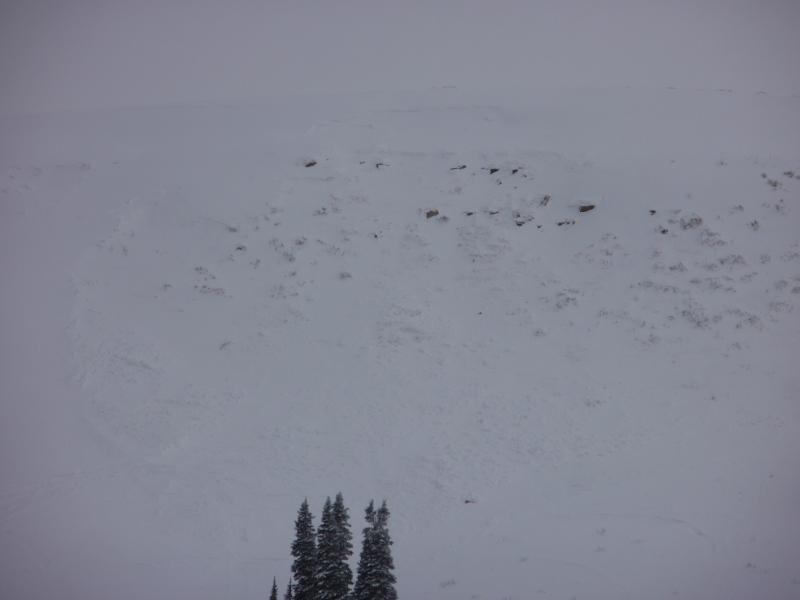
Region
Skyline » Huntington Canyon » Left Fork Huntington Canyon » Wedding Ring Ridge
Location Name or Route
East Wedding Ring Ridge
Elevation
9,600'
Aspect
Northeast
Slope Angle
35°
Trigger
Natural
Avalanche Type
Soft Slab
Weak Layer
Facets
Depth
15"
Width
250'
Vertical
125'
Comments
We did a profile in this slide path two weeks ago - There was a hard slab over facets - Looks to have been caused by new snow/wind overloading existing snow - the slope was a rocky area with a shallow snow pack. Along this ridge there were 2 other slides same characteristics. New snow 15 cm at Millers Flat.
Coordinates


