| Please join us at the 23rd annual Black Diamond Fall Fundraiser Party Thursday Sept 15. Tickets are on sale now here, at the Black Diamond store & at REI. Special bonus raffle for online ticket purchasers! |  |

| Please join us at the 23rd annual Black Diamond Fall Fundraiser Party Thursday Sept 15. Tickets are on sale now here, at the Black Diamond store & at REI. Special bonus raffle for online ticket purchasers! |  |
| Advisory: Uintas Area Mountains | Issued by Trent Meisenheimer for Monday - March 7, 2016 - 5:06am |
|---|
 |
current conditions Finally - It feels like winter again, with mountain temperatures in the 20's and a fresh coat of white paint it should be a great day in the mountains. The Uinta's picked up 3-6" of new snow in the past 24 hrs and this will greatly improve the riding conditions this week. As the storm raced through the region yesterday the wind switched to the northwest and is currently blowing 10-20mph. Uinta weather station network info is found here. Trip reports and observations are found here.
|
 |
recent activity No new avalanche activity to report. Recent avalanche observations are found here See or trigger an avalanche? Shooting cracks? Hear a collapse? It's simple. Go here to fill out an observation.
|
| type | aspect/elevation | characteristics |
|---|


|


|

LIKELIHOOD
 LIKELY
UNLIKELY
SIZE
 LARGE
SMALL
TREND
 INCREASING DANGER
SAME
DECREASING DANGER
|
|
description
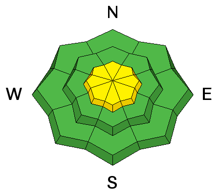
As the winds ramped up by late afternoon yesterday there was enough new snow available for the wind to grab and start loading the leeward slopes (opposite side of the mountain). This created sensitive wind slabs on all upper elevation slopes around the compass. These wind slabs will be easy to detect by their rounded looking appearance and will be most pronounced along the upper elevation ridge lines. Looking to avoid wind slabs? simply drop some elevation - get out of the wind zone, and you'll lose the problem.
|
| type | aspect/elevation | characteristics |
|---|


|


|

LIKELIHOOD
 LIKELY
UNLIKELY
SIZE
 LARGE
SMALL
TREND
 INCREASING DANGER
SAME
DECREASING DANGER
|
|
description
The last reported avalanche breaking to old snow near the ground was about two weeks ago. However, the fact is we still have many places with a very poor snowpack structure. Meaning - we have weak snow with stronger more dense snow sitting on top (bad setup). What we have been lacking is the additional weight of new snow, or what we call a slab. Remember- persistent slabs have the potential to break deeper and wider than you might expect. Steep, rocky, wind loaded terrain, facing the north half of the compass and particularly slopes that avalanched near the ground earlier this season should be considered suspect and avoided.
Steep, rocky, thin, and weak... this is the kind of terrain where you could still trigger a slide that breaks to weak snow near the ground today. (Scroggin photo) |
 |
weather This morning and into the early afternoon we should see some clearing as the storm system tracks to the east and exits the area. Under a northwest flow (cold air from the north) temperatures will remain cool with day time highs topping out in the upper 20's to low 30's. Winds will be light from the northwest and you can expect speeds along the ridge lines to be in the 10-20 mph range. We could see another shot of snow Tuesday night into Wednesday morning as a weak system passes to our north. High pressure builds in early Thursday bringing warmer temperatures and plenty of sunshine.
|
| general announcements Remember your information can save lives. If you see anything we should know about, please participate in the creation of our own community avalanche advisory by submitting snow and avalanche conditions. You can call me directly at 801-231-2170, email [email protected], or email by clicking HERE If Craig is unavailable you can reach his partner Trent at 801-455-7239, email [email protected] This is a great time of year to schedule a free avalanche awareness presentation for your group or club. You can contact me at 801-231-2170 or email [email protected]. To register for the first in our series of on-the-snow sled specific classes you can register here. The information in this advisory is from the US Forest Service which is solely responsible for its content. This advisory describes general avalanche conditions and local variations always occur. The information in this advisory expires 24 hours after the date and time posted, but will be updated by 7:00 AM on Tuesday, March 8th.
|
Advisory Hotline: (888) 999-4019 | Contact Information