| Please join us at the 23rd annual Black Diamond Fall Fundraiser Party Thursday Sept 15. Tickets are on sale now here, at the Black Diamond store & at REI. Special bonus raffle for online ticket purchasers! |
| Please join us at the 23rd annual Black Diamond Fall Fundraiser Party Thursday Sept 15. Tickets are on sale now here, at the Black Diamond store & at REI. Special bonus raffle for online ticket purchasers! |
| Advisory: Moab Area Mountains | Issued by Eric Trenbeath for Thursday - January 7, 2016 - 6:40am |
|---|

|
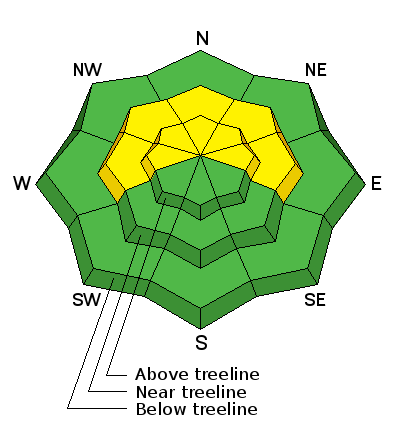
bottom line The avalanche danger is MODERATE on mid and upper elevation slopes steeper than 35 degrees that face W-N-E in areas where you can detect recent deposits of wind drifted snow. There also remains a MODERATE danger for triggering a deeper persistent slab avalanche on similar aspects right around tree line and above.
|
 |
special announcement The Utah Avalanche Center-Moab will be hosting an Avalanche 101 class on January 15,16. This course is generously sponsored by Moab Gear Trader and will consist of an evening classroom session and a day out in the field. This course will cover avalanche characteristics and snowpack fundamentals, clues to instability, assessment of avalanche terrain, route finding and companion rescue. For more information, see the link below or contact me at [email protected]. https://utahavalanchecenter.org/classes/moab-backcountry-101 |
 |
current conditions About 8" of medium density snow has fallen over the past 24 hours. Winds yesterday morning blew for a few hours in the 15-25 mph range from the SE. Around noon, they shifted to southwesterly and began tapering off, remaining light for the rest of the day and most of the night. They are currently averaging 10 mph from the WSW. The temperature at 10,000' is 17 degrees. A few more inches of snow are in the forecast today, but winds are to remain mostly calm so I don't foresee much of an increase in the avalanche danger. Buried wind slabs formed earlier in the week, as well as lingering persistent slab problems are the current concern. Riding and turning conditions should be great today. Winds, temperature and humidity on Pre-Laurel Peak New snow totals, temperature and humidity in Gold Basin Total snow depth and temperature at Geyser Pass Trailhead
|
 |
recent activity
|
| type | aspect/elevation | characteristics |
|---|

|

|
LIKELIHOOD
 LIKELY
UNLIKELY
SIZE
 LARGE
SMALL
TREND
 INCREASING DANGER
SAME
DECREASING DANGER
|
|
description
Overall, winds have been well behaved during the period of greatest snowfall. But SE winds early yesterday morning moved snow around forming shallow wind slabs on the lee sides of ridge crests and terrain features, primarily on slopes that face W-N-E. Additionally, there may still be some lingering slabs underneath that were formed by the strong winds on Monday. The new snow will be covering up these slabs and if you manage to trigger one, you could be taking a foot or more of snow with you. Carefully analyze suspect terrain by looking for smooth, rounded deposits of wind drifted snow, and pay attention to underlying drifts that have a stiff or hollow feel to them. |
| type | aspect/elevation | characteristics |
|---|

|

|
LIKELIHOOD
LIKELY
UNLIKELY
SIZE
 LARGE
SMALL
TREND
 INCREASING DANGER
SAME
DECREASING DANGER
|
|
description
Persistent slab problems vary and avalanches are becoming harder to trigger. Nevertheless, consequences remain high. In areas with weak, shallow snow, it may still be possible to trigger an avalanche to the ground. This scenario is most likely in rocky, and radical terrain right around treeline, or in areas where starting zones have been repeatedly scoured out. In areas where the snowpack is deeper, mid level facet layers are the more likely weakness. Continue to suspect slopes steeper than 35 degrees that face W-N-E that didn't run in the last cycle. Careful slope evaluation and determining whether or not a weak layer is present is essential before venturing into this terrain. |
 |
weather A continued moist weather pattern will bring periods of snow to the mountains through Friday. A chance of snow lingers though the weekend with things drying out next week. Today Snow. High near 17. South southwest wind 10 to 15 mph. Chance of precipitation is 90%. Total daytime snow accumulation of 3 to 7 inches possible. Tonight Snow. Low around 9. South wind 5 to 10 mph becoming northwest after midnight. Chance of precipitation is 80%. New snow accumulation of 3 to 7 inches possible. Friday Snow likely. Cloudy, with a high near 15. Northwest wind 5 to 10 mph. Chance of precipitation is 60%. New snow accumulation of 2 to 4 inches possible. Friday Night A 20 percent chance of snow. Mostly cloudy, with a low around 8. Northwest wind around 10 mph. Saturday A 20 percent chance of snow. Partly sunny, with a high near 12. Northwest wind around 10 mph. Saturday Night A 50 percent chance of snow. Mostly cloudy, with a low around 7. Sunday A 40 percent chance of snow, mainly before 11am. Partly sunny, with a high near 13. Sunday Night A slight chance of snow before 11pm. Partly cloudy, with a low around 5. |
| general announcements Road Conditions: I don't have updated plowing information this morning so expect to find several inches of new snow on the road. I'll be heading up today and will provide more detailed information by tomorrow. Grooming: Groomers are holding off until this wave of storminess passes. I expect they will be out by tomorrow. Thanks for sending in your observations. You can view Moab observations here. To post an observation go here. To receive this advisory by email go here. This information does not apply to developed ski areas or highways where avalanche control is normally done. This advisory is from the U.S.D.A. Forest Service, which is solely responsible for its content. This advisory describes general avalanche conditions and local variations always exist. |


