25th Annual Black Diamond Fall Fundraising Party
Thursday, September 13; 6:00-10:00 PM; Black Diamond Parking Lot
25th Annual Black Diamond Fall Fundraising Party
Thursday, September 13; 6:00-10:00 PM; Black Diamond Parking Lot
| Advisory: Uintas Area Mountains | Issued by Craig Gordon for Saturday - March 31, 2018 - 3:37am |
|---|

|
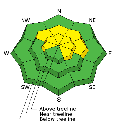
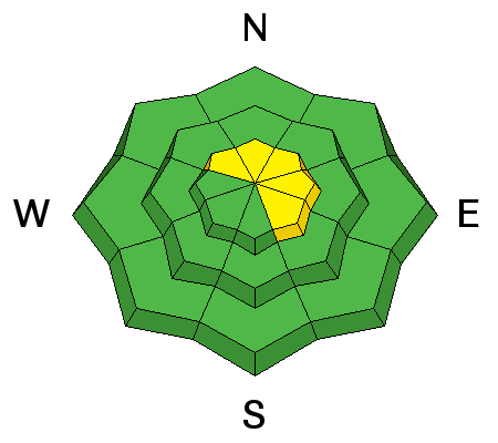
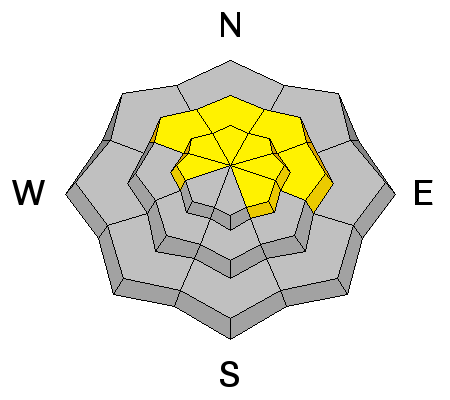
bottom line While not widespread and making up a small portion of the slopes available to ride on today, a MODERATE avalanche danger exists in mid and upper elevation terrain, particularly in the wind zone, above treeline and human triggered avalanches are POSSIBLE. Dangerous avalanches can still be triggered in steep, rocky terrain with a thin, weak snowpack, especially on slopes facing the north half of the compass, and particularly those with an easterly component to their aspect. LOW avalanche danger is found on most south facing terrain and wind sheltered slopes.
|
 |
special announcement Next Sunday April 8th will be the last of the regularly scheduled advisories for the western Uinta Mountains. |
 |
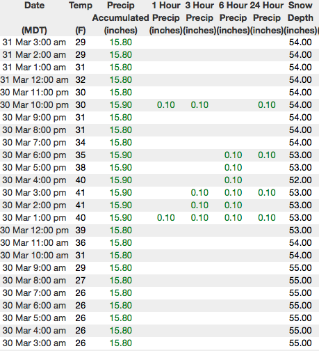
current conditions Skies are clear and an amazing moon awaits as you walk out the door this morning. Temperatures hover in the upper 20's and west-southwest winds are blowing 30-45 mph along the high peaks. Sunny slopes offer smooth, suportable, corn-like conditions that soften with strong springtime sun. Whilst on the other half of the compass, a few patches of soft shallow snow are found on upper elevation wind sheltered, shady slopes.
Above are 24 hour temperatures and snow depth near Trial Lake along with winds and temperatures from Windy Peak. More remote Uinta weather stations are found here A great body of recent trip reports, observations, and snow data here. |
 |
recent activity
We were able to trigger a few shallow, yet sensitive, fresh drifts along the leeward side of Double Hill on Thursday.
|
| type | aspect/elevation | characteristics |
|---|

|
|
LIKELIHOOD
 LIKELY
UNLIKELY
SIZE
 LARGE
SMALL
TREND
 INCREASING DANGER
SAME
DECREASING DANGER
|
|
description
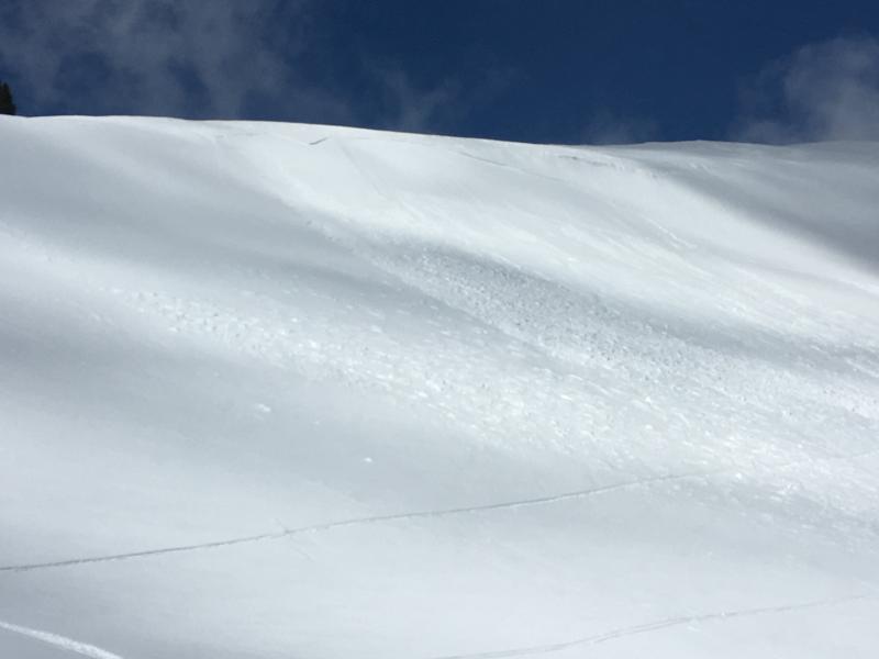
Over 72 hours of steady west and northwest, and now southwest winds, continued whipping up a fresh batch of drifts, like the one pictured above. Mostly prominent on the leeward side of upper elevation ridges, there might be a cross-loaded pocket around a terrain feature like a chute or gully wall. In any case, today you'll want to look for and avoid fat, rounded pieces of snow, especially if they sound and feel hollow like a drum. Once triggered, today's wind slabs have the potential to break deeper and wider than you might expect. |
| type | aspect/elevation | characteristics |
|---|

|
|
LIKELIHOOD
LIKELY
UNLIKELY
SIZE
 LARGE
SMALL
TREND
INCREASING DANGER
SAME
DECREASING DANGER
|
|
description
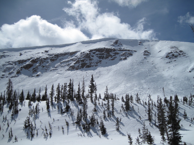
Deep slabs- They're tricky, they're dangerous, they're unpredictable, and this notoriously deceptive avalanche dragon came alive late last week on the eastern front. The good news is... last weekends cold snap welded the snowpack in place and most of these instabilities appear to be dormant for the moment. The bad news is... this strong, cohesive slab often allows us to get well out onto the slope before it fails and now the snow is breaking to the ground taking out the entire seasons snowpack. Steep, rocky, mid and upper elevation terrain facing the north half of the compass are prime suspects as are slopes that already avalanched this season, and terrain that has remained thin all year. So here's the exit strategy... if you're looking for soft snow and safe riding, simply tone down your slope angles and avoid terrain with steep slopes hanging above you. |
 |
weather
Expect mostly sunny skies this morning with high temperatures climbing into the 40's and southwest winds blowing near 50 mph along the high peaks. Clouds increase late in the day as a very weak disturbance crosses the area this evening. Not much going on in the weather department over the weekend, but a small storm on Monday has some promise to deliver a shallow coat of white paint. |
| general announcements The information in this advisory expires 24 hours after the date and time posted, but will be updated by 7:00 AM Sunday April 1st, 2018. If you're getting out and about, please let me know what you're seeing especially if you see or trigger and avalanche. I can be reached at [email protected] or 801-231-2170 It's also a good time to set up one of our very popular avalanche awareness classes. Reach out to me and I'll make it happen. This information does not apply to developed ski areas or highways where avalanche control is normally done. This advisory is from the U.S.D.A. Forest Service, which is solely responsible for its content. This advisory describes general avalanche conditions and local variations always occur. |