25th Annual Black Diamond Fall Fundraising Party
Thursday, September 13; 6:00-10:00 PM; Black Diamond Parking Lot
25th Annual Black Diamond Fall Fundraising Party
Thursday, September 13; 6:00-10:00 PM; Black Diamond Parking Lot
| Advisory: Uintas Area Mountains | Issued by Craig Gordon for Saturday - January 6, 2018 - 3:37am |
|---|


|
bottom line While more the exception than the rule, pockets of MODERATE avalanche danger are found on steep, rocky, wind drifted slopes at and above treeline particularly on slopes facing the north half of the compass. Mid and low elevation terrain, most south facing slopes, and terrain that held no snow prior to the Christmas Eve storm offer generally LOW avalanche danger.
|
 |
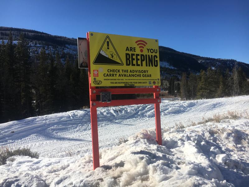
special announcement
Big thanks to Salt Valley Snowmobile Club for sponsoring and maintaining this beacon checker at Soapstone. Not hard to miss and it's up and running in the main parking lot. |
 |
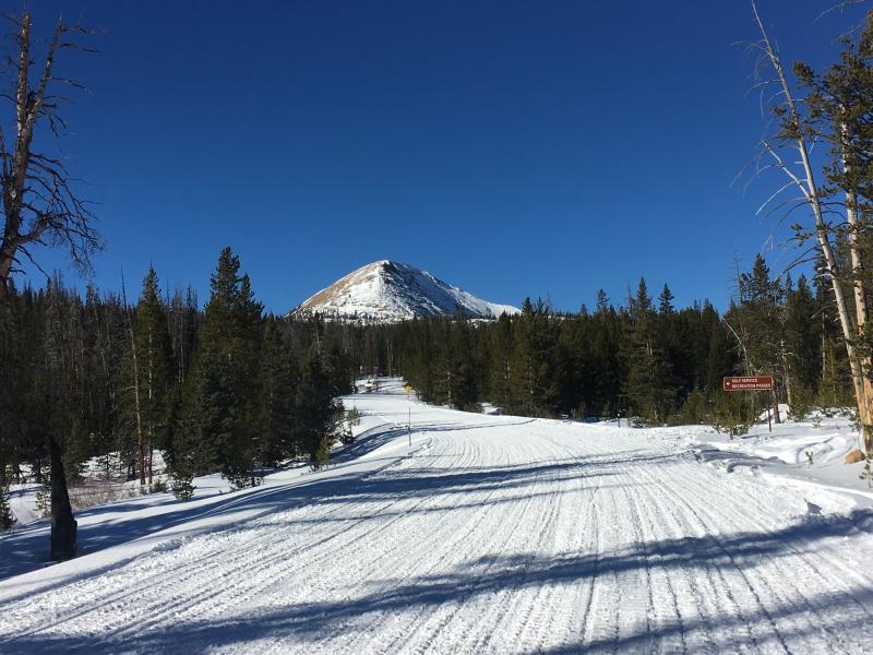
current conditions High, thin clouds moved into the region overnight, ahead of a weak storm slated to slide through the area later this morning. Temperatures are in the mid 20's and southerly winds are blowing in the teens along the high ridges. Riding and turning conditions are hit or miss. Recent winds have jacked a lot of the big open, upper elevation terrain, but soft snow is still found on mid elevation, wind protected slopes.
Above are 24 hour temperatures and snow depth from Trial Lake along with winds and temperatures from Windy Peak. More remote Uinta weather stations are found here Recent trip reports and findings can be seen here.
Trailheads are thin and boney, but with some elevation gain you'll still find resonable riding conditions. |
 |
recent activity No new avalanche activity in almost a week. Click here to see last weeks recap. |
| type | aspect/elevation | characteristics |
|---|

|
|
LIKELIHOOD
 LIKELY
UNLIKELY
SIZE
 LARGE
SMALL
TREND
 INCREASING DANGER
SAME
DECREASING DANGER
|
|
description
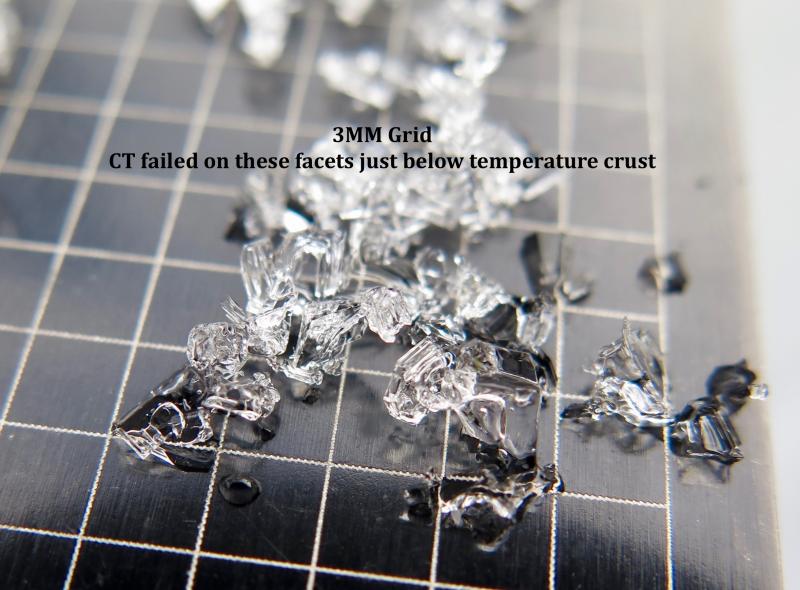
The persistent slab that's been giving us heartburn has relaxed and we haven't heard of or seen any avalanche activity in nearly a week. As a matter of fact, this weeks weather helped gobble up a lot of the cohesive properties of the Christmas slab, essentially breaking it down and turning it into weak, faceted, sugary surface snow or what we call "loud powder". Of course that's good news in the near-term, but this inherent weakness will come back to haunt us once winter returns from its hiatus.
He's back! JG's beautifully detailed snowpit clealy illustrates our problem child buried in the midpack. |
 |
weather
A weak storm system brings periods of snow late this morning through early this evening. High temperatures reach into the mid 30's and southwest winds blow 15-25 mph along the high peaks. We might be able to squeak a couple inches of snow out of this system before high pressure follows for Sunday through early next week. Another system brings a chance of snow Tuesday into Wednesday, with the potential for significant snow and water amounts depending on how far north the storm tracks. Might have a better handle on this for tomorrows update. |
| general announcements The information in this advisory expires 24 hours after the date and time posted, but will be updated by 7:00 AM Sunday January 7, 2018. If you're getting out and about, please let me know what you're seeing especially if you see or trigger and avalanche. I can be reached at [email protected] or 801-231-2170 It's also a good time to set up one of our very popular avalanche awareness classes. Reach out to me and I'll make it happen. This information does not apply to developed ski areas or highways where avalanche control is normally done. This advisory is from the U.S.D.A. Forest Service, which is solely responsible for its content. This advisory describes general avalanche conditions and local variations always occur. |