25th Annual Black Diamond Fall Fundraising Party
Thursday, September 13; 6:00-10:00 PM; Black Diamond Parking Lot
25th Annual Black Diamond Fall Fundraising Party
Thursday, September 13; 6:00-10:00 PM; Black Diamond Parking Lot
| Advisory: Uintas Area Mountains | Issued by Craig Gordon for Thursday - March 30, 2017 - 3:21am |
|---|

|
bottom line While not widespread, at and above treeline in the wind zone, pockets of MODERATE avalanche danger exist. Human triggered avalanches are POSSIBLE on steep, wind drifted slopes, especially those facing the north half of the compass. Wind sheltered low and mid elevation terrain offers generally LOW avalanche danger.
|
 |
special announcement
Yesterday we found million dollar views, miles of smiles, amazing terrain, and great snow... all provided by Park City Powder Cats and their very generous, annual donation to the Utah Avalanche Center. Huge thanks to PCPC for all the amazing support and a big shout out to Ron, Johnny, Chris and the entire crew for hosting this bitchin' day... y'all rock :) |
 |
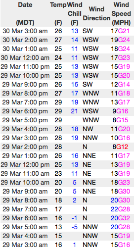
current conditions Another storm is on our doorstep. Clouds are streaming into the region, temperatures are about 10 degrees warmer than they were at this time yesterday and register in the upper 20's. Winds switched to the southwest early this morning and are blowing 10-20 mph along the high ridges. Warm temperatures, strong sunshine, and recent winds had their way with the snow surface, but wind sheltered mid and upper elevation, north facing terrain still offers shallow, cold snow.
Above... 24 hour winds from Windy Peak (10,166') and the Trail Lake snotel site (9,992') Real time temperatures, snowfall and wind for the western Uintas are found here. Snowpack observations and trip reports are found here. |
 |
recent activity
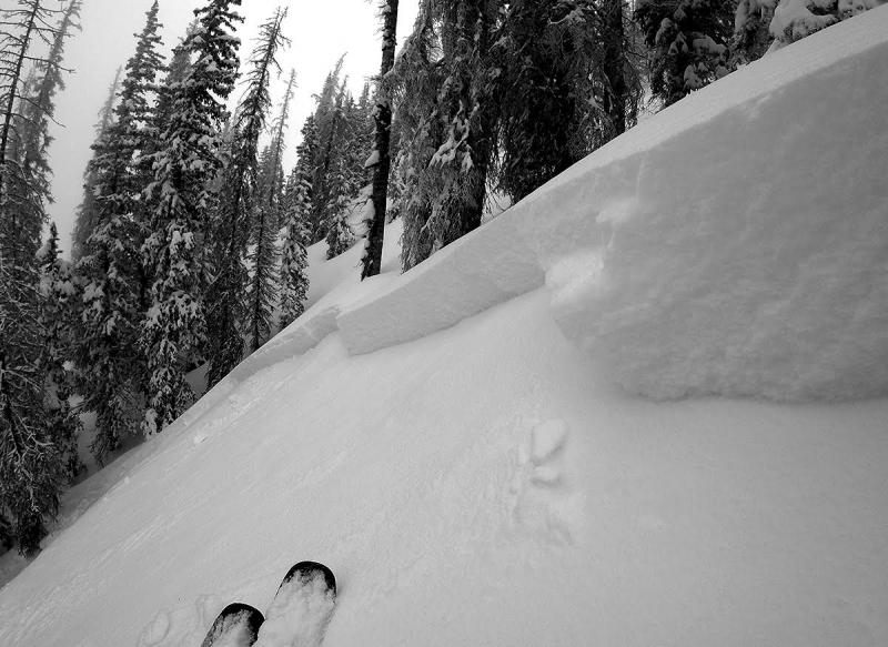
A rider triggered this wind drift Tuesday on a steep, upper elevation, north facing, cross-loaded gully in Weber Canyon. Breaking about 2' deep and not particularly connected due to terrain features, I think there's a few pockets like this one still lurking in the wind zone today. (Provo image) A full list of Uinta avalanche activity is found here. |
| type | aspect/elevation | characteristics |
|---|

|
|
LIKELIHOOD
 LIKELY
UNLIKELY
SIZE
 LARGE
SMALL
TREND
 INCREASING DANGER
SAME
DECREASING DANGER
|
|
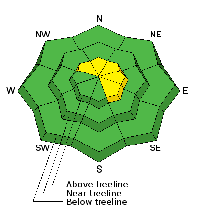
description
Strong sun, slowly warming temperatures, and a little greenhousing on Tuesday helped throw a cargo net over our snowpack, essentially locking it in place. While most of our terrain is well-behaved and predictable, the Uintas are a big place and I bet there's an old wind slab or two out there that'll still react to our additional weight. Found on steep, upper elevation slopes facing the north half of the compass, look for and avoid any fat, rounded piece of snow, especially if it feels or sounds hollow like a drum. |
| type | aspect/elevation | characteristics |
|---|

|
|
LIKELIHOOD
 LIKELY
UNLIKELY
SIZE
 LARGE
SMALL
TREND
 INCREASING DANGER
SAME
DECREASING DANGER
|
|
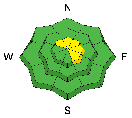
description
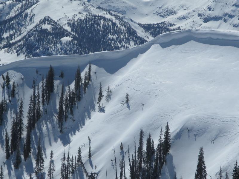
While today's corni might not be overly sensitive, these boxcar monsters are completely unpredictable and should definitely be avoided. |
 |
weather Rain and snow showers develop later this morning, but the storm actually gets going later this afternoon as a cold front moves into area. Temperatures rise into the low 40's and southwest winds increase into the 20's and 30's with gusts in the 40's along the high ridges. It looks like a good shot of snow with nearly a foot forecast for the western Uintas. Unfortunately, a portion of the storm dives south and that might produce some powder ruining northeast winds... we'll keep you posted. A break in the action ends the work week and another storm is slated for Monday/Tuesday. |
| general announcements Remember your information can save lives. If you see anything we should know about, please participate in the creation of our own community avalanche advisory by submitting snow and avalanche conditions. You can call me directly at 801-231-2170, email [email protected] The information in this advisory is from the US Forest Service which is solely responsible for its content. This advisory describes general avalanche conditions and local variations always occur. The information in this advisory expires 24 hours after the date and time posted, but will be updated by 7:00 AM on Friday March 31st. |