25th Annual Black Diamond Fall Fundraising Party
Thursday, September 13; 6:00-10:00 PM; Black Diamond Parking Lot
25th Annual Black Diamond Fall Fundraising Party
Thursday, September 13; 6:00-10:00 PM; Black Diamond Parking Lot
| Advisory: Uintas Area Mountains | Issued by Craig Gordon for Tuesday - March 14, 2017 - 3:22am |
|---|

|
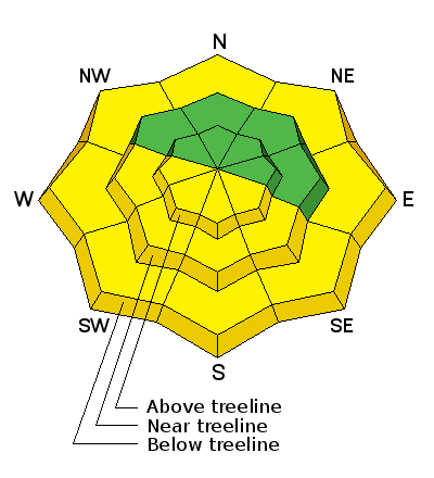
bottom line This morning the avalanche danger is generally LOW. As the sun softens the snow surface, the danger for wet slides and sluffs increases to MODERATE and human triggered avalanches are POSSIBLE, particularly on steep slopes facing the south half of the compass.
|
 |
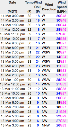
current conditions Skies are clear and temperatures about 8-10 degrees warmer than yesterday at this time, registering in the low to mid 30's. West and northwest winds are blowing 30-40 mph along the high ridges. The corn harvest is in full swing on low and mid elevation south facing terrain and will go off a bit earlier today. On the north half of the compass, you'll still find patches of cold creamy snow on wind sheltered, upper elevation slopes.
Real time wind, snow, and temperatures for the Uinta's are found here
Snowpack observations and trip reports are found here.
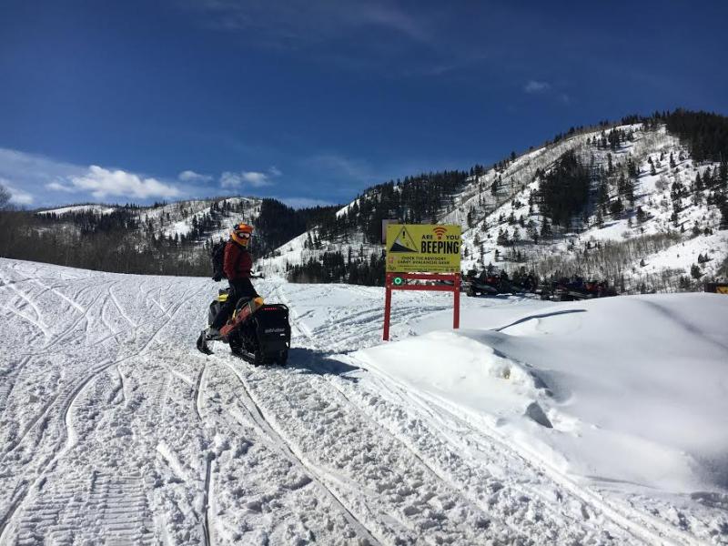
Huge thanks to BCA and all of you for helping to support the Are You Beeping, beacon checking program. Located near the Noblett's Trailhead, this is just one of the checkpoints you'll see at major trailheads throughout the range. |
 |
recent activity No new avalanche activity to report from yesterday. A full list of Uinta avalanche activity is found here. |
| type | aspect/elevation | characteristics |
|---|

|
|
LIKELIHOOD
 LIKELY
UNLIKELY
SIZE
 LARGE
SMALL
TREND
 INCREASING DANGER
SAME
DECREASING DANGER
|
|
description
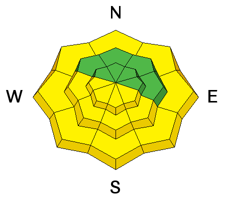
Last night's superficial refreeze will provide enough supportability for a good portion of the day before the bottom starts to fall out. If you're looking for soft snow right out of the gates, start off on east or southeast facing terrain and then just follow the sun around, ending on west facing slopes at the end of the day. Remember- this is the time of year when you wanna think about your late in the day, exit strategy. As the snow turns damp and manky, you'll need to get off of and out from under steep, sunny slopes and avoid terrain traps like gullies and road cuts where tree snapping, cement-like debris can stack up very deeply. |
| type | aspect/elevation | characteristics |
|---|

|
|
LIKELIHOOD
 LIKELY
UNLIKELY
SIZE
 LARGE
SMALL
TREND
INCREASING DANGER
SAME
DECREASING DANGER
|
|
description
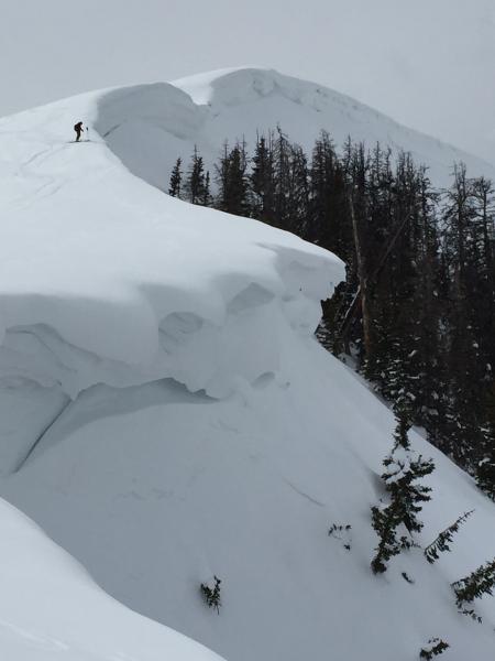
Corni... they come in all shapes and sizes and some are larger than others. In either case, these unpredictable pieces of snow are breaking further back than you might expect and you definitely don't want to be on the receiving end of one of these boxcar-like monsters. |
 |
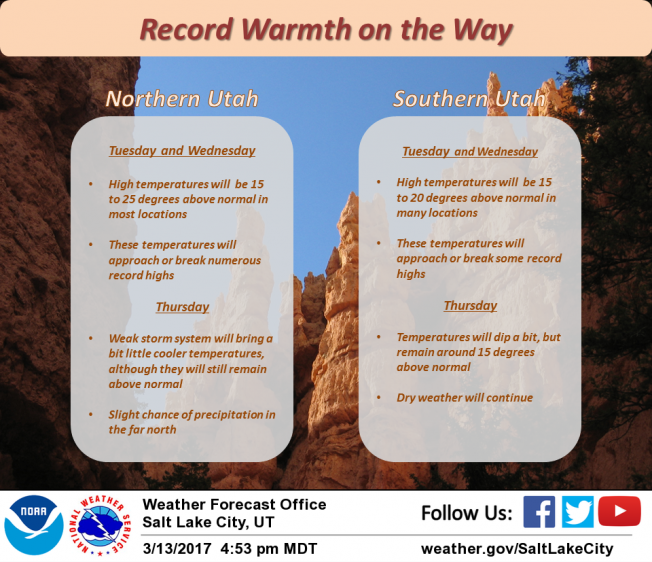
weather A ridge of high pressure gives us stunning spring weather with sunny skies and temperatures rising to nearly 50 degrees! West and northwest winds blow in the 20's and 30's with gusts in the 40's along the high ridges. Warmer yet on Wednesday ahead of a weak storm slated to swing through the region Thursday, delivering a thin coat of white paint and cooler temperatures. High pressure quickly builds for Friday with another weak storm for the weekend. It looks promising for a return to winter next week.
|
| general announcements Remember your information can save lives. If you see anything we should know about, please participate in the creation of our own community avalanche advisory by submitting snow and avalanche conditions. You can call me directly at 801-231-2170, email [email protected] The information in this advisory is from the US Forest Service which is solely responsible for its content. This advisory describes general avalanche conditions and local variations always occur. The information in this advisory expires 24 hours after the date and time posted, but will be updated by 7:00 AM on Wednesday March 15th. |