25th Annual Black Diamond Fall Fundraising Party
Thursday, September 13; 6:00-10:00 PM; Black Diamond Parking Lot
25th Annual Black Diamond Fall Fundraising Party
Thursday, September 13; 6:00-10:00 PM; Black Diamond Parking Lot
| Advisory: Uintas Area Mountains | Issued by Craig Gordon for Monday - February 27, 2017 - 3:35am |
|---|


|
bottom line At and above treeline in the wind zone, you'll find a CONSIDERABLE avalanche danger. Human triggered and natural avalanches are LIKELY on steep wind drifted slopes facing the north half of the compass and especially in terrain with an easterly component to its aspect. While less pronounced, a MODERATE avalanche danger is found in mid elevation terrain and human triggered avalanches are possible on steep slopes with recent deposits of wind drifted snow. Wind sheltered slopes in mid and lower elevations offer LOW avalanche danger.
|
 |
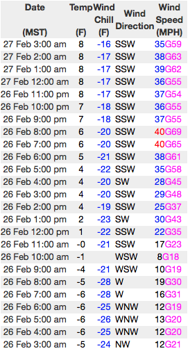
current conditions Skies are mostly cloudy and temperatures in the teens. Snow began falling right around midnight and so far an evenly distributed 3" stacked up across the range. Southwest winds are bigger news and they've been cranking all night, blowing 40-60 mph. along the high ridges. Wind sheltered mid elevation terrain will provide the best riding and turning conditions. Real time wind, snow, and temperatures for the Uinta's are found here
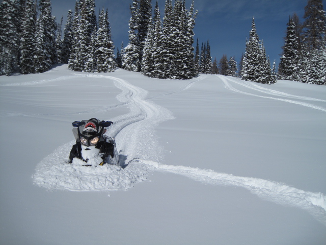
Ted was in Whitney Basin yesterday and found very good riding conditions and stable snow. Insights on his travels are found here. Snowpack observations and trip reports are found here. |
 |
recent activity Other than some cracking and a few shallow soft slabs, the snowpack has been remarkably well behaved and avalanche conditions are pretty straight-forward. However, that's going to change with today's storm. A full list of Uinta avalanche activity is found here. |
| type | aspect/elevation | characteristics |
|---|

|

|
LIKELIHOOD
 LIKELY
UNLIKELY
SIZE
 LARGE
SMALL
TREND
 INCREASING DANGER
SAME
DECREASING DANGER
|
|
description
Winds are nuking along the ridges, whipping the new snow into drifts that'll be sensitive to our additional weight. With more snow and continued strong winds throughout the day, I suspect this mornings slabs will grow bigger and burlier as the day wares on. Towards the end of the day avalanches will break deeper and wider they we might expect and they'll be packing a punch. Here's the good news... this is an easy avalanche dragon to avoid and you can have a blast riding in the storm today. Simply lose a little elevation, stick with wind sheltered terrain, and avoid fat, rounded, pieces of snow, especially if they feel or sound hollow like a drum. Done, done, and done :)
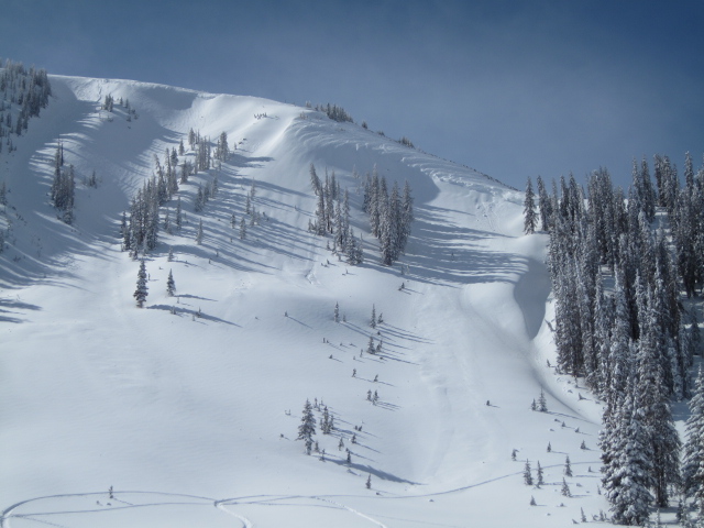
Steep, north facing, leeward terrain... the image above illustrates the type of terrain you could trigger an avalanche in today. |
| type | aspect/elevation | characteristics |
|---|

|
|
LIKELIHOOD
LIKELY
UNLIKELY
SIZE
 LARGE
SMALL
TREND
 INCREASING DANGER
SAME
DECREASING DANGER
|
|
description
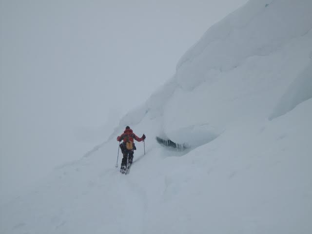
Ridgeline corni are ginormous this year. These unpredictable boxcar monsters are breaking further back than you'd think, and can easily take you for an unexpected, terrifying, elevator ride to the ground floor. |
 |
weather A good shot of snow is expected today as a storm system pushes a cold front through the area this morning into the early afternoon hours. A foot of snow looks likely before a lull in the action tonight. Southwest winds remain strong ahead of and near the cold front, blowing in the 50's and 60's along the high ridges. Temperatures climb into the upper teens and dip into the single digits overnight. Another shot of snow is expected late Tuesday. |
| general announcements Remember your information can save lives. If you see anything we should know about, please participate in the creation of our own community avalanche advisory by submitting snow and avalanche conditions. You can call me directly at 801-231-2170, email [email protected] The information in this advisory is from the US Forest Service which is solely responsible for its content. This advisory describes general avalanche conditions and local variations always occur. The information in this advisory expires 24 hours after the date and time posted, but will be updated by 7:00 AM on Tuesday February 28th. |