25th Annual Black Diamond Fall Fundraising Party
Thursday, September 13; 6:00-10:00 PM; Black Diamond Parking Lot
25th Annual Black Diamond Fall Fundraising Party
Thursday, September 13; 6:00-10:00 PM; Black Diamond Parking Lot
| Advisory: Uintas Area Mountains | Issued by Craig Gordon for Tuesday - December 20, 2016 - 3:46am |
|---|

|
bottom line In the wind zone at upper elevations, the avalanche danger is MODERATE today. Human triggered avalanches are POSSIBLE, especially on steep, wind drifted slopes facing the north half of the compass. Once triggered, today's avalanches have the potential to break deeper and wider than you might expect. Mid and low elevation wind sheltered terrain offers five star riding and generally LOW avalanche danger
|
 |
current conditions High clouds drifted into the region late yesterday and camped out overnight. Temperatures are currently in the teens and low 20's. West and southwest winds are blowing in the 20's and 30's along the high peaks. Last weeks big storm pasted the region with a couple feet of snow and a couple inches of water. With light, creamy snow on a mostly supportable base, riding and turning conditions are about as good as they get. Real time wind, snow, and temperatures for the Uinta's are found here. Recent observations are found here.
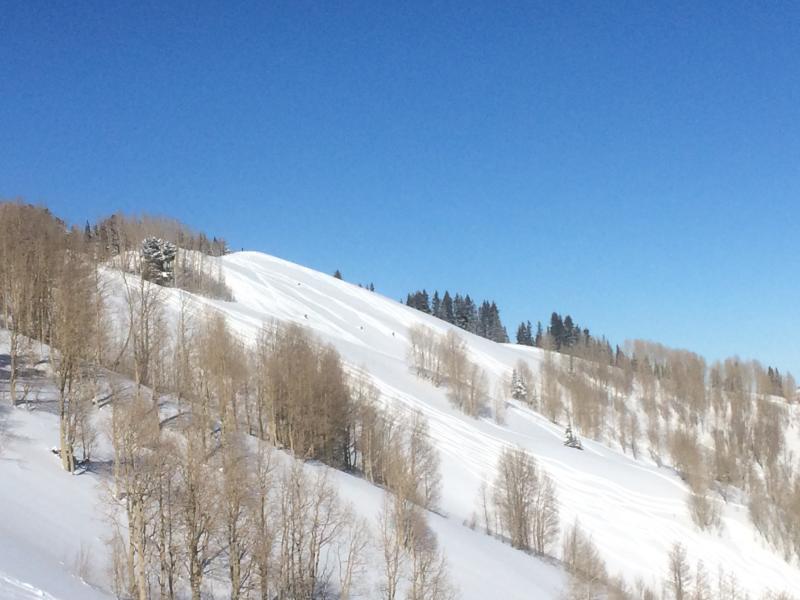
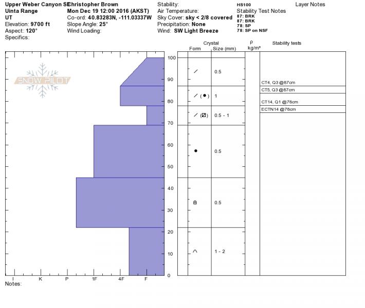
Downtown Chris Brown was in Upper Weber Canyon yesterday and reports excellent coverage and good stability for this time of year. More on his travels can be found here. |
 |
recent activity
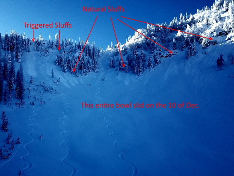
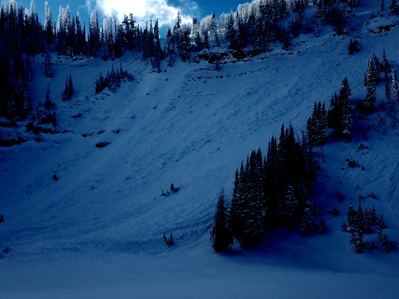
Michael Janulaitis has been crushing it this winter with top notch obs and great safe travel advice. The image above illustrates how he got the goods by safely navigating terrain he's been tracking all winter and knew it flushed out earlier this winter...image below. I appreciate all of Michaels hard work informing our community and helping to keep us on top. Strong work man!
A full list of recent avalanche activity is found here. |
| type | aspect/elevation | characteristics |
|---|

|
|
LIKELIHOOD
 LIKELY
UNLIKELY
SIZE
 LARGE
SMALL
TREND
 INCREASING DANGER
SAME
DECREASING DANGER
|
|
description
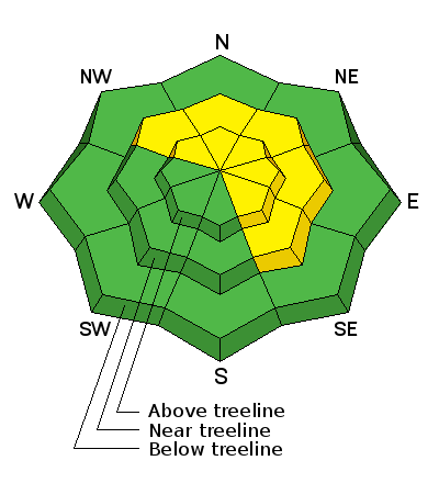
I think we're continuing to turn the corner towards stable snow, and most terrain is good to go... and that's good news. However, I bet there's a pocket or two still lurking out there that just needs a little coaxing. Once it fails... all bets are off. Found mostly on steep, rocky, upper elevation slopes facing the north half of the compass, todays slabs may be harder to initiate, but once triggered, have the potential to break into weak layers now buried deep in our snowpack.
Sort of like an aging Keith Richards celebrating his 73rd birthday, I'm not completely convinced the region is done with its wildness, but it sure feels like we're trending that way. |
| type | aspect/elevation | characteristics |
|---|

|
|
LIKELIHOOD
 LIKELY
UNLIKELY
SIZE
 LARGE
SMALL
TREND
INCREASING DANGER
SAME
DECREASING DANGER
|
|
description
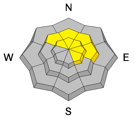
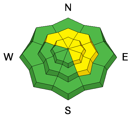
Wind drifts along the leeward side of upper elevation ridges and around terrain features like chutes, gullies, and sub-ridges are today's second avalanche issue. While predictably breaking at or below your skis, board, or sled even a shallow slab can get quickly out of hand if it breaks into deeper buried weak layers as it crashes down on the slope below. I'd look for and avoid any fat, rounded piece of snow, especially if it feels or sounds hollow like a drum. |
 |
weather Expect mostly cloudy skies today with high temperatures reaching into the low 30's. West and southwest winds blow in the 20's and 30's ahead of a weak storm system which crosses the area tonight. We'll see a brief period of generally light snow with just minor accumulations expected and overnight lows dipping into the upper teens. A dry airmass returns to the area Wednesday afternoon through Thursday before the pattern trends more active again. |
| general announcements Remember your information can save lives. If you see anything we should know about, please participate in the creation of our own community avalanche advisory by submitting snow and avalanche conditions. You can call me directly at 801-231-2170, email [email protected] The information in this advisory is from the US Forest Service which is solely responsible for its content. This advisory describes general avalanche conditions and local variations always occur. The information in this advisory expires 24 hours after the date and time posted, but will be updated by 7:00 AM on Wednesday December 21st. |