25th Annual Black Diamond Fall Fundraising Party
Thursday, September 13; 6:00-10:00 PM; Black Diamond Parking Lot
25th Annual Black Diamond Fall Fundraising Party
Thursday, September 13; 6:00-10:00 PM; Black Diamond Parking Lot
| Advisory: Uintas Area Mountains | Issued by Craig Gordon for Monday - December 12, 2016 - 3:47am |
|---|

|
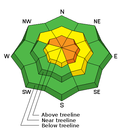
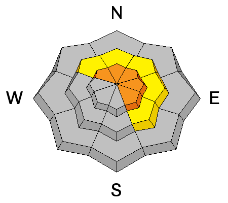
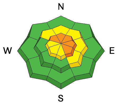
bottom line Above treeline in the wind zone, the avalanche danger is CONSIDERABLE today. Human triggered avalanches are probable on steep, wind drifted slopes facing the north half of the compass and particularly in terrain with an easterly component to its aspect. Any slide triggered has the potential to be deep and dangerous. You'll find MODERATE avalanche danger in mid elevation terrain facing the north half of the compass. Human triggered avalanches are possible on steep, wind drifted slopes. Low angle, wind sheltered slopes with nothing steep above or adjacent to where you're riding and most terrain facing the south half of the compass offers LOW avalanche danger.
|
 |
current conditions Skies remained mostly clear overnight and temperatures hovered in the teens and mid 20's where they register early this morning. Our weather station network is experiencing technical difficulties and we hope to remedy that today. In the meantime, looking at representative wind sites nearby it looks like southwest winds are blowing 20-30 mph along the high peaks. No new snow overnight, but an active storm track delivered several feet of snow this week and average settled snow depths clock in at nearly 36". Real time wind, snow, and temperatures for the Uinta's are found here. Recent observations are found here.
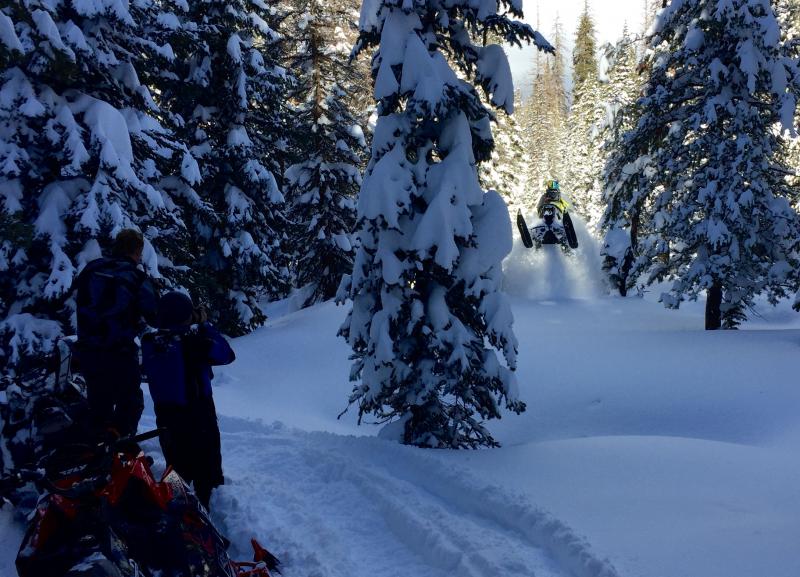
You don't need to hang it out and get onto steep slopes to have fun. UAC Director Mark Staples was out with the pro athletes from the Boondockers crew yesterday and had a blast carving deep trenches on low angle slopes. More on his travels are found here. (Staples photo) |
 |
recent activity
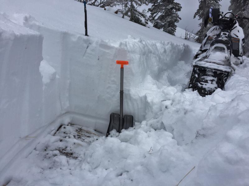
Michael Janulaitis remotely triggered this slab on a treed, northerly facing slope in Weber Canyon. Michael has been submitting killer obs throughout the storm cycle and we greatly appreciate all the hard working helping to keep our community safe! More info is found here.
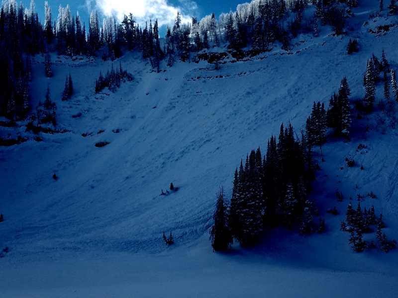
The region experienced a widespread natural avalanche cycle during the intense wind and snowfall late Saturday night. Throughout the range, slide dimensions and characteristics are similar to what Michael found here near Hoyt Peak yesterday. (Janulaitus photo) A full list of recent avalanche activity is found here. |
| type | aspect/elevation | characteristics |
|---|

|
|
LIKELIHOOD
 LIKELY
UNLIKELY
SIZE
 LARGE
SMALL
TREND
 INCREASING DANGER
SAME
DECREASING DANGER
|
|
description
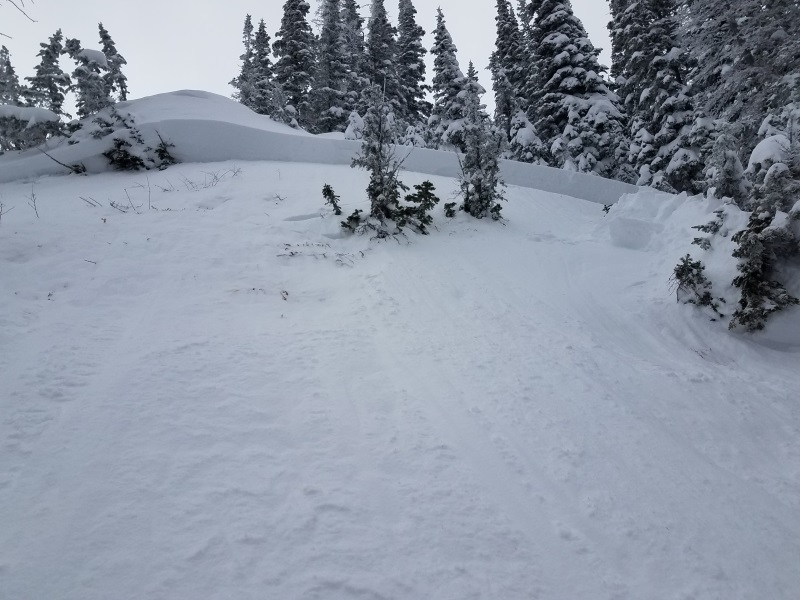
The snowpack is still adjusting to the big storm and needs sometime to get comfortable in its own skin. Our setup is tricky because the snow will feel solid and good to go under our skis, board, or sled. These kind of conditions allow us to get well out onto the slope before it fails, often times breaking above us. We've got to remember there's a weak layer now buried several feet deep in our midpack with strong, dense, cohesive snow resting on top of it. Yep, it's a strong snow on weak snow setup and you know that's a dangerous combination in our mountains. Found mostly on steep, rocky, mid and upper elevations facing the north half of the compass, todays slabs are going to be reactive to our additional weight and may break deeper and wider than you might expect. Also... any slide triggered that breaks into older snow near the ground, will take you for a body bruising ride through stumps, rocks, or deadfall, instantly ruining your day. I think it'll be a little spooky out there today, but it doesn't mean we can't ride. It does mean we should avoid rolling the dice and simply stay off of and out from under steep, wind drifted terrain. We can have a blast today carving deep trenches in wide open meadows or on low angle slopes with no steep terrain hanging above us.
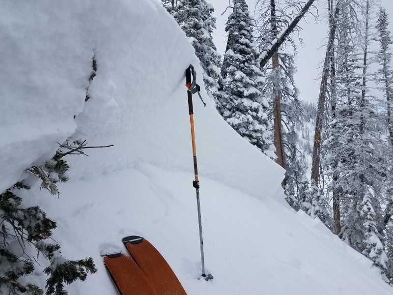
You can clearly see the new snow/old snow interface in this image and that's been the culprit in the widespread avalanche cycle we just experienced. The storm has been a big wallop to the snowpack and it's gonna need sometime to adjust. Click here to watch a short viddy as Mark explains why things remain tricky and dangerous. |
| type | aspect/elevation | characteristics |
|---|

|
|
LIKELIHOOD
LIKELY
UNLIKELY
SIZE
 LARGE
SMALL
TREND
 INCREASING DANGER
SAME
DECREASING DANGER
|
|
description
A few wind drifts linger along the leeward side of upper elevation ridges and these will remain sensitive to our additional weight are today. Easy to detect and easy to avoid, I'd steer clear of any fat, rounded piece of snow, especially if sounds or feels hollow like a drum. While found mostly on the leeward side of upper elevation ridges, I wouldn't be too surprised to find a few of these lurking in steep chutes and gullies at mid and lower elevations as well.
Easy to see when you hit the bare, rock littered ridge that the winds been blowing right to left. |
 |
weather A few high clouds drift in and out of the area today. Southwest winds are gonna be a nuisance along the ridges, blowing in the 30's and 40's. High temperatures climb into the low 30's and overnight lows dip into the teens. An active pattern develops later this week as a warm front lifts through the region on Wednesday bringing the next opportunity for accumulating snow. A good looking system is on tap for Thursday/Friday. |
| general announcements Remember your information can save lives. If you see anything we should know about, please participate in the creation of our own community avalanche advisory by submitting snow and avalanche conditions. You can call me directly at 801-231-2170, email [email protected] The information in this advisory is from the US Forest Service which is solely responsible for its content. This advisory describes general avalanche conditions and local variations always occur. The information in this advisory expires 24 hours after the date and time posted, but will be updated by 7:00 AM on Tuesday December 13th. |