25th Annual Black Diamond Fall Fundraising Party
Thursday, September 13; 6:00-10:00 PM; Black Diamond Parking Lot
25th Annual Black Diamond Fall Fundraising Party
Thursday, September 13; 6:00-10:00 PM; Black Diamond Parking Lot
| Advisory: Uintas Area Mountains | Issued by Craig Gordon for Saturday - December 10, 2016 - 4:08am |
|---|

|
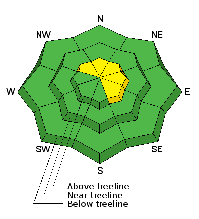
bottom line At upper elevations in the wind zone, the avalanche danger is MODERATE this morning. Human triggered avalanches are possible on steep, wind drifted slopes, particularly in terrain with an easterly component to its aspect. With a good shot of snow and wind forecast the danger may bump up to CONSIDERABLE on these same slopes by days end. Low angle slopes with nothing steep above or adjacent to where you're riding and most terrain facing the south half of the compass offers LOW avalanche danger.
|
 |
current conditions Under mostly cloudy skies there's a flurry or two in the air and another storm on the door step. Southwest winds starting ramping up around 8:00 last night and have blown steadily in the 30's and 40's. Current temperatures register a balmy 26 degrees along the ridges and it's right around freezing at the trailheads.. downright tropical for this time of year. An active storm track delivered just over a foot of snow this week and average settled snow depths clock in at 24"-30". Real time wind, snow, and temperatures for the Uinta's are found here. Recent observations are found here. |
 |
recent activity
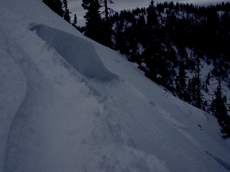
Ace observer Micheal J was out and about and intentionally triggered this wind drift late Friday, on a steep NE facing aspect at 10,400 feet, near the summit of Hoyt Peak. Breaking 6"-8" deep, it failed on the cold, light density snow that fell earlier in the weak. More info found here |
| type | aspect/elevation | characteristics |
|---|

|
|
LIKELIHOOD
 LIKELY
UNLIKELY
SIZE
 LARGE
SMALL
TREND
 INCREASING DANGER
SAME
DECREASING DANGER
|
|
description
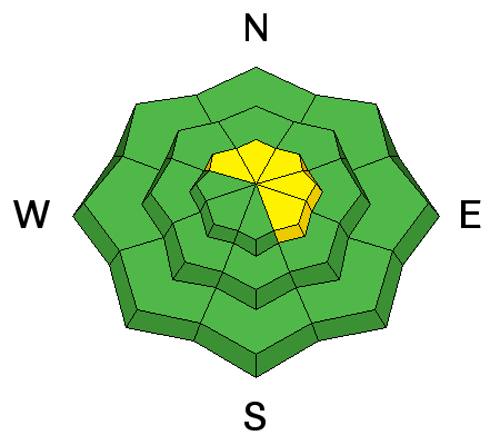
So you're probably asking yourself, "How did the avalanche danger rose go from orange and spooky to mostly green with a few wedges of yellow overnight?" You know... weather forecasting is a curious thing and our projected storm bumped to the north and didn't deliver the wind, water, or snow totals we thought it would. Of course it's a bit of a bummer, but yesterday's warm temperatures and partly cloudy skies helped the snowpack settle and gain some strength. While most slopes are good to go I bet there's a wind drift or two still lurking along the leeward side of an upper elevation ridge that'll react to our additional weight. Easy to detect by their fat, rounded appearance today's drifts will predictably break at or below your skis, board, or sled. While manageable in depth and size, remember- snow cover remains thin, so any slide triggered that breaks into older snow near the ground, will take you for a body bruising ride through stumps, rocks, or deadfall, instantly ruining your day.
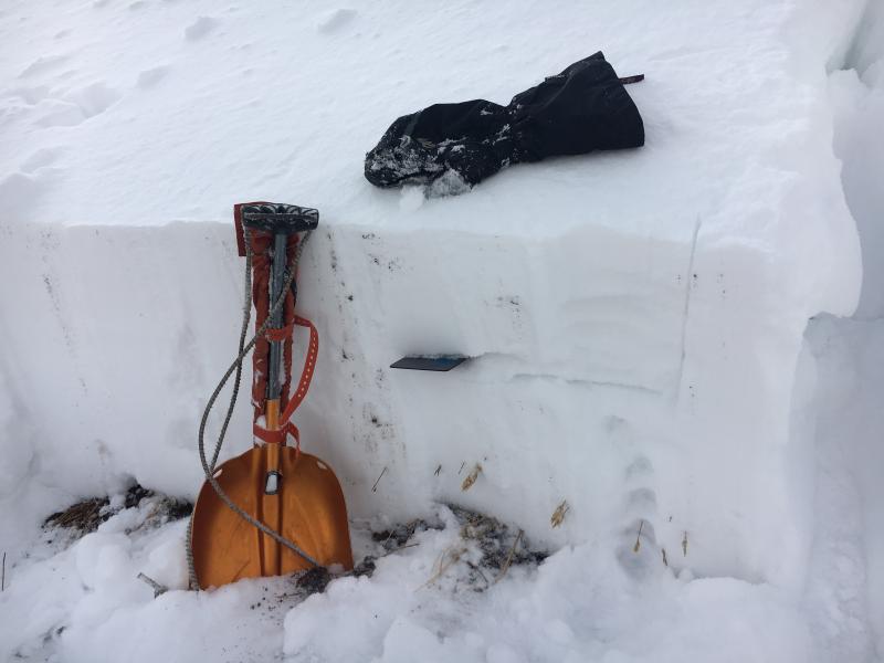
This is a good looking Uinta snowpack. In general, it's well-behaved and homogenous and we're not dealing with our usual weak snow issues near the ground. My snow crystal card is at the interface of this weeks cold snow which turned loose and sugary and now preserved and buried under Thursday night's storm.
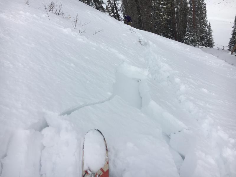
While not particularly sensitive, yesterday I did get this test slope to crack out in front of my skis. This is the type of avalanche dragon we're dealing with today. |
 |
weather Today we can expect mostly cloudy skies, high temperatures climbing into the low to mid 30's, and southwest winds increasing throughout the day. By about dinner time winds will be cranking into the 50's and 60's along the high peaks. Snow develops late in the day with 3"-6" expected and another 3"-6" overnight. A break in the action is slated for early in the week, with an active pattern on tap for the latter half of the week. |
| general announcements Remember your information can save lives. If you see anything we should know about, please participate in the creation of our own community avalanche advisory by submitting snow and avalanche conditions. You can call me directly at 801-231-2170, email [email protected] The information in this advisory is from the US Forest Service which is solely responsible for its content. This advisory describes general avalanche conditions and local variations always occur. The information in this advisory expires 24 hours after the date and time posted, but will be updated by 7:00 AM on Sunday December 11th. |