25th Annual Black Diamond Fall Fundraising Party
Thursday, September 13; 6:00-10:00 PM; Black Diamond Parking Lot
25th Annual Black Diamond Fall Fundraising Party
Thursday, September 13; 6:00-10:00 PM; Black Diamond Parking Lot
| Advisory: Uintas Area Mountains | Issued by Craig Gordon for Tuesday - December 6, 2016 - 3:59am |
|---|


|
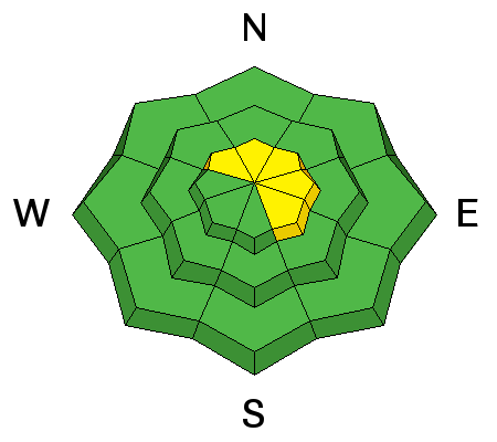
bottom line At upper elevations, in the wind zone, the avalanche danger is MODERATE today and human triggered avalanches are possible on steep, wind drifted slopes, especially shady slopes facing the north half of the compass and particularly in terrain with an easterly component to its aspect. The avalanche danger in wind sheltered terrain and on low elevation slopes is generally LOW.
|
 |
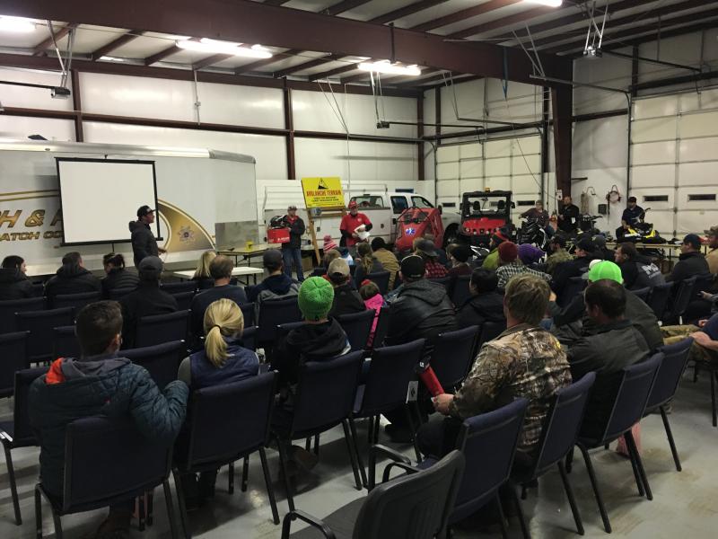
special announcement Huge thanks to Tyler St. Jeor and the amazing crew at Wasatch County Search and Rescue for organizing and hosting Saturday night's Avy Awareness presentation. Also a big shout out to everyone who attended, especially those of you who generously donated to the UAC. It was great to see the usual suspects, but even more awesome to see lots of new faces looking to stay on top of the Greatest Snow on Earth... thanks for all the support. Click here for more info on our January sled specific avy class and here for the February class.
Heads up- Plowing operations have ceased for Mirror Lake Highway. Wolf Creek Pass is still mostly pavement and access to avalanche terrain is relatively easy. Remember... just cause you can see your rig from a ridgeline doesn't necessarily make the terrain any safer and triggering even a small slide this time of year will reveal stumps, rocks, and general nastiness, easily ruining your day or perhaps your season.
Ted Scroggin photo |
 |
current conditions Yesterday's little storm piled up 7" of light density snow on the North Slope with amounts measuring about half that much from Trial Lake southward. West and southwest winds have calmed down a bit and are averaging 20-30 mph along the high ridges. I hope you remembered to plug that block heater in because temperatures are in fuel gelling zone. Most stations are reporting single digits and along the ridges it's in the negative territory, with wind chill factors registering -25 degrees. Total snow depths average 18"-24". Real time wind, snow, and temperatures for the Uinta's are found here. Recent observations are found here. |
 |
recent activity No recent avalanche activity to report. |
| type | aspect/elevation | characteristics |
|---|

|
|
LIKELIHOOD
 LIKELY
UNLIKELY
SIZE
 LARGE
SMALL
TREND
 INCREASING DANGER
SAME
DECREASING DANGER
|
|
description
West and southwest winds have been busy at work the past 24 hours and there's plenty of light snow available to move around. I'm thinking it's pretty straight-forward out there and today's main avalanche concern is fresh wind slabs. You'll find these mainly along the leeward side of upper elevation ridges, but due to the strength of the wind, especially yesterday morning, I bet there's a slab or two lurking around terrain features like chutes and gullies. Easy to detect by their fat, rounded, chalky appearance, today's drifts are going to be more cohesive and may break wider and deeper than you might expect. And remember... snow cover remains thin and any slide triggered today has the possibility of breaking into older snow near the ground. That combo will reveal stumps, rocks, or deadfall, resulting in an unexpected and possibly traumatic ride. |
 |
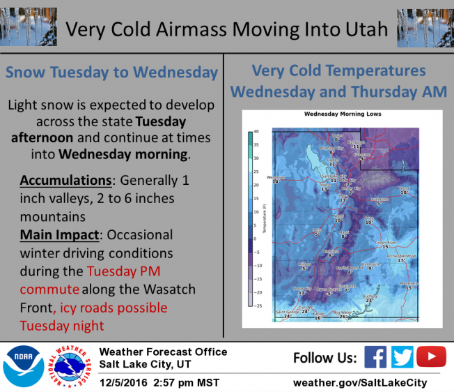
weather Skies become mostly cloudy and temperatures barely crack into the mid teens. West and southwest winds average 20-30 mph. A cold storm system crosses the area this afternoon and evening giving us a couple inches of very light density snow and overnight low temperatures right around -10 degrees. High pressure briefly builds into the region Wednesday, followed by a mild and moist westerly flow for late in the week. The system late in the week brings warmer temperatures with periods of higher density snowfall Thursday through Saturday. It looks like an active pattern is on tap for next week.
|
| general announcements Remember your information can save lives. If you see anything we should know about, please participate in the creation of our own community avalanche advisory by submitting snow and avalanche conditions. You can call me directly at 801-231-2170, email [email protected] The information in this advisory is from the US Forest Service which is solely responsible for its content. This advisory describes general avalanche conditions and local variations always occur. The information in this advisory expires 24 hours after the date and time posted, but will be updated on Wednesday December 7th. |