25th Annual Black Diamond Fall Fundraising Party
Thursday, September 13; 6:00-10:00 PM; Black Diamond Parking Lot
25th Annual Black Diamond Fall Fundraising Party
Thursday, September 13; 6:00-10:00 PM; Black Diamond Parking Lot
| Advisory: Skyline Area Mountains | Issued by Brett Kobernik for Thursday - December 22, 2016 - 6:50am |
|---|

|
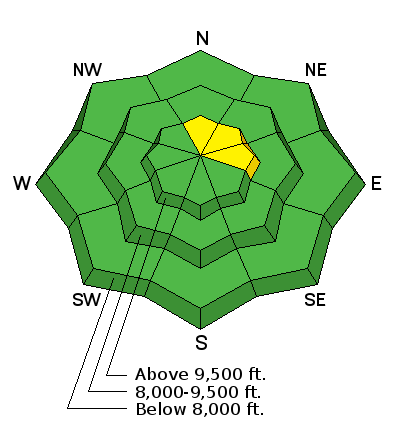
bottom line The majority of the terrain out there has a LOW avalanche danger. If you monkey around along the highest most wind effected steep terrain, you might find a pocket that could release on you. This is a fairly isolated concern only lingering in the wind blown areas.
|
 |
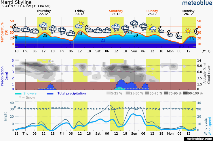
current conditions The wind was almost non-existent along the ridges on Wednesday. Temperatures have been very mild for a few days now. Southerly facing slopes have a sun crust on them. All aspects up to around 8500' had damp snow on the surface and you'll find crusts there also. You'll find some wind crusts along the higher terrain and some stout wind slabs. Soft but dense nice riding snow still exists in many locations. The snow surface looks good right now for receiving another layer on top of it. It is not very weak. Another layer on top of it should produce a mostly stable situation depending on how today's potential few inches of new snow and the anticipated weekend storm shakes out. |
 |
weather
|
| general announcements We will publish full detailed advisories Saturday and Sunday mornings by 7am. We will also be publishing basic avalanche danger ratings & info during the week. If you are getting out into the mountains, we love to hear from you! You can SUBMIT OBSERVATIONS ONLINE or EMAIL US If you would like to have avalanche advisories emailed to you, SIGN UP HERE We can provide basic avalanche awareness presentations for your school, group or club. To enquire, CLICK HERE |